- Newcastle-under-Lyme (borough)
-
Newcastle-under-Lyme District — Non-metropolitan district — Newcastle-under-Lyme shown within Staffordshire
Sovereign state United Kingdom Constituent country England Region West Midlands Non-metropolitan county Staffordshire Status Non-metropolitan district Admin HQ Newcastle-under-Lyme Incorporated 1 April 1974 Government - Type Non-metropolitan district council - Body Newcastle Borough Council - Leadership Leader and Cabinet (Conservative / Liberal Democrat) - MPs Joan Walley
William Cash
Paul Farrelly
Karen BradleyArea - Total 81.5 sq mi (211.0 km2) Area rank 163rd (of 326) Population (2010 est.) - Total 124,500 - Rank 166th (of 326) - Density 1,528.2/sq mi (590/km2) - Ethnicity 98.9% White
1.1%South AsianTime zone GMT (UTC0) - Summer (DST) BST (UTC+1) ONS code 41UE OS grid reference SJ8463746024 Website newcastle-staffs.gov.uk Newcastle-under-Lyme is a local government district with borough status in Staffordshire, England.
It is named after its main town of Newcastle-under-Lyme where the council is based, but also includes the town of Kidsgrove, the villages of Silverdale and Keele, and the rural area surrounding Audley. Most of the borough forms part of The Potteries Urban Area.
Contents
History
The present town is originally a Roman settlement. In the Middle Ages there was a large castle here, owned by John of Gaunt, and a major medieval market. In 1835 Newcastle-under-Lyme Municipal Borough was one of the boroughs reformed by the Municipal Corporations Act 1835 which required that rate payers elected councillors. In 1932 it took in what had been the Wolstanton United Urban District, covering the parishes of Chesterton, Silverdale and Wolstanton, also taking the parish of Clayton from Newcastle-under-Lyme Rural District.
The district was formed on 1 April 1974, under the Local Government Act 1972, as a merger of the Newcastle-under-Lyme Municipal Borough, the Kidsgrove Urban District, and Newcastle-under-Lyme Rural District.
Up to the time of the passing of the Municipal Reform Act an election a mock mayor occurred annually after the election of the real mayor.
Wards
The borough contains 24 wards.

- 1 - Audley and Bignall End
- 2 - Bradwell
- 3 - Butt Lane
- 4 - Chesterton
- 5 - Clayton
- 6 - Cross Heath
- 7 - Halmerend
- 8 - Holditch
- 9 - Keele
- 10 - Kidsgrove
- 11 - Knutton and Silverdale
- 12 - Loggerheads and Whitmore
- 13 - Madeley
- 14 - May Bank
- 15 - Newchapel
- 16 - Porthill
- 17 - Ravenscliffe
- 18 - Seabridge
- 19 - Silverdale and Parksite
- 20 - Talke
- 21 - Thistleberry
- 22 - Town
- 23 - Westlands
- 24 - Wolstanton
Politics
The local council has traditionally been dominated by the Labour Party. However, in the 2006 local elections a coalition of Conservative and Liberal Democrat councillors gained a majority.
The United Kingdom Independence Party (UKIP) also made gains in 2007 and 2008 but suffered a drubbing in 2011 losing all seats they were defending, including their Group Leader, Derrick Huckfield.
The Council was led since 2006-2011 by Conservative Councillor Simon Tagg. [2] The council is now run Conservative Councillor Stephen Sweeney.
The most recent set of local elections saw a resillient Labour Party make gains in every part of the Borough, successfully defending four seats and winning a further 11. Following the death of the UKIP Candidate, the 2011 Seabridge Ward poll was postponed until June, 23rd 2011. In this by-election, the Labour Campaign whittles a previous Conservative Majority of 457 down to 60.
After the 2011 Local Elections there were 25 Labour Party Councillors, 12 Liberal Democrats, 21 Conservatives and 2 from UKIP.[1]
Demographics
Comparative Census Information 2001 UK Census Borough of Newcastle-under-Lyme England Total population 122,030 49,138,831 White 98% 91% Asian 0.6% 4.6% Black 0.2% 2.3% Christian 78.5% 72% Muslim 0.5% 3.1% Hindu 0.2% 1.1% No religion 13.1% 15% Unemployed 2% 3.3% In the 2001 census, the borough was recorded as having a population of 122,030 with 51.5% being female. 78.% identified themselves as Christian, 13.1% having no religion, 0.5% Muslim, 0.2% Hindu or other and 0.1% stating Jewish or Sikh.[2] 61.2% were classed as economically active, with 22.6% working in manufacturing, 18.5% in wholesale or retail, 11.6% in health/social work and 11.6% in financial and other business related activities.[3]
Education
Newcastle-under-Lyme was chosen for the campus of University College of North Staffordshire, established in 1949 at Keele Hall in the village of Keele, two miles from the town centre, and which was granted full university status as Keele University in 1962. Keele University Medical School is based in the grounds of the University Hospital of North Staffordshire at Hartshill in Stoke-upon-Trent, about a mile from the centre of Newcastle-under-Lyme.
References
- ^ [1] | Borough Election Results 2008
- ^ "Newcastle-under-Lyme Social Profile" (PDF). Newcastle-under-Lyme Borough Council. http://www.staffordshire.gov.uk/NR/rdonlyres/8541174C-7ECB-4763-9BDE-A9819AE6E865/22519/nbcSocial1.pdf. Retrieved 2007-01-21.
- ^ "Newcastle-under-Lyme Economic Profile" (PDF). Newcastle-under-Lyme Borough Council. http://www.staffordshire.gov.uk/NR/rdonlyres/8541174C-7ECB-4763-9BDE-A9819AE6E865/22530/nbcEconomic1.pdf. Retrieved 2007-01-21.
External links
- Newcastle-under-Lyme borough council
- Newcastle-under-Lyme local life
- The Potteries
- Keele University
- Local Information from The Sentinel newspaper
- Staffordshire and Stoke-on-Trent Archive Service
Coordinates: 53°00′40″N 2°13′44″W / 53.011°N 2.229°W
Ceremonial county of Staffordshire Unitary authorities Boroughs or districts Cannock Chase • East Staffordshire • Lichfield • Newcastle-under-Lyme • South Staffordshire • Stafford • Staffordshire Moorlands • TamworthMajor settlements Biddulph • Burntwood • Burton upon Trent • Cannock • Cheadle • Eccleshall • Fazeley • Hednesford • Kidsgrove • Leek • Lichfield • Newcastle-under-Lyme • Penkridge • Rugeley • Stafford • Stoke-on-Trent (Burslem • Fenton • Hanley • Longton • Stoke • Tunstall) • Stone • Tamworth • Uttoxeter • Wombourne
See also: List of civil parishes in StaffordshireRivers Canals Topics MuseumsDistricts of the West Midlands Region Herefordshire 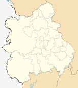
Shropshire Staffordshire Cannock Chase · East Staffordshire · Lichfield · Newcastle-under-Lyme · South Staffordshire · Stafford · Staffordshire Moorlands · Stoke-on-Trent · Tamworth
Warwickshire West Midlands Birmingham · Coventry · Dudley · Sandwell · Solihull · Walsall · Wolverhampton
Worcestershire Bromsgrove · Malvern Hills · Redditch · Worcester · Wychavon · Wyre Forest
Categories:- Local government in Staffordshire
- Newcastle-under-Lyme
- Non-metropolitan districts of Staffordshire
- Local government districts of the West Midlands (region)


Wikimedia Foundation. 2010.