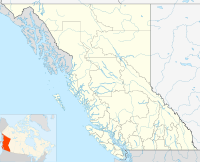
- McBride, British Columbia
-
Situated on the Yellowhead Highway (Highway 16), McBride is a small community in the Robson Valley region of British Columbia, Canada, located 210 km (130 mi) southeast of Prince George, 120 km (75 mi) west of the Alberta border, and 166 km (103 mi) west of Jasper, Alberta.
Located between the Canadian Rockies and the Cariboo Mountains, McBride lies in the Mount Robson Valley, through which the Fraser River flows.
The town got its start during the construction of the Grand Trunk Pacific Railway when settlers came into the area. Formerly known as Railway Siding 39, McBride was established in 1913, and was named in honour of the then serving premier, Richard McBride (1903–15).[1] McBride post office was established 15 February 1915 with T.R. Lloyd as first postmaster.[1]
After the Second World War, the developing timber and agriculture industries attracted more people to the Robson Valley.
The current population is 660, according to the 2006 Census. While timber and primary sawmilling industries continue to support the town, tourism is a growing source of employment for the valley. One of the primary tourist attractions is the world-famous snowmobiling, Albertans taking the majority of spots on the mountain trails that ring the town. Other attractions include hunting and whitewater rafting. McBride also produces some of the world's finest tonewoods, wood used in the production of musical instruments, and is home to several luthiers. McBride is located on the edge of the interior cedar hemlock rainforest, the world's only inland temperate rainforest, created by moisture-laden winds dumping rain and snow from the Cariboo-Chilcotin Plateau against the Cariboo Mountains. The forests around McBride contain trees that are in excess of 1,000 years old,(need citation for a claim of this type) with no evidence of disturbance. This moisture-rich ecosystem supports many species of lichen which in turn support the red listed species of caribou indigenous to the inland temperate rainforest of British Columbia.
McBride has a large percentage of Mennonites, who are attracted by inexpensive land and relative isolation to ensure their agrarian culture continues to survive. For similar reasons McBride also has a healthy population of draft dodgers from the US who settled in the late 1960s and early 1970s. Seventh Day Adventists also make up a large percentage of McBride.
McBride has a large percentage of foresters who own large pieces of equipment such as forwarders. The inexpensive land and relative isolation are attactive to this demographic as it allows them to pursue their myriad of forest related projects.
In December 2006 the town's major employer McBride Forest Industries closed its doors following the historical precedence of forest industry consolidation. It remains to be seen how the McBride economy will deal with such a blow.
Since 1986, McBride has been served by The Valley Sentinel Newspaper an independently owned and operated weekly source for all local news in the Robson Valley.
The McBride railway station is served by the Via Rail Jasper – Prince Rupert train service.
Climate
Climate data for McBride Month Jan Feb Mar Apr May Jun Jul Aug Sep Oct Nov Dec Year Record high °C (°F) 10
(50)13
(55)17
(63)27.2
(81.0)33
(91)32
(90)33.3
(91.9)35
(95)33
(91)25
(77)14
(57)10
(50)35
(95)Average high °C (°F) −3.5
(25.7)0.3
(32.5)5.3
(41.5)11.7
(53.1)16.4
(61.5)20
(68)22.3
(72.1)21.5
(70.7)16.3
(61.3)9.8
(49.6)1.3
(34.3)−2.8
(27.0)9.9 Average low °C (°F) −11
(12)−8.4
(16.9)−5
(23)−1.4
(29.5)2.5
(36.5)6.1
(43.0)7.8
(46.0)7.5
(45.5)4.1
(39.4)0.5
(32.9)−5.9
(21.4)−9.9
(14.2)−1.1 Record low °C (°F) −41
(−42)−38
(−36)−32
(−26)−15
(5)−6
(21)−3
(27)0
(32)−4
(25)−7
(19)−28
(−18)−38
(−36)−41
(−42)−41
(−42)Precipitation mm (inches) 59.8
(2.354)34.1
(1.343)47.2
(1.858)39.4
(1.551)49.5
(1.949)73.5
(2.894)66.8
(2.63)66.4
(2.614)68.3
(2.689)65
(2.56)51.4
(2.024)57.8
(2.276)679.2
(26.74)Source: Environment Canada[2] Education
Public schools are managed by School District 57 Prince George. The local high school is McBride Secondary School that educates in grades 8-12. Seventh Day Adventist School Robson Valley Junior Academy that educates in grades 1-8
References
- ^ Akrigg, G.P.V. and Akrigg, Helen (1970) 1001 British Columbia Place Names, p. 111. Vancouver: Discovery Press
- ^ Environment Canada—Canadian Climate Normals 1971–2000, accessed 25 March 2010
Coordinates: 53°18′15″N 120°09′41″W / 53.30417°N 120.16139°W
 Subdivisions of British Columbia
Subdivisions Regions · Regional districts · Forest Regions and Forest Districts · School districts · Land DistrictsSettlements Urban centres Villages Alert Bay · Anmore · Ashcroft · Belcarra · Burns Lake · Cache Creek · Canal Flats · Chase · Clinton · Fraser Lake · Fruitvale · Gold River · Granisle · Harrison Hot Springs · Hazelton · Kaslo · Keremeos · Lions Bay · Lumby · Lytton · Masset · McBride · Midway · Montrose · Nakusp · New Denver · Pemberton · Port Alice · Port Clements · Pouce Coupe · Queen Charlotte · Radium Hot Springs · Salmo · Sayward · Silverton · Slocan · Tahsis · Telkwa · Valemount · Warfield · ZeballosCategories:- Villages in British Columbia
- Robson Valley
- Populated places in the Regional District of Fraser-Fort George
- Populated places on the Fraser River
Wikimedia Foundation. 2010.

