- Keremeos, British Columbia
Infobox Settlement
official_name = Village of Keremeos
other_name =
native_name =
nickname =
settlement_type = Village
motto = Healthy Living, Naturally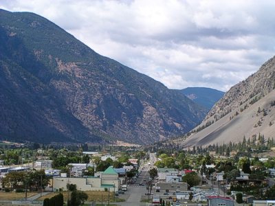
imagesize =
image_caption = Overlooking the Village of Keremeos
flag_size =
image_
seal_size =
image_shield =
shield_size =
city_logo =
citylogo_size =
mapsize = 220px
map_caption = Location of Keremeos inBritish Columbia
mapsize1 =
map_caption1 =
image_dot_
dot_mapsize =
dot_map_caption =
dot_x = |dot_y =
pushpin_
pushpin_label_position =
pushpin_map_caption =
pushpin_mapsize =
subdivision_type = Country
subdivision_name = CAN
subdivision_type1 = Province
subdivision_name1 = BC
subdivision_type2 = Region
subdivision_name2 = Similkameen
subdivision_type3 = Regional district
subdivision_name3 = Okanagan-Similkameen
subdivision_type4 =
subdivision_name4 =
government_footnotes =
government_type =
leader_title = Governing body
leader_name = Keremeos Village Council
leader_title1 = Mayor
leader_name1 = Walter F. Despot
leader_title2 =
leader_name2 =
leader_title3 =
leader_name3 =
leader_title4 =
leader_name4 =
established_title = Incorporated
established_date = 1956
established_title2 = Founded
established_date2 = 1909
established_title3 =
established_date3 =
area_magnitude =
unit_pref =
area_footnotes =
area_total_km2 = 2.11
area_land_km2 =
area_water_km2 =
area_total_sq_mi =
area_land_sq_mi =
area_water_sq_mi =
area_water_percent =
area_urban_km2 =
area_urban_sq_mi =
area_metro_km2 =
area_metro_sq_mi =
area_blank1_title =
area_blank1_km2 =
area_blank1_sq_mi =
population_as_of = 2006
population_footnotes =
population_note =
population_total = 1,289
population_density_km2 =
population_density_sq_mi =
population_metro =
population_density_metro_km2 =
population_density_metro_sq_mi =
population_urban =
population_density_urban_km2 =
population_density_urban_sq_mi =
population_blank1_title =
population_blank1 =
population_density_blank1_km2 =
population_density_blank1_sq_mi =
timezone = PST
utc_offset = -8
timezone_DST =
utc_offset_DST =
latd= 49|latm= 12|lats= 9|latNS=N
longd= 119|longm= 49|longs= 46|longEW=W
elevation_footnotes =
elevation_m = 365
elevation_ft =
postal_code_type =
postal_code =
area_code =
blank_name = Highways
blank_info = Highway 3
Highway 3A
blank1_name = Waterways
blank1_info =Similkameen River
website = [http://www.keremeos.ca Village of Keremeos]
footnotes = Keremeos (pronEng|kærə'miːəs) is a village in southern centralBritish Columbia, Canada . The name originated from the Similkameen native word "Keremeyeus" meaning "creek which cuts its way through the flats" referring to Keremeos Creek which flows down from the Upper Benchlands to theSimilkameen River that runs by the village. Local legend claims the name means "the meeting of the winds" due to the often windy conditions experienced in the valley.Keremeos' main industries are
horticulture ,agriculture ,ranching , andwine making , among others.Fruit stand s are also a major component of the local economy, making it the self-titled "fruit stand capital ofCanada ." All sorts of soft fruits and vegetables are grown in the South Similkameen's warm climate and vineyards and wineries are quickly being added as the Valley's superior wine-growing potential is being recognized.With K Mountain as a backdrop, Keremeos, BC is a community, whose "Wild West" looks date back to 1909 when the postmaster of the now-abandoned community of Upper Keremeos, Mr. George Kirby, purchased land alongside the Similkameen River in anticipation of the V.V. & E. Railway passing through the area. He was right and other businesses soon followed. Keremeos was officially incorporated in 1956 and is now one of the fastest growing communities in British Columbia.
Area attractions include Cathedral Provincial Park, the Red Bridge, the Keremeos Columns, the Keremeos Grist Mill, excellent fishing in area lakes and rivers, APEX Mountain Resort, Twin Lakes Golf Resort, Spotted Lake, the Hedley Mining Museum and the Mascot Mine.
The geography of the Keremeos area ranges from cottonwood groves along the river to orchards to true desert landscapes to alpine peaks.
External links
* [http://www.keremeos.ca Village of Keremeos]
* [http://www.keremeos.net Keremeos and area information]
Wikimedia Foundation. 2010.