- Osoyoos, British Columbia
-
Town of Osoyoos Town of Osoyoos
Motto: Canada's warmest welcome[1] Location of Osoyoos in British Columbia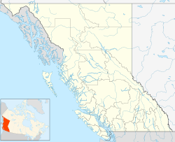
 Town of Osoyoos
Coordinates: 49°01′56″N 119°28′05″W / 49.03222°N 119.46806°W Country  Canada
Province  British Columbia
Region South Okanagan/Boundary Regional District Okanagan-Similkameen Incorporated 1946 Government - Mayor Stu Wells - Governing Body Osoyoos Town Council Area - Total 8.76 km2 (3.4 sq mi) Elevation 283 m (928 ft) Population (2010) - Total 5,203 - Density 593.9/km2 (1,538.2/sq mi) Time zone Pacific Time Zone (UTC-8) - Summer (DST) Pacific Daylight Time (UTC-7) Postal code span V0H Area code(s) +1-250 Website Osoyoos.ca Osoyoos (
 /ɒˈsuːjuːs/ o-soo-ews,[2] historically /ˈsuːjuːs/ soo-ews)[3] is a town in the southern part of the Okanagan Valley in British Columbia near the border with Washington state. The town is also adjacent to the Indian Reserve of the Osoyoos Indian Band.[3] The origin of the name Osoyoos was the word suius meaning "narrowing of the waters" in the local Okanagan language (Syilx'tsn). The "O-" prefix is not indigenous in origin and was attached by settler-promoters wanting to harmonize the name with other O-names in the Okanagan region (Oliver, Omak, Oroville, Okanagan).[citation needed]
The town’s population of just over 5,000 according to the 2010 BC Stats estimates (with another 1921 people surrounding the town in Okanagan-Similkameen Electoral Area A according to the 2006 Statscan census[4]) swells in the summer months with visitors from elsewhere in British Columbia and neighbouring Alberta, as well as elsewhere in Canada. There is also a newer contingent of international visitors, supported by the proximity to the Kelowna International Airport about 1.5 hours north of the town. There is also a rapidly growing year-round retiree population as is evident with the recent boom of condominium and suburban development (though somewhat thwarted by the 2008-2009 economic downturn).
Contents
History
Aboriginal people have lived in the Osoyoos area for thousands of years, as evidenced by rock and an oral tradition explaining their history before Europeans arrived to the valley in 1811.
The first Europeans to Osoyoos were fur traders working for the Pacific Fur Company, an American enterprise. They ventured up the Okanagan River to Osoyoos Lake and farther north. After the Hudson’s Bay Company took over the fur trade in 1821, the Okanagan Valley became a major trade route for supplies to inland forts of British Columbia and furs that were shipped south to the Columbia River and the Pacific to European and Asian markets. The final Hudson’s Bay Company brigade in 1860 was the end of an era, as gold rushes transformed the economy of the new Colony of British Columbia. As parties of miners headed for the Fraser goldfields via the Okanagan Trail, they commonly met conflict with the Okanagan people.[5] [6][7]
Thousands of miners heading to the goldfields and drovers with large herds of livestock crossed the 49th parallel after 1858. A custom house was built in Osoyoos in 1861 with John Carmichael Haynes the tax collector.[8][9] Haynes was also the first pioneer settler who obtained land along the Okanagan River north of Osoyoos that had been part of the Osoyoos Indian Reserve established by the Joint Indian Reserve Commissionin 1877. These lands, now known as the Haynes Lease lands, can still be visited today and are home to an original barn.
Osoyoos was incorporated as a village in 1946 and became a town in the 1980s.
Location, Geography & Ecology
Osoyoos is situated on the east-west Crowsnest Highway (Highway 3) with a significant ascent out of the Okanagan Valley in either direction. The Crowsnest headed east begins with an 18 km switchback up the flank of the Okanagan Highland with a 685 m rise to the mining and ranching region of Anarchist Mountain, which is part of the Boundary Country (the stretch of rising highway is also referred to as Anarchist Mountain). Highway 3 westbound leads to Keremeos and the Similkameen Valley via Richter Pass. On Highway 97 south, there is a 24 hour border crossing between Canada and the United States between Osoyoos and Oroville, Washington. The border crossing is located 4 kilometres (2.5 mi) south of the Highway 3 and 97 intersection on the northwest side of town.
The town is situated on Osoyoos Lake, which has a perimeter of 47.9 km, an elevation of 276 m, a maximum depth of 63 m and a mean depth of 14 m. The lake’s elevation marks the lowest point in the Okanagan Valley.
The far southern reaches of the Okanagan and Similkameen Valleys are the far northern reaches of the Sonoran Life Zone and include semi-desert landscape species found nowhere else in Canada, including scorpions.[10] While the area is not technically desert, it is part of a threatened ecosystem in Canada known as shrub-steppe. Specifically, the ecosystem of the area is named after the Antelope Brush plant typical of the local climate. This ecosystem was once more prevalent in the South Okanagan but is now becoming fragmented and degraded due to the spread of agriculture, urban development, and other human activities. The area is also sometimes referred to as the Osoyoos Arid Biotic Zone.
Since 2003 there has been an ongoing feasibility study by Parks Canada to determine the need for protection of a large area of grasslands west of the town known as the South Okanagan-Lower Similkameen National Park Reserve Feasibility Study.[11]
Climate
The climate, according to the Köppen climate classification, is semi-arid (BSk)[12] with summers that are generally hot and dry. The result is one of the longest growing seasons in Canada and the highest annual average maximum temperature anywhere in the country.[citation needed] Daily temperatures in July and August average above 30°C (86°F), with overnight lows of around 14°C (57°F) with low humidity. September and October are usually dry and sunny with cool mornings. Winters are short and mild, but can be cold for brief periods during arctic outflow conditions. Spring arrives earlier than other parts of the Okanagan. The table below includes temperature records for the "Osoyoos CS" station (with records from 1990–2010), and precipitation values from the "Osoyoos West" station (with records from 1971–2001). It is important to note that these temperature records are only go back as far as 1990, meaning that higher and lower extremes have likely occurred. Of note, the town of Oliver just over 20 km north of Osoyoos reached 43.9°C on July 16, 1941 the same day that Lytton and Lillooet hit the highest temperature ever recorded in British Columbia of 44.4°C.[13] It is quite possible that on this day that Osoyoos met or surpassed this record as Osoyoos tends to be warmer than Oliver.[13] Numerous websites peg annual sunshine at 2039 hours, however no site sources this fact, it is relatively consistent with other Okanagan communities.[13] It is important to note that the area's climate is variable depending on elevation, for instance, a climate station 25 km northeast of the town in the mountains, records and annual average snowfall of 650 cm.[14] During the summer months, the southern Okanagan Valley is among the hottest areas in Canada, and Osoyoos often reaches the highest daytime temperature of any location in Canada.[citation needed] Temperatures typically reach the upper 30s (Celsius) (95-104°F) in the summer for short periods of time.[15] Although it is hot, the humidity is low and nights are generally pleasant. Winters are generally dry and cool, but are usually mild compared to directly adjacent regions.
Climate data for Osoyoos Month Jan Feb Mar Apr May Jun Jul Aug Sep Oct Nov Dec Year Record high °C (°F) 17.5
(63.5)17
(63)25.4
(77.7)32.8
(91.0)36.1
(97.0)39.9
(103.8)42.8
(109.0)41.7
(107.1)37.5
(99.5)28.9
(84.0)21.1
(70.0)14.9
(58.8)42.8
(109.0)Average high °C (°F) 1.9
(35.4)6.2
(43.2)12.3
(54.1)17.7
(63.9)22.9
(73.2)26.5
(79.7)31.5
(88.7)30.9
(87.6)25.5
(77.9)16.2
(61.2)7.4
(45.3)1.7
(35.1)16.8 Average low °C (°F) −4
(24.8)−2.8
(27.0)−0.1
(31.8)3.4
(38.1)8.0
(46.4)11.7
(53.1)14.5
(58.1)13.7
(56.7)9.1
(48.4)3.6
(38.5)−0.5
(31.1)−3.7
(25.3)4.4 Record low °C (°F) −21.5
(−6.7)−20.9
(−5.6)−11.5
(11.3)−7.3
(18.9)−6.3
(20.7)2.3
(36.1)6.1
(43.0)4.0
(39.2)−1.3
(29.7)−9.8
(14.4)−16.9
(1.6)−21.7
(−7.1)−21.7
(−7.1)Precipitation mm (inches) 27.8
(1.094)25.5
(1.004)22.5
(0.886)23.5
(0.925)37.4
(1.472)35.9
(1.413)24.3
(0.957)21.2
(0.835)16.1
(0.634)17.1
(0.673)32.1
(1.264)34.2
(1.346)317.6
(12.504)Rainfall mm (inches) 11.9
(0.469)17.9
(0.705)20.3
(0.799)23.4
(0.921)37.4
(1.472)35.9
(1.413)24.3
(0.957)21.2
(0.835)16.1
(0.634)16.8
(0.661)25.8
(1.016)17
(0.67)267.9
(10.547)Snowfall cm (inches) 15.9
(6.26)7.7
(3.03)2.2
(0.87)0
(0)0
(0)0
(0)0
(0)0
(0)0
(0)0.3
(0.12)6.3
(2.48)17.3
(6.81)49.6
(19.53)Source: Environment Canada[16] Average number of days:[15]
- above 20°C (68°F): 153.4 (Max number of days, 1994: 174) Compared to averages 74.6 in Vancouver,[17]
85.5 in Calgary[18] and 118 in Toronto.[19]
- above 30°C (86°F): 55.1 (Max number of days, 1994: 78) Compared to averages 0.44 in Vancouver,[17] 4.5 in Calgary[18] and 12.6 in Toronto.[19]
Agriculture
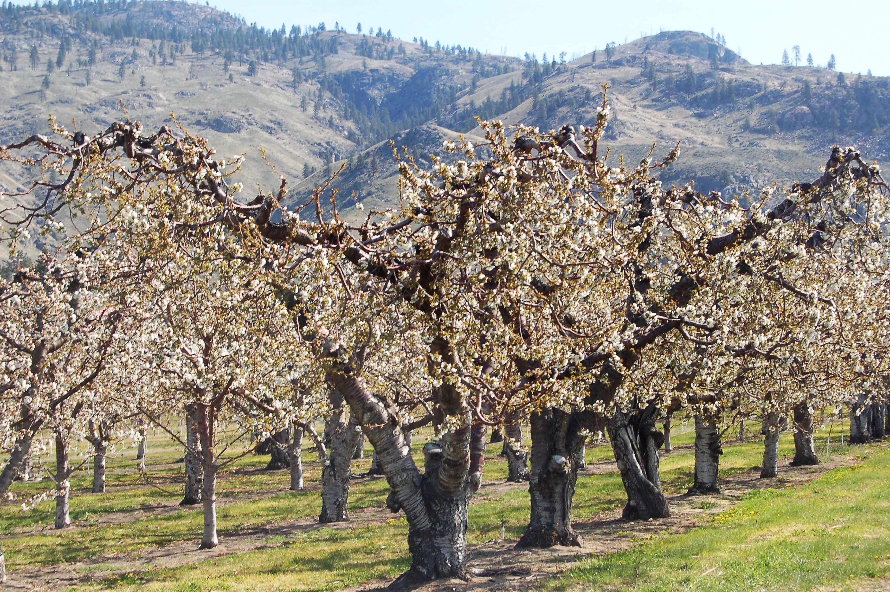
 Osoyoos fruit trees in April
Although the fruit-growing possibilities were noticed by the early settlers, it was not until 1907 when the first commercial orchard in the area was established, growing cherries, apricots, peaches, plums, and apples. Osoyoos Orchard Limited was formed in 1920 and an irrigation project was planned which finally brought water to the west bench via “The Ditch” in 1927. The former shrub-steppe environment was transformed into a lush agricultural belt and Osoyoos promoted “the earliest fruit in Canada.”
Today, the area continues to produce many of these tender fruit crops. Aside from tourism, agriculture is a major component of the local economy, as is evident by the abundant produce stands along Highways 3 and 97, and the numerous commercial orchards surrounding the town. With the growing popularity of viticulture, some of these orchards are being converted to vineyards, as the area is a major wine producing region of Canada. Some of the main wineries in the area are Nk’Mip, La Stella and Osoyoos Larose.
The vast majority of the land in the valley bottom surrounding the town is protected by the Agricultural Land Reserve, which prevents valuable agricultural lands from being converted into other uses.
Tourism
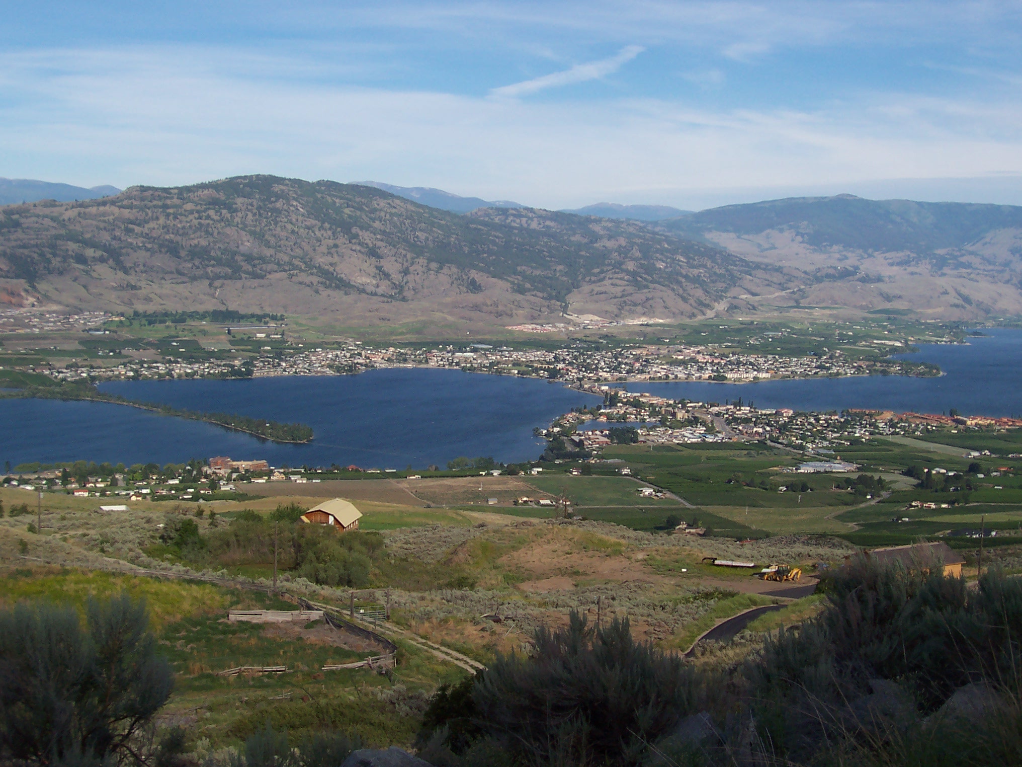
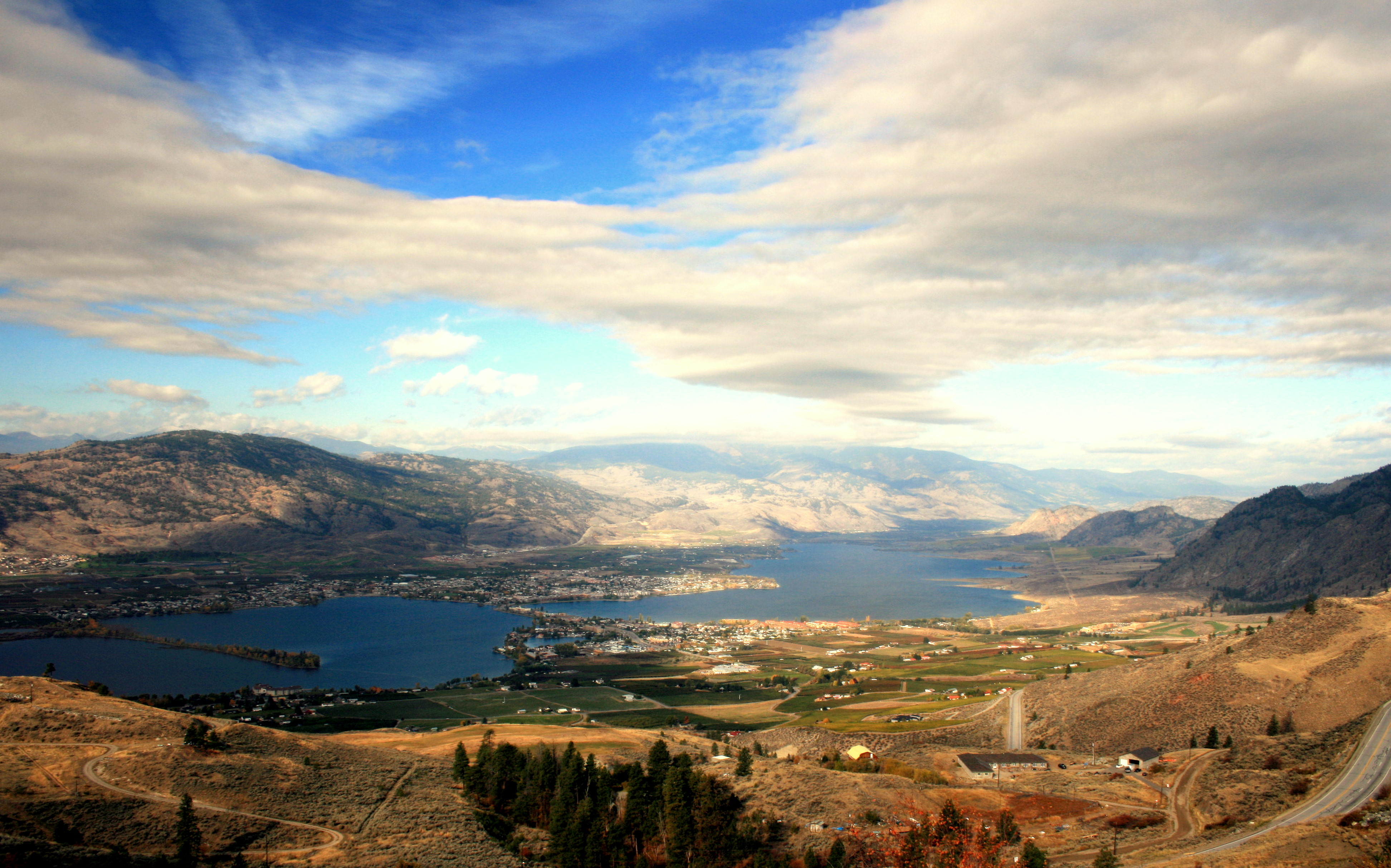
 Looking over Osoyoos Lake
Tourism in the Osoyoos area has become a large contributor to the local economy. This tourism is brought on by the many amenities in the Osoyoos area.
Osoyoos Lake is often believed Canada's warmest lake, with average summer water temperatures of 24°C (75°F) – a claim disputed only by Christina Lake. The lake is surrounded by kilometres of beaches (public and private), parks and picnic grounds, such as Gyro Beach, Lions Centennial Park, Kinsmen Park, Legion Beach and Haynes Point Provincial Park. There are also major plans to revitalize the waterfront along the town core,[20] spurred on by recent major developments such as the Watermark Beach Resort which include increased public space and an expanded marina.
There are two museums dedicated to the dry landscape of the area, both of which label the area as "Canada's only desert", even though it's not technically desert and other areas of BC are similarly dry and hot. The Osoyoos Desert Centre is located on the west side of town at the junction of Highways 3 and 97,[21] while the Nk'mip Desert Cultural Centre is located adjacent to the Nk'mip Winery on the Osoyoos Indian Reserve.[22]
The area is also served by two golf courses: the Osoyoos Golf and Country Club and the Nk’Mip Canyon Desert Golf Course.
Demographics & Development
As of the 2010 BC Stats estimate, the town has a population of 5203. The town’s popularity among retirees is reflected in the age of the average resident at 58.8 years compared to 40.8 years for the rest of the population of British Columbia. Median household income was $43,764, compared to the $52,709 earned per household on average, province-wide.[23]
The area’s increasing aging population, has sparked the need for increased healthcare services. One proposal (known as the Oasis development) currently before town council includes a 5 storey medical-commercial facility.[24] The development also includes three residential buildings between 6 and 10 stories. Despite the town’s small size, there is an abundance of condominium developments.
Sports
Club League Sport Venue Established Championships Osoyoos Coyotes KIJHL Ice hockey Osoyoos Sunbowl Arena 2010 0 Notable residents
Osoyoos is the hometown of the NHL's Chuck Kobasew who plays for the Minnesota Wild and television journalist and anchor Alison Smith.
Sister cities
Osoyoos has one city in the sister cities programme.
 Palm Desert, California, United States
References
- ^ "Osoyoos Town Website". Town of Osoyoos. http://www.osoyoos.ca/siteengine/activepage.asp?bhcp=1. Retrieved 19 December 2009.
- ^ "Town of Osoyoos". Osoyoos.ca. http://www.osoyoos.ca/siteengine/ActivePage.asp?PageID=31. Retrieved 2011-07-28.
- ^ a b "Osoyoos". BC Geographical Names. http://apps.gov.bc.ca/pub/bcgnws/names/18788.html.
- ^ "Area ‘A’ Osoyoos Rural Official Community Plan Bylaw 2450, 2008" (PDF). Regional District Okanagan-Siilkameen. April 7, 2008. http://www.rdosmaps.bc.ca/min_bylaws/bylaws/planning/consolidated/2450.pdf.
- ^ McGowan's War, Chapter: The Okanagan Trail, Donald J. Hauka, New Star Books, Vancouver (2000) ISBN 1-55420-001-6
- ^ British Columbia Chronicle, 1847–1871: Gold & Colonists, Helen and G.P.V. Akrigg, Discovery Press, Vancouver (1977) ISBN 0-919624-03-0
- ^ Claiming the Land, Dan Marshall, UBC Ph.D Thesis, 2002 (unpubl.)
- ^ "Detailed history on "Crowsnest Highway" website history page". Crowsnest-highway.ca. http://www.crowsnest-highway.ca/cgi-bin/citypage.pl?city=OSOYOOS#2. Retrieved 2011-07-28.
- ^ Wilma, David (2006-01-30). "''Indians ambush gold prospectors in McLoughlin Canyon (Okanogan Valley) on July 29, 1858'', HistoryLink.org Essay 7614". Historylink.org. http://www.historylink.org/essays/output.cfm?file_id=7614. Retrieved 2011-07-28.
- ^ Dyer, Orville (2002). "List of Species at Risk: South Okanagan-Similkameen Conservation Program Study Area". Updated to May, 2002. Ministry of Water, Land and Air Protection, Penticton, British Columbia.
- ^ "South Okanagan–Lower Similkameen National Park Reserve Feasibility Study". Pc.gc.ca. 2006-11-17. http://www.pc.gc.ca/progs/np-pn/cnpn-cnnp/os-os/index_e.asp. Retrieved 2011-07-28.
- ^ "World Map of the Köppen-Geiger climate classification updated". Meteorologische Zeitschrift, Vol. 15, No. 3, 259-263 (June 2006). Archived from the original on 2009-03-27. http://web.archive.org/web/20090327074742/http://koeppen-geiger.vu-wien.ac.at/pdf/metz_15_3_0259_0263_kottek_wm.pdf. Retrieved 27 July 2011.
- ^ a b c Environment Canada[dead link]
- ^ "Stats". Skibaldy.com. 2008-09-15. http://www.skibaldy.com/default.asp?node=Stats. Retrieved 2011-07-28.
- ^ a b "Daily Data | Canada's National Climate Archive". Climate.weatheroffice.gc.ca. 2011-05-18. http://www.climate.weatheroffice.gc.ca/climateData/dailydata_e.html?StationID=1041. Retrieved 2011-07-28.
- ^ "Canadian Climate Normals 1971–2000". Environment Canada. Accessed 30 September 2011.
- ^ a b Weather[dead link]
- ^ a b Weather[dead link]
- ^ a b Weather[dead link]
- ^ "CivicWeb: Waterfront Master Plan". Osoyoos.fileprosite.com. http://osoyoos.fileprosite.com/Documents/DocumentList.aspx?ID=2110. Retrieved 2011-07-28.
- ^ "Osoyoos Desert Society". Desert.org. http://www.desert.org/. Retrieved 2011-07-28.
- ^ "Nk'mip Desert Cultural Centre". Nkmipdesert.com. http://www.nkmipdesert.com/. Retrieved 2011-07-28.
- ^ "Community Profiles from the 2006 Census, Statistics Canada - Census Subdivision". 2.statcan.gc.ca. 2010-12-06. http://www12.statcan.gc.ca/census-recensement/2006/dp-pd/prof/92-591/details/Page.cfm?Lang=E&Geo1=CSD&Code1=5907005&Geo2=PR&Code2=59&Data=Count&SearchText=Osoyoos&SearchType=Begins&SearchPR=01&B1=All&Custom=. Retrieved 2011-07-28.
- ^ "CivicWeb: Public Hearing (Including ADDENDUMS) - 07 Sep 2010 - Pdf". Osoyoos.civicweb.net. http://osoyoos.civicweb.net/Documents/DocumentList.aspx?ID=12052&Search=1&All=oasis. Retrieved 2011-07-28.
External links
- Town of Osoyoos
- Osoyoos Times newspaper
- Osoyoos Commercial Digest
- WikiTravel.org article on Osoyoos
- http://www.bcstats.gov.bc.ca/data/pop/pop/estspop.asp#totpop
- Climate Normals for Osoyoos
Subdivisions of British ColumbiaSubdivisions Regions · Regional districts · Forest Regions and Forest Districts · School districts · Land DistrictsSettlements Urban centres Towns Comox · Creston · Cumberland · Fort Nelson · Gibsons · Golden · Ladysmith · Lake Cowichan · Oliver · Osoyoos · Port McNeill · Princeton · Qualicum Beach · Sidney · Smithers · View Royal Category:British Columbia ·
  Portal:British Columbia ·
  WikiProject:British Columbia
Coordinates: 49°1′57″N 119°27′58″W / 49.0325°N 119.46611°W
Categories:- Populated places in the South Okanagan
- Towns in British Columbia

Wikimedia Foundation. 2010.