- Oliver, British Columbia
-
Oliver — Town & Rural Community — 
Motto: "Borne of the Waters, Blest by the Sun" Location of Oliver in British Columbia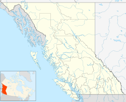
 Oliver
Coordinates: 49°10′58″N 119°33′5″W / 49.18278°N 119.55139°W Country  Canada
Province  British Columbia
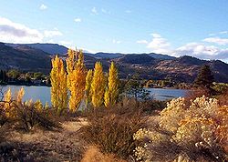
Region South Okanagan Regional district Okanagan-Similkameen Incorporated 1945 Village Founded 1918 Government – Governing body Band Council, Town Council, RDOS Board – Chief/Mayor/Director C. Louie, P.Hampson, A.Patton Area – Total 4.88 km2 (1.9 sq mi) Elevation 310 m (1,017 ft) Population (2006)[1] – Total 4,370 Time zone PST (UTC-8) Area code(s) (250) Highways Highway 97 Website Town of Oliver Oliver is a community at the south end of the Okanagan Valley in the Southern Interior of British Columbia, Canada, with a population of 4370. The community of Oliver is made up of land governed by three different bodies: the Town of Oliver, the Regional District of Okanagan-Similkameen and the Osoyoos Indian Band. Industries include grape and fruit production, agri-tourism, wine production, ranching, golfing & recreation, retail & service trades. Oliver is north of Osoyoos and south of Okanagan Falls. Tourism BC labels the community as the Wine Capital of Canada.[2]
Contents
Origin of Name
Named after John Oliver (1856–1927), Premier of British Columbia. 'Honest John' and his government brought irrigation water and settlement lots to the area with the South Okanagan Lands Project.
Early history
The First Nations of the South Okanagan settled near the river, creeks and valley lakes. The first encroachment from the outside world came circa 1811, when fur traders came to the area with the establishment of Fort Okanagan (now in the US) and first penetrated the area for trade. In the 1880s, free gold-bearing quartz was found at Camp McKinney (east of Oliver) becoming a busy gold mine, attracting miners, con men, and outlaws. Fairview (just west of and above Oliver) miners found gold and fueled the growth of a boomtown but it lasted just a few years and no remnants of the town survive today, other than a heritage marker.
- Established in 1918 Oliver was a settlement for unemployed veterans of the First World War, a gravity-fed canal was constructed to provide irrigation to the semi-arid area.
- On January 30, 1919, the SOLP (South Okanagan Lands Project) began work on the Intake Dam at the base of McIntyre Bluff. Over the next eight years the 23 concrete lined miles of the Main Canal was dug southward to the Boundary. Eighteen and a half feet across the top, five feet deep and delivering 230 cubic feet per second, SOLP designed it to enable farmers to put nearly a foot of water per month on every acre of bottom land in the southern Valley. To get the Canal from the east side of the Valley to the benches on the west, the “big siphon”—now concrete, but originally a 1,940-foot (590 m)-long wood-stave pipe of six and a half-foot-diameter—was constructed. It runs directly beneath the centre of Oliver. The offices of the land project and the building that housed the BC Police built circa 1924 stand today in Oliver as preserved heritage sites.
- A post office was established in 1921 and the BC government administered the area until 1945 when a village was incorporated and a council elected. In 1991, the community's municipal incorporation was upgraded to Town, its current status.[3]
- In 1922 electrical power was brought to Oliver by the West Kootenay Power and Light Co.
- In 1923 the Kettle Valley Railway (CPR) constructed Oliver station and rails to transport fruit north to Penticton.
Administration of Water
- SOLP (1919–1964) South Okanagan Lands Project - established by the Province of BC 1921 and run by provincial government employees for over forty years. In the spring of 1964 the Oliver/Osoyoos Fruit Growers’ Association was informed that the province was getting out of the irrigation business.
- SOLID (1964–1989) South Okanagan Lands and Irrigation District - On June 25, 1964 the Fruit Growers' Association volunteered itself to be the cornerstone of the locally constituted South Okanagan Lands Irrigation District which operated the system until 1989.
- Oliver Water (1989 to present) Town of Oliver - The water district was divided into two parts to be run by municipal governments. The Towns of Oliver and Osoyoos now deliver nineteen billion imperial gallons—nearly one hundred billion litres—to the Valley’s parched soils annually. 1990 saw the election of Water Councillors in both communities - a first in BC
Population
Based on 2006 census:[citation needed]
- Town of Oliver 4370
- Regional District Area 'C' 3899
- Osoyoos Indian Band 900
Notable people from Oliver
- John Anderson, Admiral (Ret) Former Chief of Defense Staff, graduate of SOHS
- Bill Barisoff, current Speaker of the British Columbia Legislative Assembly, graduate of SOSS
- George Bowering, First Canadian Poet Laureate, graduate of SOHS
- Patricia Churchland, philosopher and neuroscientist, born in Oliver
- Ross Fitzpatrick, Canadian Senator (Okanagan-Similkameen), graduate of SOHS
- Clarence Louie, Chief of Osoyoos Indian Band - Order of BC
- John Shannon, former NHL Executive Vice President - Broadcasting, graduate of SOSS
- Julie Skinner, 2002 Bronze Medal at Winter Olympics in Salt Lake City, Utah (Kelly Law team)
- Alison Smith, CBC TV anchor, graduate of SOSS
Climate

Climate data for Oliver Month Jan Feb Mar Apr May Jun Jul Aug Sep Oct Nov Dec Year Record high °C (°F) 15.5
(59.9)17
(63)24
(75)30.6
(87.1)36.5
(97.7)38
(100)43.9
(111.0)39.4
(102.9)36.1
(97.0)29.4
(84.9)20
(68)15.6
(60.1)42.8
(109.0)Average high °C (°F) 0.4
(32.7)4.6
(40.3)11.4
(52.5)17.3
(63.1)21.8
(71.2)25.5
(77.9)29.2
(84.6)28.5
(83.3)23.1
(73.6)15.2
(59.4)6.2
(43.2)1.1
(34.0)15.4 Average low °C (°F) −5.6
(21.9)−3.3
(26.1)−0.4
(31.3)3
(37)7.2
(45.0)10.9
(51.6)13
(55)12.5
(54.5)7.4
(45.3)2.4
(36.3)−0.9
(30.4)−4.5
(23.9)3.5 Record low °C (°F) −30.6
(−23.1)−30.6
(−23.1)−22.2
(−8.0)−8.3
(17.1)−7.8
(18.0)−0.6
(30.9)2.8
(37.0)2.8
(37.0)−4.4
(24.1)−13.5
(7.7)−21
(−6)−28.3
(−18.9)−30.6
(−23.1)Precipitation mm (inches) 26
(1.02)24.8
(0.976)22.2
(0.874)24.5
(0.965)37.2
(1.465)37.2
(1.465)30.4
(1.197)27.2
(1.071)19.3
(0.76)17.3
(0.681)28
(1.1)33.4
(1.315)327.5
(12.894)Source: Environment Canada[4] External links
- Oliver Daily News
- Oliver Chronicle
- Oliver Museum and Archives
- Wine Capital of Canada
- South Okanagan Chamber of Commerce
- Town of Oliver
- Osoyoos Indian Band
- Area C Oliver RDOS
- Oliver Parks and Recreation
References
- ^ "2006 Community Profiles". 2006 Census. Statistics Canada. http://www12.statcan.ca/census-recensement/2006/dp-pd/prof/92-591/details/page.cfm?B1=All&Code1=5907014&Code2=59&Custom=&Data=Count&Geo1=CSD&Geo2=PR&Lang=E&SearchPR=01&SearchText=Oliver&SearchType=Begins.
- ^ Tourism BC website
- ^ BCGNIS entry "Oliver (town)"
- ^ Environment Canada—Canadian Climate Normals 1971–2000, accessed 26 March 2010
Categories:- Populated places in the South Okanagan
- Towns in British Columbia

Wikimedia Foundation. 2010.