- Regional District of Okanagan-Similkameen
-
Okanagan
Similkameen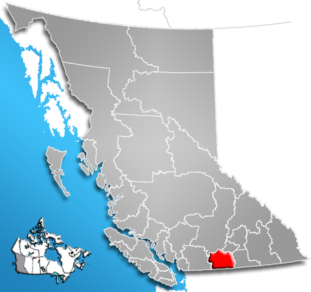
The Regional District of Okanagan-Similkameen (RDOS) is a regional district in southern British Columbia, adjacent to the U.S. state of Washington. It is bounded by Fraser Valley Regional District to the west, Thompson-Nicola Regional District and Regional District of Central Okanagan to the north, Regional District of Kootenay Boundary to the east, and by Okanogan County, Washington to the south. As of the 2006 census the population was 79,475. The district covers a land area of 10,413.44 km² (4,020.65 sq mi). The administrative offices are in the city of Penticton. Other important population centres include the district municipality of Summerland, the towns of Oliver, Osoyoos, and Princeton, and the village of Keremeos.
Description
- Population:
- 2006: 79,475 (38,827 private dwellings)
- 2001: 76,635
Electoral areas
Okanagan-Similkameen A, British Columbia
Electoral Area A comprises the rural areas surrounding Osoyoos, including Anarchist Mountain. Pop. 1,921.
Okanagan-Similkameen B, British Columbia
Electoral Area B comprises the valley of the Similkameen River from Cawston downstream to Chopaka, at the US border. Pop. 1,082.
Okanagan-Similkameen C, British Columbia
Electoral Area C comprises the rural areas surrounding Oliver, including the Mount Baldy Ski Area (though there are no residents there). Pop. 3,899.
Okanagan-Similkameen D, British Columbia
Electoral Area D comprises rural areas and unincorporated communities south of Penticton, including Kaleden and Okanagan Falls. Pop. 5,913.
Okanagan-Similkameen E, British Columbia
Electoral Area E comprises rural areas and unincorporated settlements to the northeast of Penticton including Naramata. Pop. 2,010.
Okanagan-Similkameen F, British Columbia
Electoral Area F comprises the rural areas west of Summerland and northwest of Penticton. Pop. 2,011.
Okanagan-Similkameen G, British Columbia
Electoral Area G comprises rural areas of the middle Similkameen Valley surrounding Keremeos, including Hedley. Pop. 2,308.
Okanagan-Similkameen H, British Columbia
Electoral Area H comprises rural areas and unincorporated communities in the upper Similkameen valley, including Tulameen and Coalmont. Pop. 2,208.
References
External links
Coordinates: 49°25′00″N 120°00′00″W / 49.4166667°N 120°W
 Subdivisions of British Columbia
Subdivisions Regions · Regional districts · Forest Regions and Forest Districts · School districts · Land DistrictsSettlements Urban centres Regional districts Alberni-Clayoquot · Bulkley-Nechako · Capital · Cariboo · Central Coast · Central Kootenay · Central Okanagan · Columbia-Shuswap · Comox Valley · Cowichan Valley · East Kootenay · Fraser Valley · Fraser-Fort George · Kitimat-Stikine · Kootenay Boundary · Greater Vancouver · Mount Waddington · Nanaimo · North Okanagan · Northern Rockies · Okanagan-Similkameen · Peace River · Powell River · Stikine Region (non-RD) · Skeena-Queen Charlotte · Squamish-Lillooet · Strathcona · Sunshine Coast · Thompson-NicolaCategories:- Regional districts of the British Columbia Interior
- Regional District of Okanagan-Similkameen
- British Columbia Interior geography stubs
- Population:

Wikimedia Foundation. 2010.