- Columbia-Shuswap Regional District
-
Columbia
Shuswap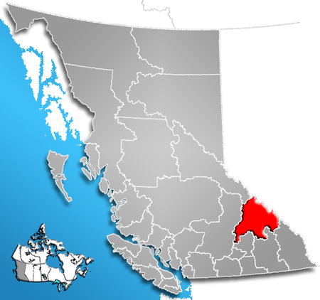
The Columbia-Shuswap Regional District is a regional district in the Canadian province of British Columbia, located in the Southern Interior region on the Trans-Canada Highway between Vancouver and Calgary. The regional district comprises the regions known as the Shuswap Country, which focuses around Shuswap Lake and lies to the north of the Okanagan, and the northern part of the Columbia Country, namely the "Big Bend" of the valley of the Columbia River from the Town of Golden to the City of Revelstoke (Revelstoke is sometimes referred to as being in the North Kootenay, Golden is usually thought of as being part of the East Kootenay sub-region, the Columbia Valley). The Canada 2006 Census population was 50,141. The regional district's offices are in Salmon Arm.
Contents
Communities
Incorporated Communities
- Salmon Arm- 16,012
- Revelstoke- 7,230
- Golden- 3,811
- Sicamous- 2,676
Regional District Electoral Areas
- Columbia-Shuswap Electoral Area "A" - 3,097
- Columbia-Shuswap Electoral Area "B" - 706
- Columbia-Shuswap Electoral Area "C"- 7,695
- Columbia-Shuswap Electoral Area "D"- 3,899
- Columbia-Shuswap Electoral Area "E" - 1,528
- Columbia-Shuswap Electoral Area "F" - 2,731
Unincorporated Communities
- Anglemont- 454
- Blind Bay- 1,149
- Celista- 408
- Craigellachie
- Eagle Bay- 528
- Falkland- 805
- Malawka- 619
- Notch Hill- 515
- Ranchero- 971
- Scotch Creek- 762
- Silver Creek- 1,038
- Sorrento- 1,360
- Sunnybrae- 699
- Swansea Point- 243
- Tappen- 773
- White Lake- 623
References
External links
- Columbia Shuswap Regional District
- "Columbia-Shuswap Regional District". BC Geographical Names. http://apps.gov.bc.ca/pub/bcgnws/names/20398.html.
 Subdivisions of British Columbia
Subdivisions Regions · Regional districts · Forest Regions and Forest Districts · School districts · Land DistrictsSettlements Urban centres Regional districts Alberni-Clayoquot · Bulkley-Nechako · Capital · Cariboo · Central Coast · Central Kootenay · Central Okanagan · Columbia-Shuswap · Comox Valley · Cowichan Valley · East Kootenay · Fraser Valley · Fraser-Fort George · Kitimat-Stikine · Kootenay Boundary · Greater Vancouver · Mount Waddington · Nanaimo · North Okanagan · Northern Rockies · Okanagan-Similkameen · Peace River · Powell River · Stikine Region (non-RD) · Skeena-Queen Charlotte · Squamish-Lillooet · Strathcona · Sunshine Coast · Thompson-Nicola Category:British Columbia ·
  Portal:British Columbia ·
  WikiProject:British Columbia
Coordinates: 51°25′00″N 117°40′00″W / 51.4166667°N 117.6666667°W
Categories:- Columbia-Shuswap Regional District
- Regional districts of the British Columbia Interior
- Shuswap Country
- Columbia Country

Wikimedia Foundation. 2010.