- Mynytho
-
Coordinates: 52°50′56″N 4°31′05″W / 52.849°N 4.518°W
Mynytho Community Llanengan Principal area Gwynedd Ceremonial county Gwynedd Country Wales Sovereign state United Kingdom Post town PORTHMADOG Postcode district LL Police North Wales Fire North Wales Ambulance Welsh EU Parliament Wales UK Parliament Caernarfon Welsh Assembly Dwyfor Meirionnydd List of places: UK • Wales • Gwynedd Mynytho is a small village in the parish of Llangian near the southern coast of the Llŷn Peninsula in north-west Wales. It consists of only a few houses, beautiful scenery and some farmland. There are also campsites scattered around the village's outskirts.
Mynytho's memorial hall [1] occupies a significant place in the history of the struggle for the recognition of Welsh culture and the Welsh language.
The following englyn by the poet R. Williams Parry appears on a plaque mounted on the wall of the hall.
- Adeiladwyd gan dlodi, — nid cerrig
-
- Ond cariad yw'r meini;
- Cydernes yw'r coed arni,
- Cyd-ddyheu a'i cododd hi.
-
In English this means
- It is built of poverty, not stones
-
- But love is its masonry,
- Shared aspirations are its timber,
- And shared commitment is what raised it up.
-
Another notable Welsh poet, Richard Goodman Jones (aka Dic Goodman) is a resident of the village.
Mynytho is also the site of a small yet highly visible tower that stands on a hill (Foel Tŵr) overlooking the area. The tower, which is popularly known to English residents as the "Jampot",[2] is an old windmill but was never a success due to crosswinds on the hill, it is identified on maps as being an old mill. The land (Foel Tŵr) on which it stands is owned by the National Trust.
The community supports its own large chapel called Horeb, which stands close to the common land and a spring [3] said to have healing properties. Of historical interest is the older (18th century) but disused chapel (Capel Newydd)[4] which stands on the left hand side of the road to Nanhoron.
Neighbouring villages and settlements include Llanbedrog, Abersoch, Llangian,[5] Nanhoron, Rhydyclafdy[6] and Botwnnog.
References
- ^ Mynytho Penllyn.com
- ^ Mynytho, Pwllheli, Gwynedd
- ^ Holy Wells of Wales, Francis Jones, Gwasg Prifysgol Cymru, Cardiff 2003
- ^ Comisiwn Brenhinol Henebion Cymru / Royal Commission on the Ancient and Historical Monuments of Wales
- ^ Llangian Penllyn.com
- ^ Rhydyclafdy Penllyn.com
External links
Gwynedd Principal settlements Bala • Bangor • Barmouth • Bethesda • Blaenau Ffestiniog • Caernarfon • Criccieth • Dolgellau • Ffestiniog • Harlech • Nefyn • Porthmadog • Pwllheli • Tywyn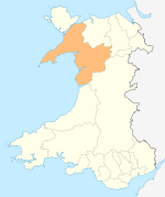
Towns and villages Aberangell • Aberdaron • Aberdesach • Aberdyfi • Abererch • Abergeirw • Abergwyngregyn • Abergynolwyn • Aberllefenni • Abersoch • Abertrinant • Afon Wen • Anelog • Arthog • Beddgelert • Bethania • Bethel • Bethesda • Betws Garmon • Bodferin • Boduan • Bontddu • Bontnewydd • Botwnnog • Bryncroes • Bryn-crug • Brynrefail • Buan • Bwlch-derwin • Caeathro • Capel Celyn • Carmel • Carnguwch • Ceidio • Chwilog • Clwt-y-bont • Clynnog Fawr • Corris Uchaf • Corris • Croesor • Cwm y Glo • Deiniolen • Dinas • Dinas Dinlle • Dinas Mawddwy • Dinorwig • Dolbenmaen • Dolmelinllyn • Dwygyfylchi • Edern • Efailnewydd • Eisingrug • Fairbourne • Friog • Frongoch • Ganllwyd • Garndolbenmaen • Garneddwen • Gellilydan • Glasinfryn • Groeslon • Llan Ffestiniog • Llanaber • Llanaelhaearn • Llanarmon • Llanbedr • Llanbedrog • Llanberis • Llandanwg • Llandegwning • Llandeiniolen • Llandudwen • Llandwrog • Llandygai • Llanegryn • Llanelltyd • Llanengan • Llanfaelrhys • Llanfaglan • Llanfair • Llanfihangel Bachellaeth • Llanfihangel-y-Pennant • Llanfihangel-y-Pennant, Dolbenmaen • Llanfrothen • Llangelynnin • Llangian • Llangwnnadl • Llangybi • Llaniestyn • Llanigian • Llanllechid • Llanllyfni • Llannor • Llanrug • Llanuwchllyn • Llanwnda • Llanymawddwy • Llanystumdwy • Llithfaen • Llwyndyrys • Llwyngwril • Maentwrog • Mallwyd • Mellteyrn • Minffordd • Morfa Bychan • Morfa Nefyn • Mynydd Llandygai • Mynydd Nefyn • Mynytho • Nantlle Valley • Rhostryfan • Nantmor • Nasareth • Nebo • Pant Glas • Penffridd • Penisa'r Waun • Penllech • Penllyn • Penmaenpool • Pennal • Penrhos • Penrhyndeudraeth • Pentre Gwynfryn • Penygroes • Pen-y-meinl • Pistyll • Pontrug • Porthdinllaen • Portmeirion • Prenteg • Rachub • Rhiwddolion • Rhosgadfan • Rhoshirwaun • Rhoslefair • Rhos-y-gwaliau • Rhyd Ddu • Rhyd • Rhydyclafdy • Sarn Meyllteyrn • Soar • Talsarnau • Tal-y-bont (near Bangor) • Tal-y-bont (near Barmouth) • Talysarn • Tanygrisiau • Trawsfynydd • Trefor • Tregarth • Tremadog • Tudweiliog • Tywyn • Waunfawr • Y Felinheli • Y Ffor • Y Fron • Y RhiwUniversities and colleges Castles and forts Rivers Afon Artro • Afon Cwmnantcol • Afon Dwyryd • Afon Dysynni • Afon Fathew • Afon Glaslyn • Afon Llyfni • Afon Mawddach • Afon Rhythallt • Afon Seiont • Afon TrywerynIslands Categories:- Gwynedd geography stubs
- Villages in Gwynedd
- Adeiladwyd gan dlodi, — nid cerrig

Wikimedia Foundation. 2010.