- Corris Uchaf
-
Coordinates: 52°39′46″N 3°51′34″W / 52.66288°N 3.85951°W
Corris Uchaf 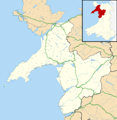
 Corris Uchaf
Corris Uchaf shown within GwyneddOS grid reference SH743088 Principal area Gwynedd Ceremonial county Gwynedd Country Wales Sovereign state United Kingdom Police North Wales Fire North Wales Ambulance Welsh EU Parliament Wales UK Parliament Meirionnydd Nant Conwy Welsh Assembly Dwyfor Meirionnydd List of places: UK • Wales • Gwynedd Corris Uchaf (English: Upper Corris), locally known as Top Corris, is a village lying in the south of the Snowdonia National Park in Gwynedd, Wales. The name is believed to be derived from the English word "quarries"[citation needed], and the extensive slate quarries that surround the village are its most prominent historical feature.
The village lies in the valley of the Afon Deri, and is threaded by the A487 road, a trunk road between Dolgellau and Machynlleth. To the south the Deri runs into the Afon Dulas in the neighbouring village of Corris.
Among the quarries that once thrived around the village are Abercwmmeiddaw and Abercorris (also known as Cwmodyn) on the east bank of the river, and Gaewern and Braichgoch on the western slopes of the valley.
A narrow-gauge horse-drawn tramway carried slate in waggons from the quarries to Maespoeth Junction, where they joined the main line of the narrow gauge Corris Railway which took them onward to Machynlleth.
References
External links
- Eco Dyfi Valley Partnership
- Corris Craft Centre
- King Arthur's Labyrinth
- Historical links
- www.geograph.co.uk : photos of Corris Uchaf and surrounding area
Corris Railway Locomotives № 3 • № 4Locations Morben • Derwenlas • Machynlleth • Ffridd Gate • Llwyngwern • Esgairgeiliog • Maespoeth Junction • Corris • Corris Uchaf • Garneddwen • Aberllefenni
Quarries and mines People George Vane-Tempest, 5th Marquess of Londonderry • Clifton Robinson • George White • Edward Temperley Gourley • Sydney Ernest Smith •
Miscellaneous Gwynedd Principal settlements Bala • Bangor • Barmouth • Bethesda • Blaenau Ffestiniog • Caernarfon • Criccieth • Dolgellau • Ffestiniog • Harlech • Nefyn • Porthmadog • Pwllheli • Tywyn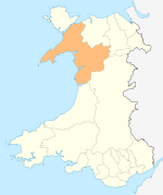
Towns and villages Aberangell • Aberdaron • Aberdesach • Aberdyfi • Abererch • Abergeirw • Abergwyngregyn • Abergynolwyn • Aberllefenni • Abersoch • Abertrinant • Afon Wen • Anelog • Arthog • Beddgelert • Bethania • Bethel • Bethesda • Betws Garmon • Bodferin • Boduan • Bontddu • Bontnewydd • Botwnnog • Bryncroes • Bryn-crug • Brynrefail • Buan • Bwlch-derwin • Caeathro • Capel Celyn • Carmel • Carnguwch • Ceidio • Chwilog • Clwt-y-bont • Clynnog Fawr • Corris Uchaf • Corris • Croesor • Cwm y Glo • Deiniolen • Dinas • Dinas Dinlle • Dinas Mawddwy • Dinorwig • Dolbenmaen • Dolmelinllyn • Dwygyfylchi • Edern • Efailnewydd • Eisingrug • Fairbourne • Friog • Frongoch • Ganllwyd • Garndolbenmaen • Garneddwen • Gellilydan • Glasinfryn • Groeslon • Llan Ffestiniog • Llanaber • Llanaelhaearn • Llanarmon • Llanbedr • Llanbedrog • Llanberis • Llandanwg • Llandegwning • Llandeiniolen • Llandudwen • Llandwrog • Llandygai • Llanegryn • Llanelltyd • Llanengan • Llanfaelrhys • Llanfaglan • Llanfair • Llanfihangel Bachellaeth • Llanfihangel-y-Pennant • Llanfihangel-y-Pennant, Dolbenmaen • Llanfrothen • Llangelynnin • Llangian • Llangwnnadl • Llangybi • Llaniestyn • Llanigian • Llanllechid • Llanllyfni • Llannor • Llanrug • Llanuwchllyn • Llanwnda • Llanymawddwy • Llanystumdwy • Llithfaen • Llwyndyrys • Llwyngwril • Maentwrog • Mallwyd • Mellteyrn • Minffordd • Morfa Bychan • Morfa Nefyn • Mynydd Llandygai • Mynydd Nefyn • Mynytho • Nantlle Valley • Rhostryfan • Nantmor • Nasareth • Nebo • Pant Glas • Penffridd • Penisa'r Waun • Penllech • Penllyn • Penmaenpool • Pennal • Penrhos • Penrhyndeudraeth • Pentre Gwynfryn • Penygroes • Pen-y-meinl • Pistyll • Pontrug • Porthdinllaen • Portmeirion • Prenteg • Rachub • Rhiwddolion • Rhosgadfan • Rhoshirwaun • Rhoslefair • Rhos-y-gwaliau • Rhyd Ddu • Rhyd • Rhydyclafdy • Sarn Meyllteyrn • Soar • Talsarnau • Tal-y-bont (near Bangor) • Tal-y-bont (near Barmouth) • Talysarn • Tanygrisiau • Trawsfynydd • Trefor • Tregarth • Tremadog • Tudweiliog • Tywyn • Waunfawr • Y Felinheli • Y Ffor • Y Fron • Y RhiwUniversities and colleges Castles and forts Rivers Afon Artro • Afon Cwmnantcol • Afon Dwyryd • Afon Dysynni • Afon Fathew • Afon Glaslyn • Afon Llyfni • Afon Mawddach • Afon Rhythallt • Afon Seiont • Afon TrywerynIslands Categories:- Villages in Gwynedd
- Corris Railway


Wikimedia Foundation. 2010.