- Coldstream
-
Coordinates: 55°39′05″N 2°15′15″W / 55.65147°N 2.25423°W
Coldstream Scottish Gaelic: An Sruthan Fuar Scots: Cauldstream 
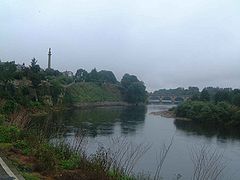
Coldstream Bridge over the River Tweed
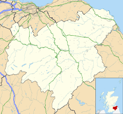
 Coldstream shown within the Scottish Borders
Population 1,813 [1] (2001 census)
est. 2,050[2] (2006)OS grid reference NT841398 Council area Scottish Borders Lieutenancy area Berwickshire Country Scotland Sovereign state United Kingdom Post town COLDSTREAM Postcode district TD12 Dialling code 01890 Police Lothian and Borders Fire Lothian and Borders Ambulance Scottish EU Parliament Scotland UK Parliament Berwickshire, Roxburgh & Selkirk Scottish Parliament Roxburgh & Berwickshire List of places: UK • Scotland • Coldstream (Scottish Gaelic: An Sruthan Fuar)[3] is a small town in the Borders district of Scotland. It lies on the north bank of the River Tweed in Berwickshire, while Northumberland in England lies to the south bank, with Cornhill-on-Tweed the nearest village. A former burgh, Coldstream is the home of the Coldstream Guards, a regiment in the British Army, and is the location where Edward I of England invaded Scotland in 1296.
In February 1316 during the Wars of Scottish Independence, Sir James Douglas defeated a numerically superior force of Gascon soldiery led by Edmond de Caillou at the Skaithmuir to the north of the town.
In the 18th and 19th centuries, Coldstream was a popular centre for runaway marriages, in a similar vein to Gretna Green, as it lay on a major road (now the A697). Notable buildings in the town include the toll house where marriages were conducted, and The Hirsel, which is the family seat of the Earls of Home.
An imposing monument to Charles Marjoribanks, MP for Berwickshire, stands at the east end of the town, close to the Coldstream Bridge.
Alec Douglas-Home, who served as prime minister of the United Kingdom from 1963 to 1964, is buried in Coldstream.[4]
Henderson Park has good views of the river and "Nun's Walk", the closest one can get to the water.
See also
References
- ^ "Comparative Population Profile: Coldstream Locality". Scotland's Census Results Online. 2001-04-29. http://www.scrol.gov.uk/scrol/browser/profile.jsp?profile=Population&mainArea=coldstream&mainLevel=Locality. Retrieved 2008-09-01.
- ^ http://www.gro-scotland.gov.uk/statistics/publications-and-data
- ^ "Search Results: Coldstream". Ainmean-Àite na h-Alba. http://www.gaelicplacenames.org/databasedetails.php?id=880. Retrieved 31 October 2011.
- ^ [1]
Abbey St Bathans · Allanton · Auchencrow · Ayton · Birgham · Burnmouth · Chirnside · Cockburnspath · Coldingham · Coldstream · Cove · Duns · Earlston · Edrom · Eyemouth · Fogo · Foulden · Gavinton · Gordon · Grantshouse · Greenlaw · Hume · Hutton · LauderRiver Tweed, Great Britain Administrative areas Flows into Towns
(upstream to downstream)Tweedsmuir · Peebles · Innerleithen · Walkerburn · Galashiels · Melrose · Newstead · St Boswells · Kelso · Coldstream · Berwick-upon-Tweed
Major tributaries
(upstream to downstream by confluence)Cor Water · Talla Water · Holms Water · Lyne Water · Manor Water · Quair Water · Leithen Water · Caddon Water · Ettrick Water · Yarrow Water · Gala Water · River Leader · River Teviot · River Till · Whiteadder Water
Major bridges
(upstream to downstream)Neidpath Viaduct · Tweed Bridge · Yair Bridge · Leaderfoot Viaduct · Dryburgh Bridge · Mertoun Bridge · Rennie Bridge · Hunter Bridge · Coldstream Bridge · Ladykirk and Norham Bridge · Union Bridge · A1 bridge, River Tweed · Royal Border Bridge · Royal Tweed Bridge · Berwick Bridge
Categories:- Scottish Borders geography stubs
- Towns in the Scottish Borders
- Populated places on the River Tweed
- Berwickshire
Wikimedia Foundation. 2010.

