- Oxgangs
-
For the ancient unit of measurement, see Oxgang.
Coordinates: 55°54′29″N 3°13′16″W / 55.908°N 3.221°W
Oxgangs 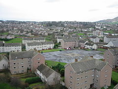
 Oxgangs
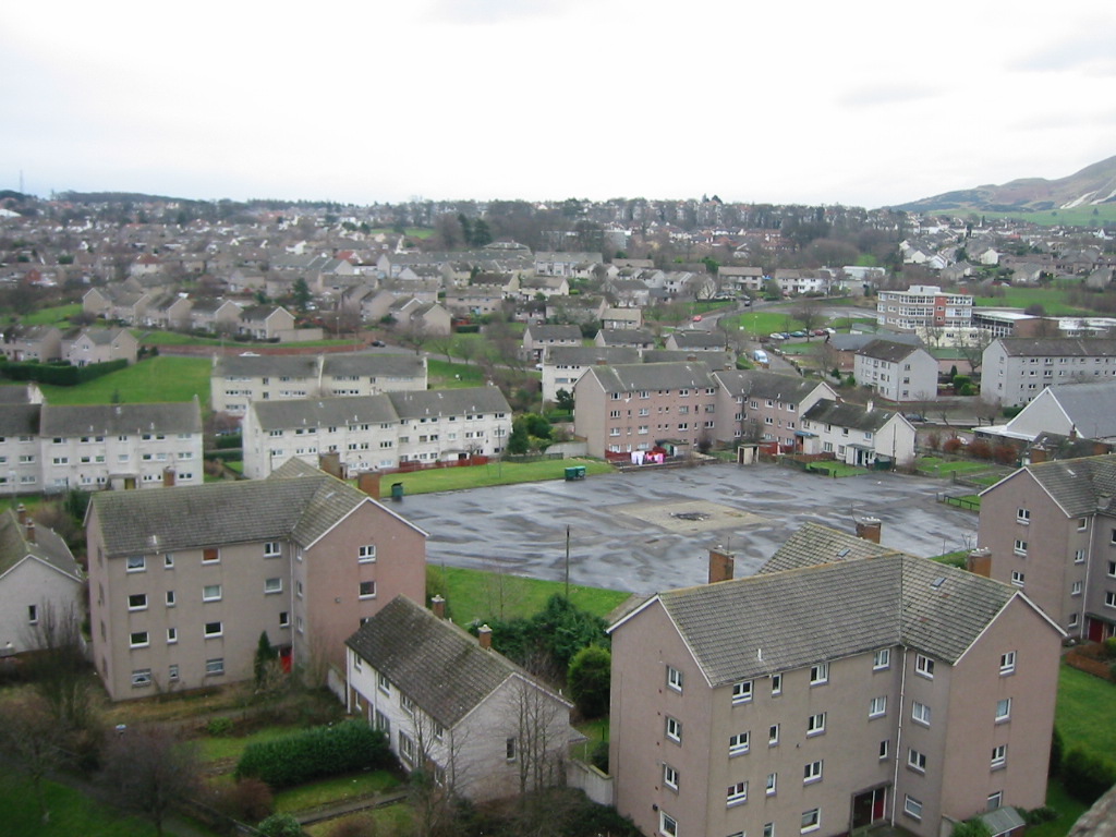
Oxgangs shown within EdinburghPopulation Unknown Council area City of Edinburgh Country Scotland Sovereign state United Kingdom Post town Edinburgh Postcode district EH13 Dialling code 0131 (441, 445) Police Lothian and Borders Fire Lothian and Borders Ambulance Scottish EU Parliament Scotland UK Parliament Edinburgh Pentlands (UK Parliament constituency) Scottish Parliament Edinburgh Pentlands (Scottish Parliament constituency) List of places: UK • Scotland • Edinburgh Oxgangs is a suburb in the south-west of Edinburgh, Scotland, United Kingdom. It is named for an oxgang, an ancient Scottish land measure.
Surrounding districts include Caiystane, Dreghorn, Redford, Fairmilehead, Colinton and Swanston and Colinton Mains. The post code area for Oxgangs is EH13.
Contents
History
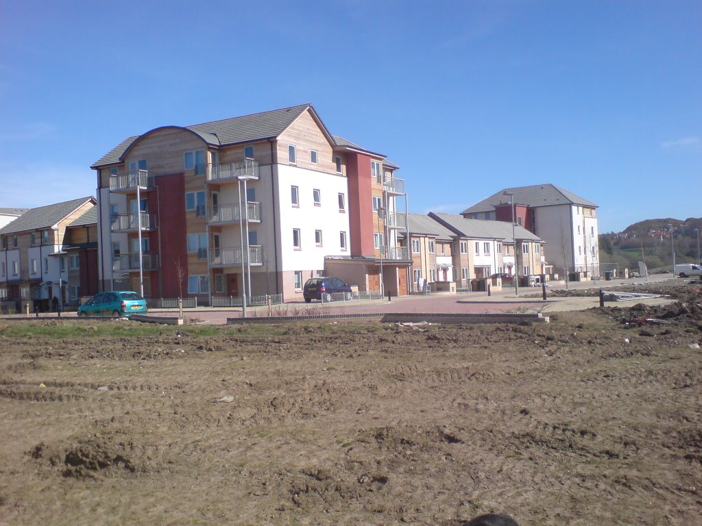
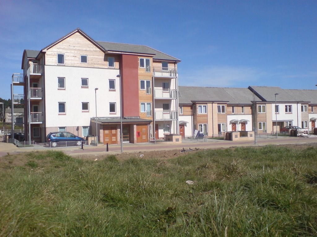
The building of the area started in around 1953/54; before that (with the exception of Colinton Mains) there had only been a number of prefab houses and several farms but it had been mostly farmland and was basically considered to be part of the countryside. The area consists of large public housing schemes aimed at low to middle income groups, ranging from private bungalows to Edinburgh City Council-owned high rise tower blocks (although these have now been demolished).
 Colinton Mains Grove, a street which lies in the neighbouring housing scheme of Colinton Mains
A significant majority of former council-owned properties in Oxgangs have been bought by tenants under the right to buy scheme leaving approximately 659 properties in council ownership thus making it extremely difficult to be allocated a council home in the area.[1]
Amenities
The area has two small shopping areas at each end of Oxgangs known to locals as the "top" and "bottom" shops. The top shops (Oxgangs Broadway) are the larger and feature a small convenience store called "Premier - Broadway Convenience Store" known as "Dennis'" after the owner of the shop. Other shops in the top shop area include a newsagents named Finn's, a movie rental store named Movie Express, a tanning salon, a bakers (Ford's), a barbers and hairdressers, a bookies, three take aways (a chip shop, a Chinese and an Indian takeaway). There is also a post office and a pharmacy. Located in and around Oxgangs and adjacent areas are a police station, a medical practice, a public library, a nursery, three primary schools and a high school, and a pub. There are three churches in the area: Church of Scotland, Scottish Episcopal Church and Roman Catholic Church. Recently a Kingdom Hall was built in the Oxgangs Green area.
Surrounding Oxgangs are three large supermarkets. A Tesco next to Firrhill High School, a Morrisons near the Swanston area and a Scotmid in Colinton Mains.
AC Oxgangs
Known locally as "ACO", this is the community football team which was founded in 2001. ACO currently operates 15 teams selected from a total player pool of almost 160 youngsters ranging in age from 7 to 19 years old. Home matches are played at Colinton Mains Park (11-a-side) or at St Mark's Primary School (7-a-side).
Recent changes
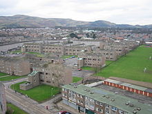
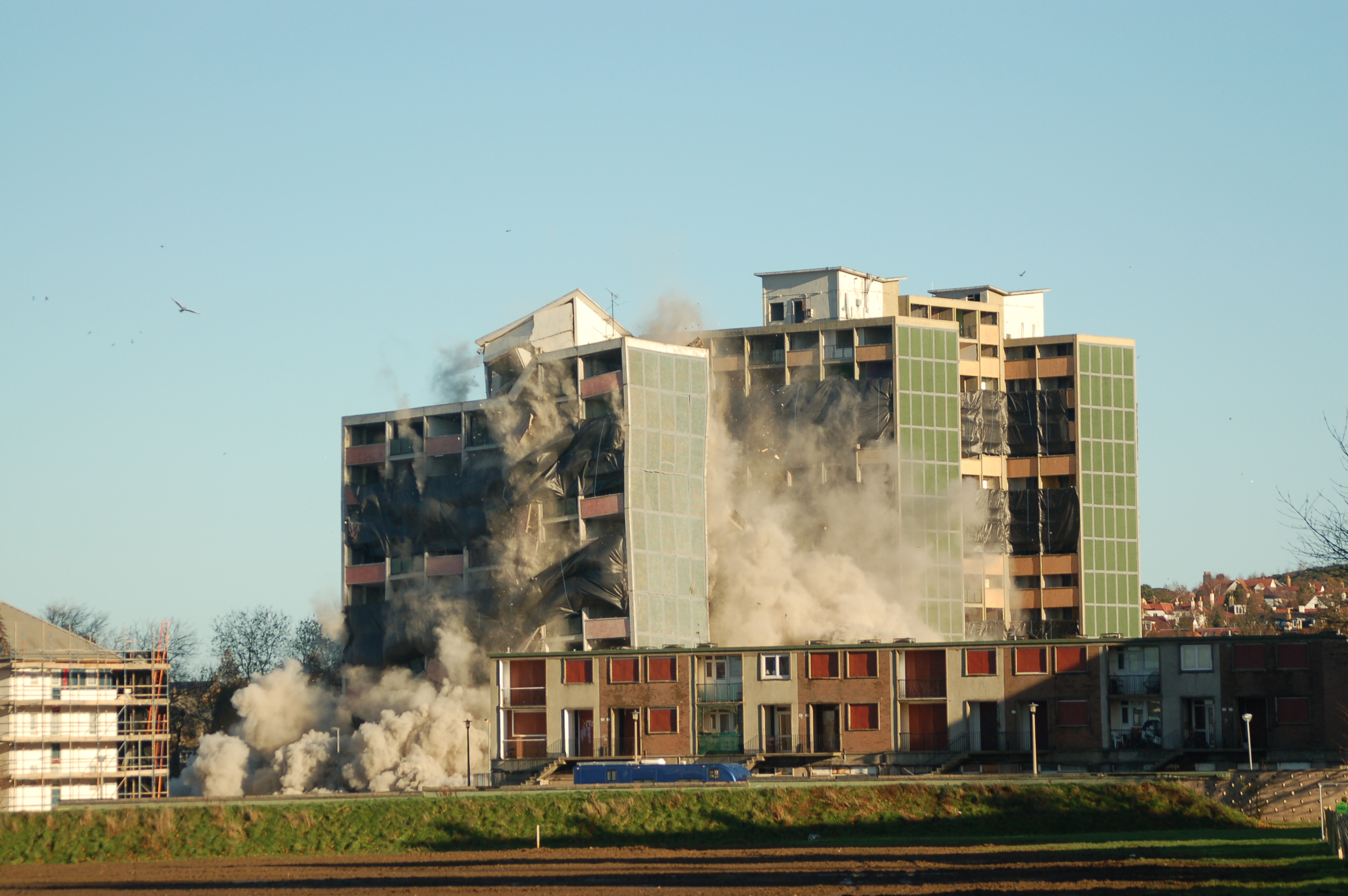
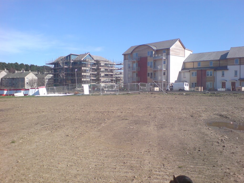
 Oxgangs tower block demolition on 26 November 2006
In 2003, after years of campaigning by fed up residents the council took the decision to demolish and redevelop Oxgangs high rise flats. In April 2005 longstanding tower block Capelaw Court was demolished to make way for new housing. Capelaw was one of three high rise flats built in Oxgangs Crescent in 1961 and 1962. The other two buildings (Caerketton Court and Allermuir Court) were demolished in November 2006. The demolition of Capelaw Court was filmed and featured on the National Geographic Channel, which interviewed residents of Oxgangs and community leader Heather Levy.
Two neighbouring primary schools situated on Oxgangs Green (Comiston and Hunters Tryst) were recently merged and renamed Pentland Primary. At first the Comiston pupils moved into the building formerly known as Hunters Tryst alongside current Tryst pupils while Comiston was renovated and a year later all staff and children moved permanently into the refurbished Comiston building, now known as Pentland Primary.
-

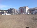
Firrhill Park
-

-
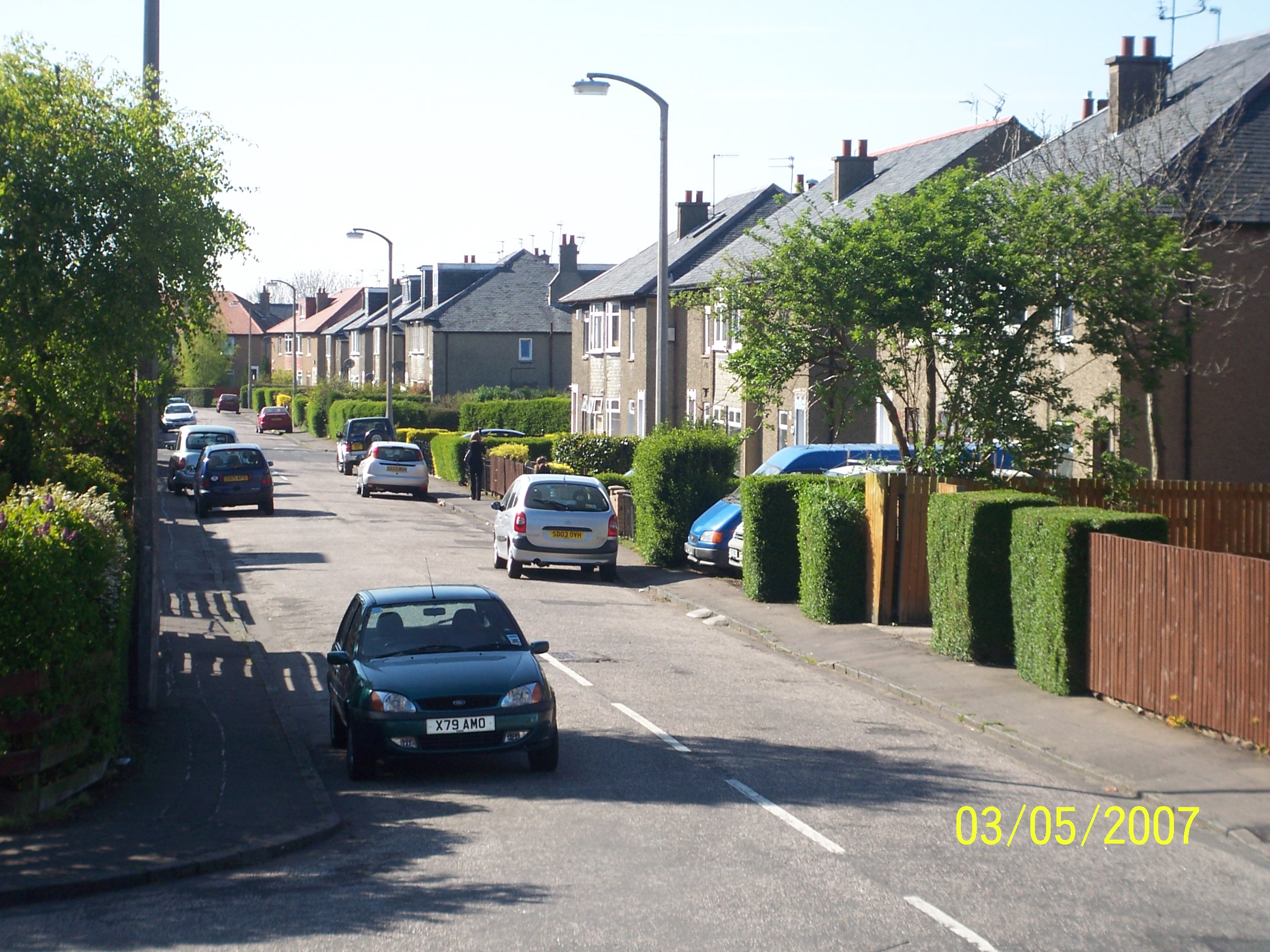
Public transport
Public transport is frequent with Lothian Buses operating chartered services. Bus routes 4, 5, 16, 18, 27 plus night service N16 all serve the area.
See also
- Oxgangs high rise flats
- Firrhill
References
External links
Categories: -


Wikimedia Foundation. 2010.