Ferranti — Infobox Defunct Company company name = Ferranti company slogan = fate = Bankrupt broken up successor = GEC Marconi, Matra Marconi Space foundation = 1905 (as Ferranti Ltd) defunct = Bankrupt 1993 location = industry = Electronics Defence key… … Wikipedia
Craigleith, Edinburgh — For the island in East Lothian, see Craigleith. Craigleith (Scottish Gaelic: Creag Lìte) is a district of north Edinburgh, Scotland. Its name comes from the Scottish Gaelic Creag liath meaning grey rock which was obtained from Craigleith quarry.… … Wikipedia
Ferranti (entreprise) — Pour les articles homonymes, voir Ferranti. Moteur Ferranti, au Museum des Sciences et de l Industrie … Wikipédia en Français
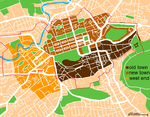
Edinburgh — For other uses, see Edinburgh (disambiguation). City of Edinburgh Scottish Gaelic: Dùn Èideann Scots: Edinburgh Unitary Authority City City of Edinburgh … Wikipedia
Leith — This article is about Leith, Scotland. For other uses, see Leith (disambiguation). Coordinates: 55°58′48″N 3°10′12″W / 55.980089°N 3.170049°W / … Wikipedia
Edinburgh tram network — Edinburgh Trams is a project to build a new tramway in Edinburgh, where local public transport has been limited to buses since the closing of the city’s original tramway on 16 November 1956.Following years of transport studies in Edinburgh two… … Wikipedia
Dean Village — The Dean Village Dean Village (from dene, meaning deep valley ) is a former village immediately northwest of Edinburgh, Scotland city centre. It was known as the Water of Leith Village and was a successful grain milling hamlet for more than 800… … Wikipedia
Newhaven, Edinburgh — Newhaven harbour in overcast sunlight Newhaven is a district in the City of Edinburgh, Scotland, between Leith and Granton. Formerly a village and harbour on the Firth of Forth, it currently has approximately 5,000 inhabitants. Newhaven is a… … Wikipedia
Holyrood Park — (also called the Queen s Park or King s Park depending on the current monarch s gender) is a royal park in central Edinburgh, Scotland about a mile to the east of Edinburgh Castle. It has an array of hills, lochs, glens, ridges, basalt cliffs,… … Wikipedia
Cramond — Harbour Population 7,502 (2001) OS grid reference … Wikipedia

