Dumbiedykes

Dumbiedykes
Dumbiedykes flats from Salisbury Crags

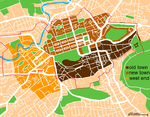
Dumbiedykes is a residential area in the centre of Edinburgh, Scotland.

It is bounded in the north by Holyrood Road, the west by the Pleasance and St Leonard's Street and the east by Holyrood Park.

The area was originally densely populated and poverty-stricken, but since the 1960s the majority of the tenement buildings and council flats have been completely demolished and the tenants moved to the new estates in Craigmillar and The Inch, Liberton with only Dumbiedykes Road, Viewcraig Street and Viewcraig Gardens still containing council-owned buildings.

The rest of the area has received a regeneration building modern flats, student residents and University of Edinburgh sports facilities and is now a popular area to live in due to its closeness to the centre of Edinburgh and the Scottish Parliament.[1]

See also

References

Coordinates: 55°56′56.28″N 3°10′40.44″W / 55.9489667°N 3.1779°W / 55.9489667; -3.1779


Wikimedia Foundation. 2010.

Игры ⚽ Поможем решить контрольную работу

Look at other dictionaries:

  • Holyrood Park — (also called the Queen s Park or King s Park depending on the current monarch s gender) is a royal park in central Edinburgh, Scotland about a mile to the east of Edinburgh Castle. It has an array of hills, lochs, glens, ridges, basalt cliffs,… …   Wikipedia

  • Edinburgh — For other uses, see Edinburgh (disambiguation). City of Edinburgh Scottish Gaelic: Dùn Èideann Scots: Edinburgh   Unitary Authority City   City of Edinburgh …   Wikipedia

  • Dean Village — The Dean Village Dean Village (from dene, meaning deep valley ) is a former village immediately northwest of Edinburgh, Scotland city centre. It was known as the Water of Leith Village and was a successful grain milling hamlet for more than 800… …   Wikipedia

  • Leith — This article is about Leith, Scotland. For other uses, see Leith (disambiguation). Coordinates: 55°58′48″N 3°10′12″W / 55.980089°N 3.170049°W / …   Wikipedia

  • Newhaven, Edinburgh — Newhaven harbour in overcast sunlight Newhaven is a district in the City of Edinburgh, Scotland, between Leith and Granton. Formerly a village and harbour on the Firth of Forth, it currently has approximately 5,000 inhabitants. Newhaven is a… …   Wikipedia

  • Holyrood — The name Holyrood may refer to:cotland* Holyrood , a metonym for the Scottish Parliament, or the Scottish Parliament Building (because they are in the Holyrood district of Edinburgh) * Holyrood, Edinburgh, one of the areas of Edinburgh (partly… …   Wikipedia

  • Cramond — Harbour Population 7,502 (2001) OS grid reference …   Wikipedia

  • Scottish Parliament Building — The Scottish Parliament Building ( gd. Pàrlamaid na h Alba) [ [http://www.scottish.parliament.uk/vli/language/gaelic/index.htm scottish.parliament.uk] , accessed 2 May 2007] is the home of the Scottish Parliament at Holyrood, within the UNESCO… …   Wikipedia

  • Marchmont — For other uses, see Marchmont (disambiguation). Marchmont Road Marchmont is a mainly residential affluent area of Edinburgh, Scotland. It lies roughly a mile to the south of the Old Town, separated from it by The Meadows and Bruntsfield Links. To …   Wikipedia

  • Murrayfield — Ice Rink Corstorphine Hill, seen in the nor …   Wikipedia

Share the article and excerpts

Direct link
Do a right-click on the link above
and select “Copy Link”