- Chiddingly
-
Coordinates: 50°55′N 0°11′E / 50.91°N 0.19°E
Chiddingly 
 Chiddingly
Chiddingly shown within East SussexArea 17.6 km2 (6.8 sq mi) [1] Population 1,006 (Parish-2007) [1] - Density 148 /sq mi (57 /km2) OS grid reference TQ543142 - London 43 miles (69 km) NNW District Wealden Shire county East Sussex Region South East Country England Sovereign state United Kingdom Post town LEWES Postcode district BN8 Dialling code 01825 Police Sussex Fire East Sussex Ambulance South East Coast EU Parliament South East England UK Parliament Wealden Website http://www.chiddingly.gov.uk/ List of places: UK • England • East Sussex Chiddingly (pronounced /ˈtʃɪdɪŋlaɪ/ "Chidding-lye") is a village and civil parish in the Wealden District of East Sussex, some five miles (8 km) northwest of Hailsham. The parish is rural in character: it includes the village of Chiddingly and a collection of hamlets: the largest of these being Muddles Green and Thunder's Hill; others being Gun Hill, Whitesmith, Golden Cross, Broomham and Upper Dicker.[2] It covers 7 square miles (18 km2) of countryside. Of the more than 340 dwellings in the parish, over fifty have the word "Farm" in their postal address.
Contents
Geography
The parish is in the Low Weald. Like Rome, it is founded upon seven hills: Thunders Hill; Gun Hill; Pick Hill; Stone Hill; Scrapers Hill; Burgh Hill and Holmes Hill,[3] the latter being on the A22 road in the south of the parish. Tributaries of the River Cuckmere flow both north and south of the village.
History
The presence of low-grade iron ore in the local sandstone supported Roman mining and smelting in the area.[citation needed]
The Domesday Book of 1086 refers to Cetelingei: the final -ly of the name shows it to have had Saxon origins. There is a large number of manorial buildings in the parish, including Chiddingly Place.
Points of interest
Burgh Hill Farm Meadow is a Site of Special Scientific Interest (SSSI) within the parish.[4] This is a hedgerow-surrounded meadow of an uncommon grassland type.
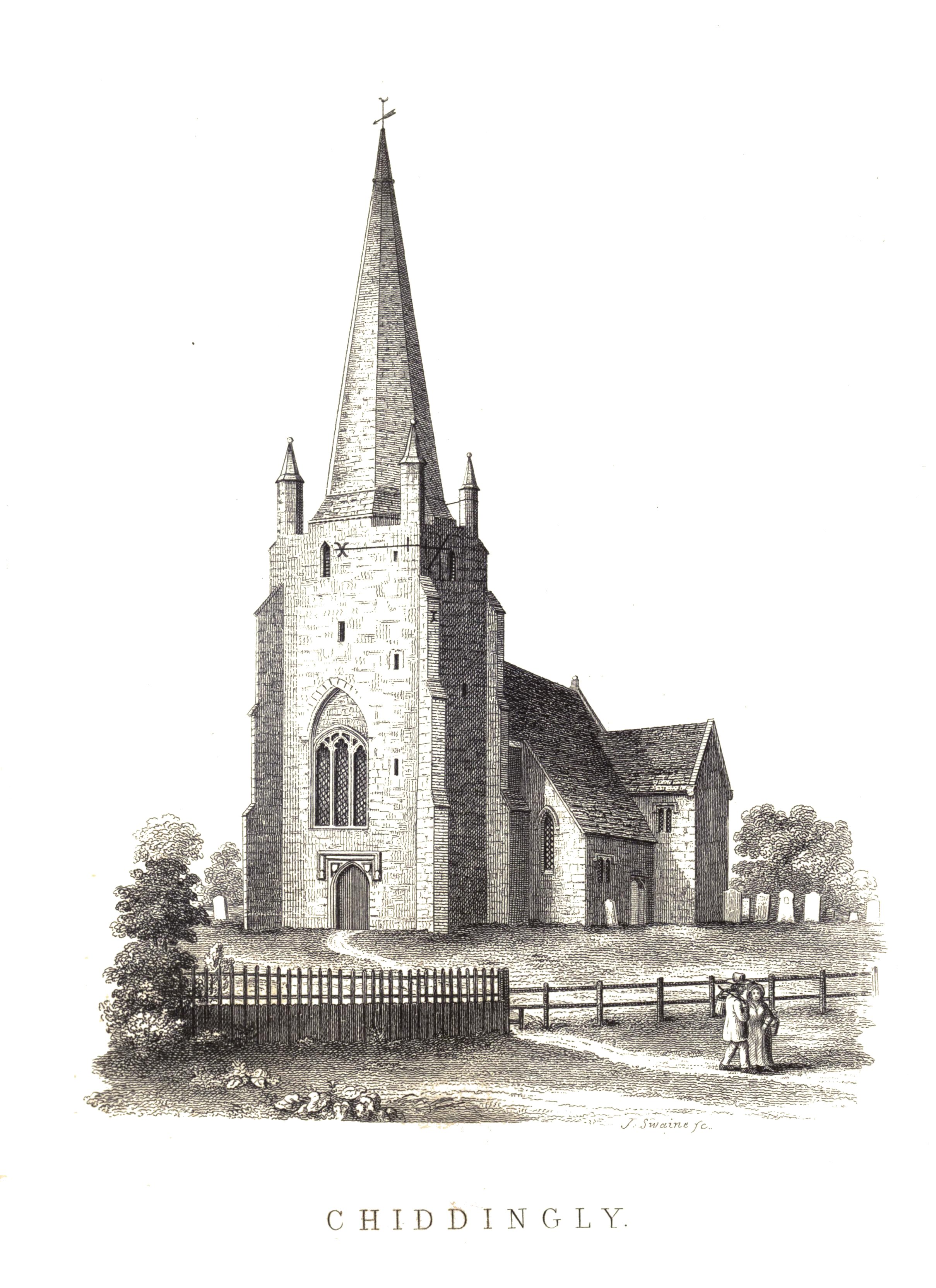
The Church of England parish church at Chiddingly is of unknown date and dedication, but references to it occur from the 13th century.[5] Today the parish is part of a united benefice with the neighbouring parish of East Hoathly. A Congregational chapel was founded in Chiddingly 1901.
Chiddingly has a primary school.[6]
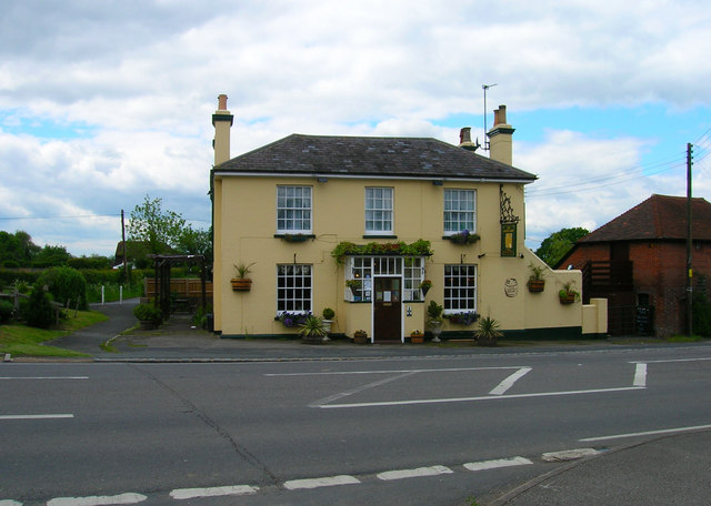
The annual Chiddingly Festival includes various entertainments around the village.[7] Chiddingly has four public houses: The Six Bells Inn in the village, The Gun Inn, The Golden Cross Inn, and The Inn on the Park at Golden Cross. Chiddingly has a village hall.
In 1971 the film director Philip Trevelyan made the documentary film The Moon and the Sledgehammer[8] about the Page family who lived in a wood outside the village and operated two traction engines: an Allchin[9] and a Fowler.
References
- ^ a b "East Sussex in Figures". East Sussex County Council. http://www.eastsussexinfigures.org.uk/webview/. Retrieved 2008-04-26.
- ^ Map showing location of Chiddingly
- ^ Parochial history of Chiddingly
- ^ "Natural England - SSSI". English Nature. http://www.english-nature.org.uk/special/sssi/sssi_details.cfm?sssi_id=1001647. Retrieved 2008-05-29.
- ^ Chiddingly parish church
- ^ Chiddingly Primary School
- ^ Chiddingly Festival
- ^ The Moon and the Sledgehammer official website
- ^ Allchin Files about Wm. Allchin traction engines
-
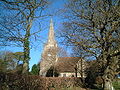 Chiddingly Church
 -
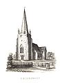 Chiddingly Church
 -
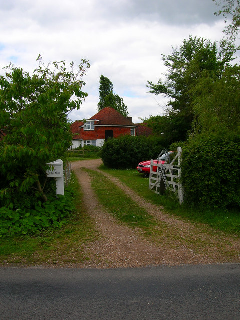
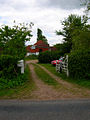 Dicker Mill House, Golden Cross
 -
 Golden Cross Inn, Golden Cross
External links
- Chiddingly at the Open Directory Project
 Media related to Chiddingly at Wikimedia Commons
Towns, villages and hamlets in the Wealden District of East Sussex, England Alciston • Alfriston • Arlington • Berwick • Best Beech Hill • Birling Gap • Blackboys • Blackham • Bodle Street Green • Boreham Street • Broad Oak • Burlow • Buxted • Chalvington • Chelwood Gate • Chiddingly • Coleman's Hatch • Cooper's Green • Cowbeech • Cross in Hand • Crowborough • Danehill • Duddleswell • East Dean • East Hoathly • Eridge Green • Etchingwood • Exceat • Fairwarp • Five Ash Down • Five Ashes • Fletching • Folkington • Forest Row • Framfield • Frant • Friston • Furner's Green • Golden Cross • Groombridge • Gun Hill • Hadlow Down • Hailsham • Halland • Hammerwood • Hankham • Hartfield • Heathfield • Hellingly • Heron's Ghyll • Herstmonceux • High Hurstwood • Holtye • Hooe • Hooe Common • Horam • Horney Common • Isfield • Jevington • Laughton • Litlington • Little Horsted • Little London • Lower Dicker • Lower Horsebridge • Lullington • Magham Down • Maresfield • Mark Cross • Mayfield • Maynard's Green • Milton Street • Muddles Green • Ninfield • Nutley • Old Heathfield • Pevensey • Pevensey Bay • Polegate • Poundgate • Punnett's Town • Rickney • Ripe • Roser's Cross • Rotherfield • Rushlake Green • Selmeston • Stone Cross • Stunts Green • Tidebrook • Three Cups Corner • Uckfield • Upper Dicker • Upper Hartfield • Vines Cross • Wadhurst • Waldron • Warbleton • Wartling • Westdean • Westham • Whitesmith • Willingdon • Wilmington • Windmill Hill • Winton • Withyham • Wych CrossWealden District Categories:- Wealden
- Local government in East Sussex
- Villages in East Sussex


Wikimedia Foundation. 2010.