- Ninfield
-
Coordinates: 50°53′N 0°26′E / 50.89°N 0.43°E
Ninfield
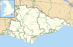
 Ninfield shown within East Sussex
Area 10.6 km2 (4.1 sq mi) [1] Population 1,520 (2007)[1] - Density 372 /sq mi (144 /km2) OS grid reference TQ706124 - London 49 miles (79 km) NNW District Wealden Shire county East Sussex Region South East Country England Sovereign state United Kingdom Post town BATTLE Postcode district TN33 Dialling code 01424 Police Sussex Fire East Sussex Ambulance South East Coast EU Parliament South East England UK Parliament Bexhill and Battle List of places: UK • England • East Sussex Ninfield is a village and civil parish in the Wealden District of East Sussex, England. The village is situated 4 miles (6.4 km) north of Bexhill-on-Sea, at the junction of two roads: the A269 from Bexhill to Battle and the A271 to Hailsham. The parish covers some 2,500 acres (1,010 ha) on the Weald.
To the west of the village is Standard Hill, said to be the place that William the Conqueror placed his flag after the Battle of Hastings.[2] As with many other Wealden villages, it was involved in the iron industry: that fact is commemorated by the presence in the village of a set of iron stocks. Smuggling was also rife in the eighteenth century.
The village name is said to come from the fact that it was originally composed of nine and three quarter fields.[citation needed]
The parish council consists of nine councillors.[3] They put on several events, including a gala with professional cabaret, each year to raise money for nominated charities such as Alzheimers and Sussex Ambulance.
There are two churches in Ninfield: the parish church dedicated to St Mary the Virgin; and the Methodist church. There is a primary school,[4] and a village post office and shop. There are two pubs in Ninfield - The Kings Arms and the Blacksmiths Inn.
References
- ^ a b "East Sussex in Figures". East Sussex County Council. http://www.eastsussexinfigures.org.uk/webview/. Retrieved 2008-04-26.
- ^ Historical notes, Vision of Britain website
- ^ The Parish Council representatives
- ^ Ninfield CE Primary School website
External links
 Media related to Ninfield at Wikimedia Commons
Towns, villages and hamlets in the Wealden District of East Sussex, England Alciston • Alfriston • Arlington • Berwick • Best Beech Hill • Birling Gap • Blackboys • Blackham • Bodle Street Green • Boreham Street • Broad Oak • Burlow • Buxted • Chalvington • Chelwood Gate • Chiddingly • Coleman's Hatch • Cooper's Green • Cowbeech • Cross in Hand • Crowborough • Danehill • Duddleswell • East Dean • East Hoathly • Eridge Green • Etchingwood • Exceat • Fairwarp • Five Ash Down • Five Ashes • Fletching • Folkington • Forest Row • Framfield • Frant • Friston • Furner's Green • Golden Cross • Groombridge • Gun Hill • Hadlow Down • Hailsham • Halland • Hammerwood • Hankham • Hartfield • Heathfield • Hellingly • Heron's Ghyll • Herstmonceux • High Hurstwood • Holtye • Hooe • Hooe Common • Horam • Horney Common • Isfield • Jevington • Laughton • Litlington • Little Horsted • Little London • Lower Dicker • Lower Horsebridge • Lullington • Magham Down • Maresfield • Mark Cross • Mayfield • Maynard's Green • Milton Street • Muddles Green • Ninfield • Nutley • Old Heathfield • Pevensey • Pevensey Bay • Polegate • Poundgate • Punnett's Town • Rickney • Ripe • Roser's Cross • Rotherfield • Rushlake Green • Selmeston • Stone Cross • Stunts Green • Tidebrook • Three Cups Corner • Uckfield • Upper Dicker • Upper Hartfield • Vines Cross • Wadhurst • Waldron • Warbleton • Wartling • Westdean • Westham • Whitesmith • Willingdon • Wilmington • Windmill Hill • Winton • Withyham • Wych CrossWealden District Categories:- Wealden
- Local government in East Sussex
- Villages in East Sussex
- East Sussex geography stubs
Wikimedia Foundation. 2010.

