- Wadhurst
-
Coordinates: 51°04′N 0°20′E / 51.06°N 0.34°E
Wadhurst 
 Wadhurst
Wadhurst shown within East SussexArea 40.1 km2 (15.5 sq mi) [1] Population 4,818 (Parish-2007)[1] - Density 311 /sq mi (120 /km2) OS grid reference TQ640318 - London 36 miles (58 km) NNW District Wealden Shire county East Sussex Region South East Country England Sovereign state United Kingdom Post town WADHURST Postcode district TN5 Dialling code 01892 Police Sussex Fire East Sussex Ambulance South East Coast EU Parliament South East England UK Parliament Wealden Website Wadhurst Parish Council List of places: UK • England • East Sussex -
For the Melbourne grammar school campus, see Melbourne Grammar School
Wadhurst is a market town in East Sussex, England. It is the centre of the civil parish of Wadhurst, which also includes the hamlets of Cousley Wood and Tidebrook. Wadhurst is twinned with Aubers in France.
Contents
Situation
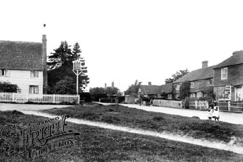
 Cousley Wood c.1899
Wadhurst is situated on the Kent-Sussex border seven miles (11 km) east of Crowborough and about seven miles (11 km) south of Tunbridge Wells. Other nearby settlements include Ticehurst, Burwash, Mayfield and Heathfield in East Sussex, and Lamberhurst, Hawkhurst and Cranbrook in Kent.
Physically, Wadhurst lies on a high ridge of the Weald - a range of wooded hills running across Sussex and Kent between the North Downs and the South Downs. The reservoir of Bewl Water is nearby. The River Bewl, which is a sub-tributary of the River Medway, and the Limden rise within the civil parish of Wadhurst.
History
The name Wadhurst (Wadeherst in early records)[citation needed] is Anglo-Saxon and most probably derives from Wada which is believed to be the name of a Saxon tribe which occupied the area[citation needed] and began the clearing of the forests in the 7th or 8th century. There is an Anglo-Saxon manor known as Bivelham which lay between the parishes of Wadhurst and Mayfield.
Although Wadhurst was almost certainly in existence at the time of the Domesday survey in 1086,[citation needed] it was part of the Archbishop of Canterbury's land and was therefore not mentioned.[citation needed] The earliest record relating to the area is a reference in the Cartulary of Battle Abbey to "Snape in the parish of Wadhurst".[citation needed]
Henry III granted Wadhurst its charter in 1253,[citation needed] allowing Wadhurst to hold a market every Saturday and a fair on the feast of St Peter and St Paul, the 29 June.[citation needed]
In the 16th, 17th and 18th centuries Wadhurst, as with many towns and villages in the Weald, had a thriving iron industry.[citation needed] Two of the large Georgian buildings in the High Street, Hill House and The Old Vicarage, were both ironmasters houses, along with a number of other large houses on the outskirts of Wadhurst.[citation needed] Within the church of St Peter and St. Paul there are several iron ledger-stone memorials of ironmasters, which are unique to this area.[citation needed]
During World War I, Wadhurst lost 649 men, out of a total village population of 3,500. The worst losses were during the Battle of Aubers Ridge, where twenty five men from Wadhurst were killed in one day, comprising 80% of the men who from Wadhurst who went into no mans land that day.[2]
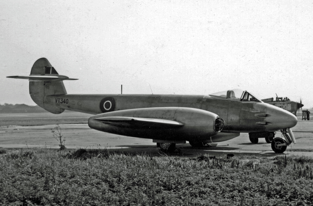
On 20 January 1958 a Royal Air Force Gloster Meteor night fighter WS661 was on a training flight from RAF North Luffenham when it crashed into the High Street of the village after control of the aircraft was lost. A number of shops and buildings were destoyed or damaged in the crash. The accident killed both of the Meteor crew and two people on the ground.
 A RAF Gloster Meteor like the one that crashed into the village.
Buildings and people
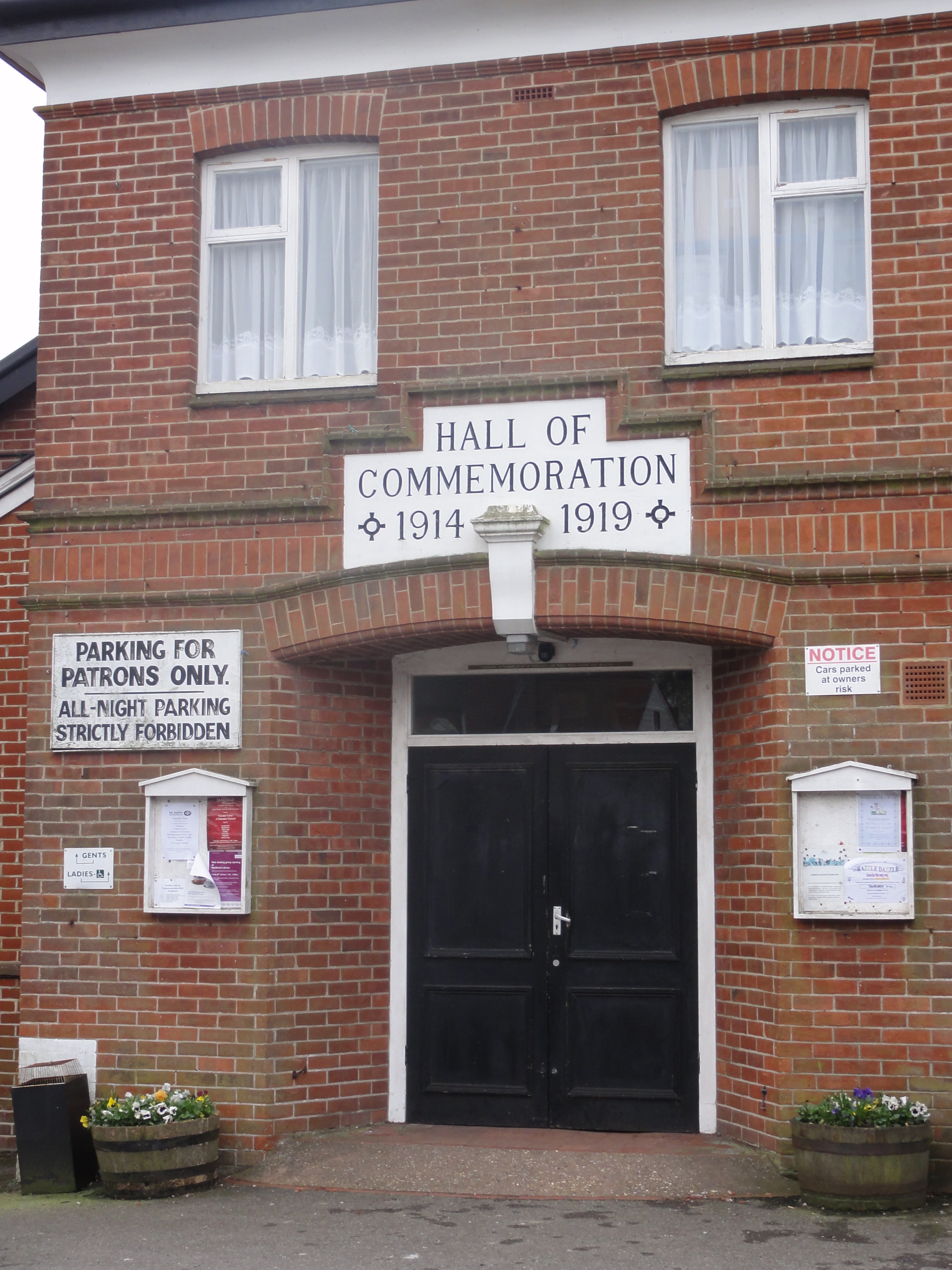
 Commemoration hall on High Street.See also: List of places of worship in Wealden
Wadhurst is a small market town, and has kept a very good range of shops considering its size. It has a traditional butcher, baker, ironmonger, hairdresser, bank, post office, gift shop, several pubs and much more. Such a wide range of small traders and services is almost unique in the villages in the locality. The population of the ward was 5,075 during the 2001 Census.[3]
There are three buildings of particular architectural interest in the town itself, and a good range of old manor houses and farms nearby. The Church of St. Peter and St. Paul dominates the centre of the town. Wadhurst's heritage as a centre of the iron industry is shown by the many iron gravestones in the church. There are two early Georgian houses on the High Street, the Old Vicarage and Hill House. On the outskirts is the nineteenth century Wadhurst Castle.
The rest of the town is in a variety of vernacular styles, dating from the 15th century onwards, though little in the centre of the town is very modern apart from a range of shops which replaced the Queens Head Hotel, demolished in a jet crash in the 1950s.
The Victorian era saw the town expand towards the new railway station, about 1.5 miles (2.4 km) north of the town. The station (the highest in southern England) is on the line from London Charing Cross to Hastings via Tunbridge Wells, and was opened in 1851 by the South Eastern Railway. The resulting expansion brought the hamlets of Sparrow's Green, Turners Green and Best Beech Hill into the town. In addition to the railway station, there are a bus services running to Tunbridge Wells, Crowborough and Hastings, as well as community transport and 'rail link' buses to Ticehurst and Mayfield.[4]
In the centre of Wadhurst there are two churches: St. Peter and St.Paul is an Anglican church in the centre of Wadhurst, with parts of the church dating back to the 1100s CE.[5][6][7] Wadhurst Methodist Church is also in the High Street and was founded in 1874.[7] There is also a Catholic church in Mayfield Lane attached to the Sacred Heart school.[7][8] The three churches also participate in Churches Together, an interdenominational organization, along with St John the Baptist, an Anglican church in Tidebrook, and St Peter in Stonegate.[9]
Places of worship in the parish also include two early 19th-century former Strict Baptist chapels of similar design in the hamlets of Pell Green (Rehoboth Chapel) and Shover's Green (the Shover's Green Baptist Chapel).[10] Both are listed at Grade II.[11][12]
Wadhurst is home to two schools the state-maintained sector: a Church of England primary school (with a nursery) in Sparrows Green[13] and Uplands, a community secondary school and sixth form with technology college status.[14] The latter also has an affiliated youth and community centre. In addition, in Mayfield Lane there is an independent Catholic preparatory school, Sacred Heart.[15][16] Wadhurst also used to be the site of Bellerbys College (formerly known as Wadhurst College and Micklefield Wadhurst), a private girls school on Mayfield Lane that has been defunct since approximately 2004.
Wadhurst United F.C.
Wadhurst United F.C. (based at the Recreation Ground, South View Road) is Wadhurst's local football team. They were formed in 1890 and joined the Sussex County League Division Three in 2004. They left the league after the 2005–06 season, to rejoin the East Sussex Football League. The club won the East Sussex League Division Two title in the 2008-09 season. They also have many junior teams of different ages.
Notable people
- Jeff Beck, guitarist, has lived in Wadhurst since summer 1975. His move came a few months after the release of his Blow by Blow album, which reached #4 in the U.S. His large stone country house dates to 1591.[17]
- Caroline Augusta Foley Rhys Davids, Pāli language scholar and translator
- Davina McCall, television presenter, has a house in Wadhurst [18]
- Irfan Orga (1908–70), exiled Turkish writer, lived at Spike Island, Wadhurst, 1961–70
- Hans Rausing, billionaire inheritor of Tetra Pak, has a house and deer park in Wadhurst
Notes
- ^ a b "East Sussex in Figures". East Sussex County Council. http://www.eastsussexinfigures.org.uk/webview/. Retrieved 2008-04-26.
- ^ Kelly, Jon (11 November 2011). "Thankful villages: The places where everyone came back from the wars". BBC News. http://www.bbc.co.uk/news/magazine-15671943. Retrieved 11 November 2011.
- ^ "National Statistics - Neighbourhood statistics by ward". http://neighbourhood.statistics.gov.uk/dissemination/areasubject.do.
- ^ Bus Services, wadhurst.info
- ^ The church building, St Peters and St Pauls church website
- ^ Church page on wadhurst.info
- ^ a b c All about Wadhurst: Wadhurst Chapels and Churches, wadhurst.info
- ^ Sacred Heart, Wadhurst churches, wadhurst.info
- ^ Churches Together in Wadhurst, wadhurst.info
- ^ Stell, Christopher (2002). Nonconformist Chapels and Meeting-houses in Eastern England. Swindon: English Heritage. p. 352. ISBN 1-873592-50-7.
- ^ "Detailed Record: Baptist Chapel, Ticehurst Road, Shover's Green, Wadhurst, Wealden, East Sussex". Images of England. English Heritage. 2007. http://www.imagesofengland.org.uk/Details/Default.aspx?id=296835&mode=quick. Retrieved 21 April 2010.
- ^ "Detailed Record: Rehoboth Chapel, Pell's Green (sic), Wadhurst, Wealden, East Sussex". Images of England. English Heritage. 2007. http://www.imagesofengland.org.uk/Details/Default.aspx?id=296813&mode=quick. Retrieved 21 April 2010.
- ^ Wadhurst CE Primary School homepage
- ^ Uplands home page
- ^ Sacred Heart school, Wadhurst
- ^ History of schools in Wadhurst, wadhurst.info
- ^ Hjort, Christopher, and Doug Hinman (2000). Jeff's Book: A Chronology of Jeff Beck's Career, 1965-1980; From the Yardbirds to Jazz-Rock. Rumford, Rhode Island: Rock 'n' Roll Research Press. p. 165.
- ^ Big Brother's Davina McCall moves to Wadhurst
References
- Savidge, Alan and Oliver Mason. (1988). Wadhurst: Town of the High Weald. Gillingham: Meresborough. 10-ISBN 0-948-19335-2; 13-ISBN 978-0—948-19335-4; OCLC 20798945
Towns, villages and hamlets in the Wealden District of East Sussex, England Alciston • Alfriston • Arlington • Berwick • Best Beech Hill • Birling Gap • Blackboys • Blackham • Bodle Street Green • Boreham Street • Broad Oak • Burlow • Buxted • Chalvington • Chelwood Gate • Chiddingly • Coleman's Hatch • Cooper's Green • Cowbeech • Cross in Hand • Crowborough • Danehill • Duddleswell • East Dean • East Hoathly • Eridge Green • Etchingwood • Exceat • Fairwarp • Five Ash Down • Five Ashes • Fletching • Folkington • Forest Row • Framfield • Frant • Friston • Furner's Green • Golden Cross • Groombridge • Gun Hill • Hadlow Down • Hailsham • Halland • Hammerwood • Hankham • Hartfield • Heathfield • Hellingly • Heron's Ghyll • Herstmonceux • High Hurstwood • Holtye • Hooe • Hooe Common • Horam • Horney Common • Isfield • Jevington • Laughton • Litlington • Little Horsted • Little London • Lower Dicker • Lower Horsebridge • Lullington • Magham Down • Maresfield • Mark Cross • Mayfield • Maynard's Green • Milton Street • Muddles Green • Ninfield • Nutley • Old Heathfield • Pevensey • Pevensey Bay • Polegate • Poundgate • Punnett's Town • Rickney • Ripe • Roser's Cross • Rotherfield • Rushlake Green • Selmeston • Stone Cross • Stunts Green • Tidebrook • Three Cups Corner • Uckfield • Upper Dicker • Upper Hartfield • Vines Cross • Wadhurst • Waldron • Warbleton • Wartling • Westdean • Westham • Whitesmith • Willingdon • Wilmington • Windmill Hill • Winton • Withyham • Wych CrossCategories:- Wealden
- Market towns in East Sussex
- Local government in East Sussex
- Towns in East Sussex
- Aviation accidents and incidents in the United Kingdom
-

Wikimedia Foundation. 2010.