- Rotherfield
-
Coordinates: 51°02′N 0°13′E / 51.04°N 0.22°E
Rotherfield 
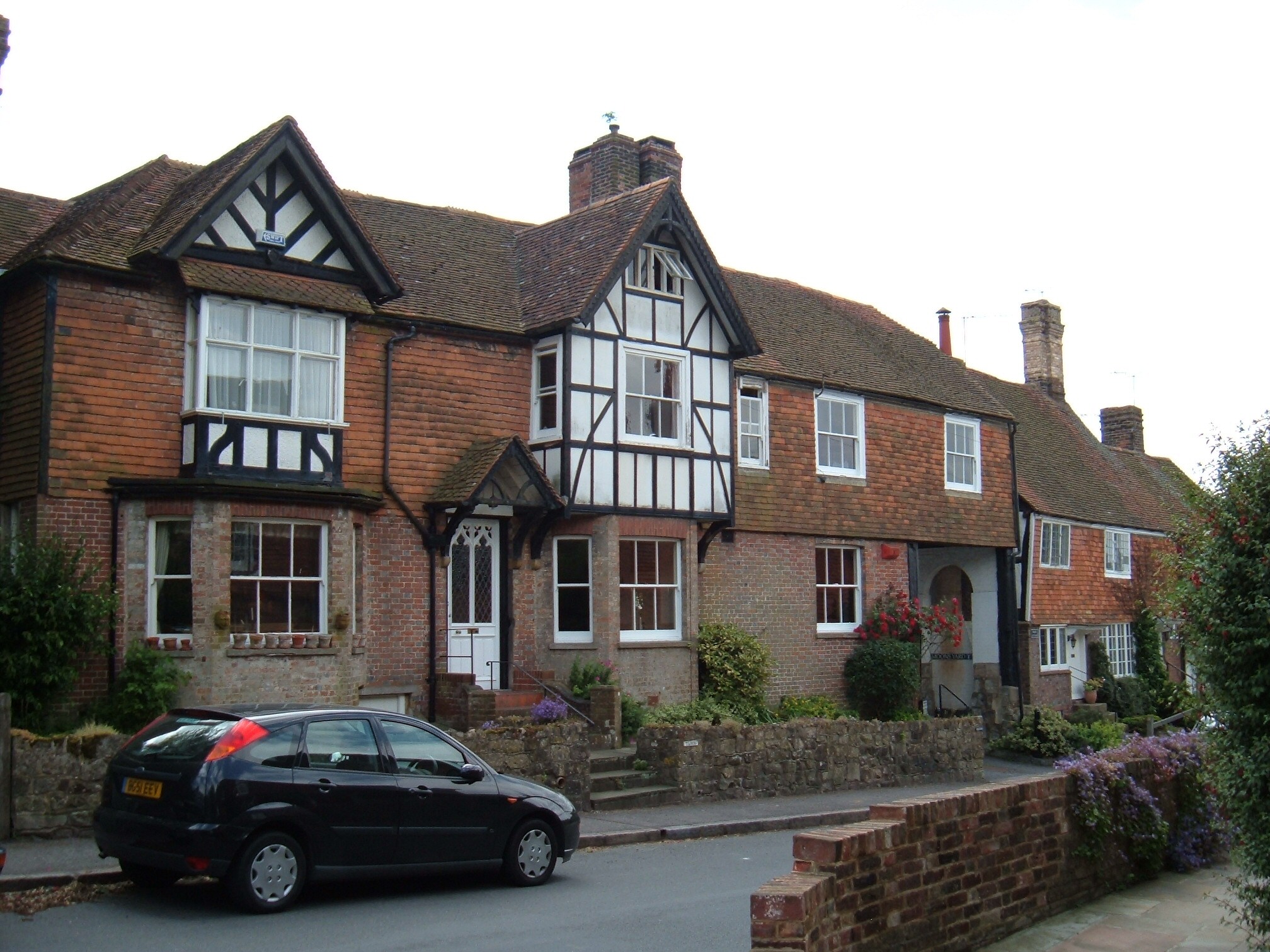
Rotherfield High Street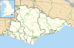
 Rotherfield
Rotherfield shown within East SussexArea 46.1 km2 (17.8 sq mi) [1] Population 3,151 (2007)[1] - Density 177 /sq mi (68 /km2) OS grid reference TQ556297 - London 35 miles (56 km) NNW District Wealden Shire county East Sussex Region South East Country England Sovereign state United Kingdom Post town CROWBOROUGH Postcode district TN6 Dialling code 01892 Police Sussex Fire East Sussex Ambulance South East Coast EU Parliament South East England UK Parliament Wealden Website Rotherfield Parish Council List of places: UK • England • East Sussex Rotherfield is a village and civil parish in the Wealden District of East Sussex, England. It is one of the largest parishes in East Sussex. There are three villages in the parish: Rotherfield, Mark Cross, and Eridge.
Contents
Etymology
The name Rotherfield is thought to derive from the Anglo-Saxon redrefeld meaning cattle lands, although it has been speculated that it may have originally been called or Hrytheranfelda meaning Hrother's field.[2]
History
There are written records of Rotherfield in the 8th century; it was also included in the Domesday Book and in various other medieval documents.[3] In Tudor times three of the inhabitants were burned at the stake for their religious beliefs.[4]
In the 18th century, the road through the village became part of the Turnpike Trust road between Tunbridge Wells and Lewes. Until 1880, when a new ecclesiastical parish was formed, Crowborough was also part of the parish; in 1905 the latter became a civil parish in its own right.
Governance
The Parish Council consists of thirteen members, three representing the Eridge and Mark Cross ward and ten representing the Rotherfield Ward.[5]
Landmarks
Rotherfield parish lies to the south of Tunbridge Wells in the High Weald, an Area of Outstanding Natural Beauty. Within the parish boundaries lies Bream Wood, a designated Site of Special Scientific Interest.[6] This is a woodland with a stream (ghyll) which hosts several species of fern and moss that are not found elsewhere in the area.
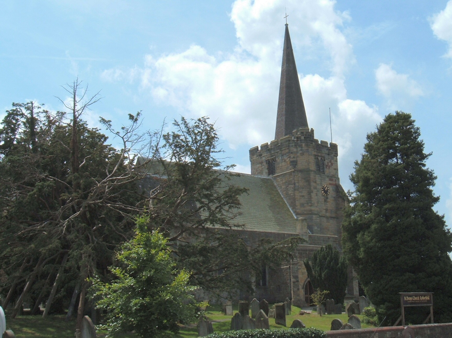
Rotherfield has been designated as a conservation area because of the quality of the buildings, including the Grade I listed St Denys church.
The villages
Rotherfield
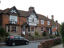 Cottages in the main street of Rotherfield
Rotherfield was originally a Saxon settlement in an area generally covered with oak forest. The church stands at the top of a hill, and was then surrounded by cleared land. The areas nearest to the valley bottoms, where water was available, were farmed. Rotherfield became a royal hunting estate in the times of Kings Alfred the Great, Athelstan and William Rufus.
Eridge
 Mark Cross village sign
Eridge is a small village sitting high on a sandstone ridge on the border of East Sussex and Kent. It commands many far-reaching views across the Kent and Sussex countryside. Although the village is in East Sussex, it has a Kent postal address. It is located on the A26 between Tunbridge Wells (Kent) and Crowborough (East Sussex).
The name Eridge derives from 'Eagle ridge', or 'ridge frequented by eagles'.[7] It is located north of Rotherfield, and also contains the ecclesiastical parish of Eridge Green. It was formed on 5 February 1856 out of parts of the parishes of Frant, Rotherfield, Eridge Park and Eridge Castle—the latter being the seat of the Marquess of Abergavenny.
In 1792 the Henry Nevill, 2nd Earl of Abergavenny converted the old Eridge House into a Gothic castle, which he named Eridge Castle. It was replaced by a Neo-Georgian mansion in the 1930s. The area also contains several follies, including the Saxonbury Tower and several ornamental buildings near the Sham Farm business park.
Mark Cross
Mark Cross is located to the east of Rotherfield, at the junction of the A267 and B2100 Lamberhurst to Crowborough road.[8] One notable residence is Walter's Mill, a house converted from a windmill.
Boarshead
Boarshead is a hamlet within the parish. Amenities include an eponymous pub and a public golf course.
Railway
Eridge railway station used to be the junction for the cross-country railway to Hailsham, Polegate and Eastbourne. Rotherfield was served by a station on this line. Eridge station serves Southern railway services between Uckfield, Edenbridge, Oxted, East Croydon and London. The preserved Spa Valley Railway extension to Eridge opened in 2011 where connections are with made trains to London and Uckfield. A new campaign group has been started along the former Cuckoo and Forest Row lines. A first meeting of interested parties was held in Spring 2010, and a website is in the process of being constructed. Although the group wish to see the line from Heathfield (largest town in the south without a rail station) to Eridge, and Eridge to Forest Row re-opened (in order to provide heritage services as well as 'community' based services), this would appear to be most unlikely as not only has approximately a mile of the trackbed near Mayfield been replaced with a road, but houses have been built over the trackbed around Heathfield.
Education
There are two schools in the parish: Rotherfield Primary School, located in North Street[9] and Mark Cross CE Primary School.[10]
Religion
Main article: List of places of worship in Wealden Church of St Denys
There are five churches in Rotherfield parish: Rotherfield’s 11th-century parish church is dedicated to St Denys. A timber church was first built on the site in 792 AD, and the present sandstone church occupies the same site; the original church is believed to have been under the north-east corner of the current building, in the area now known as the Nevill chapel. The Nevill family were lords of the manor from 1450. The building was extended at various times, with the last major alteration being the addition of the tower, porch and spire in the 15th century. The original spire was destroyed by a storm in October 1987 and reconstructed using a steel frame raised to the roof by helicopter. Construction of the tower meant that a new porch and entrance had to be constructed on the north side of the nave, to replace the west door obstructed by the tower. A new west door was also built.
Also in Rotherfield are the Providence Chapel (Strict Baptist); and the Roman Catholic Church dedicated to St Peter, Prince of Apostles.
The church in Mark Cross is dedicated to St Mark; that at Eridge Green, Holy Trinity.
Transport
The A267 road between Tunbridge Wells and Eastbourne passes through the parish.
The one railway station still operating in the parish is at Eridge, on the Uckfield branch of the Oxted Line. The parish used to be served by Rotherfield and Mark Cross railway station on the Cuckoo Line which closed in 1965: the southern part of this line has now been developed as the long-distance footpath the Cuckoo Trail, although the section that runs through Rotherfield does not form part of this path and is currently in private ownership. The preserved Spa Valley Railway commenced services from Eridge to Tunbridge Wells in 2011.
Leisure, Culture and Sport
In the Eridge area lies one of several local sandstone outcrops used for climbing.[11]
The area has the following pubs: in Rotherfield, The Catts Inn and The Kings Arms; in Mark Cross, The Mark Cross Inn; and in Eridge, The Huntsman and The Nevill Crest and Gun.
Notable residents
- Richard Jefferies (1848–1912), writer, lived briefly at Rehoboth Villa (now Brook View House), Jarvis Brook, Rotherfield.
- Sophia Jex-Blake (1840–1912), one of the first women doctors, lived in Mark Cross: she is buried in Rotherfield graveyard.
References
- ^ a b "East Sussex in Figures". East Sussex County Council. http://www.eastsussexinfigures.org.uk/webview/. Retrieved 26 April 2008.
- ^ "History of Sussex - Some Place Names of Sussex". Ye Olde Sussex Pages. http://www.yeoldesussexpages.com/history/placen2.htm. Retrieved 02 November 2011.
- ^ http://theweald.org/P5H.asp?Pid=5251Roth Historical notes about Rotherfield: The Weald of Kent, Surrey and Sussex[dead link]
- ^ Rotherfield Countryside: history notes[dead link]
- ^ "Rotherfield Parish Council Members list". http://www.rotherfieldparishcouncil.co.uk/Core/Rotherfield-PC/UserFiles/Files/Reference%20information/Public%20Contact%20details%20for%20Councillors%20updated%2020%20June%202011.pdf. Retrieved 2 November 2011.
- ^ "Bream Wood SSSI". Natural England. http://www.natureonthemap.naturalengland.org.uk/map.aspx?map=sssi&feature=1002075,sssi,HYPERLINK,LABEL. Retrieved 2 November 2011.
- ^ Glover, Judith (1975) The Place Names of Sussex, p. 53, London: B.T. Batsford Ltd. ISBN 0 7134 2853 8
- ^ "The Mark Cross village website". http://www.markcross.org.uk. Retrieved 2 November 2011.
- ^ "Rotherfield Primary School website". http://www.school-portal.co.uk/GroupHomepage.asp?GroupID=394421. Retrieved 2 November 2011.
- ^ "Mark Cross Primary School website". http://www.eastsussex.gov.uk/educationandlearning/schools/primary/markcross8453331.htm. Retrieved 2 November 2011.
- ^ "Eridge Green Rocks". Climb-Guide climbing wiki. http://www.climb-guide.com/guides/ssand/sscrags/eridge.htm. Retrieved 2 November 2011.
External links
 Media related to Rotherfield at Wikimedia Commons
Towns, villages and hamlets in the Wealden District of East Sussex, England Alciston • Alfriston • Arlington • Berwick • Best Beech Hill • Birling Gap • Blackboys • Blackham • Bodle Street Green • Boreham Street • Broad Oak • Burlow • Buxted • Chalvington • Chelwood Gate • Chiddingly • Coleman's Hatch • Cooper's Green • Cowbeech • Cross in Hand • Crowborough • Danehill • Duddleswell • East Dean • East Hoathly • Eridge Green • Etchingwood • Exceat • Fairwarp • Five Ash Down • Five Ashes • Fletching • Folkington • Forest Row • Framfield • Frant • Friston • Furner's Green • Golden Cross • Groombridge • Gun Hill • Hadlow Down • Hailsham • Halland • Hammerwood • Hankham • Hartfield • Heathfield • Hellingly • Heron's Ghyll • Herstmonceux • High Hurstwood • Holtye • Hooe • Hooe Common • Horam • Horney Common • Isfield • Jevington • Laughton • Litlington • Little Horsted • Little London • Lower Dicker • Lower Horsebridge • Lullington • Magham Down • Maresfield • Mark Cross • Mayfield • Maynard's Green • Milton Street • Muddles Green • Ninfield • Nutley • Old Heathfield • Pevensey • Pevensey Bay • Polegate • Poundgate • Punnett's Town • Rickney • Ripe • Roser's Cross • Rotherfield • Rushlake Green • Selmeston • Stone Cross • Stunts Green • Tidebrook • Three Cups Corner • Uckfield • Upper Dicker • Upper Hartfield • Vines Cross • Wadhurst • Waldron • Warbleton • Wartling • Westdean • Westham • Whitesmith • Willingdon • Wilmington • Windmill Hill • Winton • Withyham • Wych CrossWealden District Categories:- Wealden
- Local government in East Sussex
- Villages in East Sussex


Wikimedia Foundation. 2010.