- Conway (CDP), New Hampshire
-
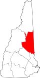
Conway, New Hampshire — CDP — Location within the state of New Hampshire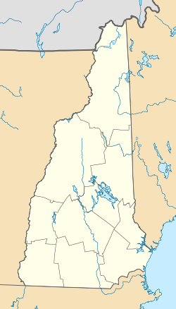
 Conway, New Hampshire
Coordinates: 43°58′44″N 71°7′36″W / 43.97889°N 71.12667°WCoordinates: 43°58′44″N 71°7′36″W / 43.97889°N 71.12667°W Country United States State New Hampshire County Carroll Area – Total 3.1 sq mi (7.9 km2) – Land 2.9 sq mi (7.5 km2) – Water 0.2 sq mi (0.5 km2) Elevation 459 ft (140 m) Population (2000) – Total 1,823 – Density 597.7/sq mi (230.8/km2) Time zone Eastern (EST) (UTC-5) – Summer (DST) EDT (UTC-4) ZIP code 03818 Area code(s) 603 FIPS code 33-14580 GNIS feature ID 0871721 Conway is a census-designated place (CDP) in the town of Conway in Carroll County, New Hampshire, United States. The population was 1,823 at the 2010 census,[1] making it the second-largest settlement in the town of Conway, after the village of North Conway.
Geography
According to the United States Census Bureau, the CDP has a total area of 3.1 square miles (7.9 km²). 2.9 square miles (7.5 km²) of it is land and 0.2 square miles (0.5 km²) of it (5.88%) is water.
The village lies in the southwestern part of the town of Conway, situated at the juncture of the Saco River, the Swift River, and Pequawket Brook. New Hampshire Route 16, Route 113, and Route 153 converge at the village center.
Demographics
As of the census of 2000, there were 1,692 people, 754 households, and 435 families residing in the CDP. The population density was 587.6 people per square mile (226.8/km²). There were 974 housing units at an average density of 130.6 persons/km² (338.2 persons/sq mi). The racial makeup of the town was 98.05% White, 0.06% African American, 0.65% Native American, 0.18% Asian, 0.06% from other races, and 1.00% from two or more races. 0.41% of the population were Hispanic or Latino of any race.
There were 754 households out of which 26.4% had children under the age of 18 living with them, 42.6% were married couples living together, 9.4% have a woman whose husband does not live with her, and 42.3% were non-families. 36.2% of all households were made up of individuals and 15.8% had someone living alone who was 65 years of age or older. The average household size was 2.23 and the average family size was 2.90.
In the CDP the population was spread out with 23.1% under the age of 18, 7.7% from 18 to 24, 27.8% from 25 to 44, 26.0% from 45 to 64, and 15.3% who were 65 years of age or older. The median age was 40 years. For every 100 females there were 94.0 males. For every 100 females age 18 and over, there were 87.7 males.
The median income for a household is $31,392, and the median income for a family was $37,000. Males had a median income of $29,702 versus $20,865 for females. The per capita income for the town was $16,987. 14.2% of the population and 10.0% of families were below the poverty line. Out of the total people living in poverty, 23.1% are under the age of 18 and 11.5% are 65 or older.
References
- ^ United States Census Bureau, American FactFinder, 2010 Census figures. Retrieved March 23, 2011.
Municipalities and communities of Carroll County, New Hampshire Towns Albany | Bartlett | Brookfield | Chatham | Conway | Eaton | Effingham | Freedom | Hart's Location | Jackson | Madison | Moultonborough | Ossipee | Sandwich | Tamworth | Tuftonboro | Wakefield | Wolfeboro
Township Villages Center Conway | Center Ossipee | Center Sandwich | Chocorua | Conway | East Wakefield | Ferncroft | Glen | Intervale | Kearsarge | Melvin Village | North Conway | Redstone | Sanbornville | Silver Lake | Suissevale | Union | Wonalancet
Categories:- Census-designated places in New Hampshire
- Populated places in Carroll County, New Hampshire
- Unincorporated communities in New Hampshire


Wikimedia Foundation. 2010.