- North Conway, New Hampshire
-
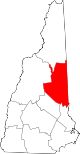
North Conway, New Hampshire — CDP — Saco River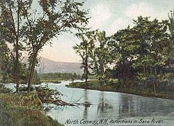 Location within the state of New Hampshire
 North Conway, New Hampshire
Coordinates: 44°3′11″N 71°7′41″W / 44.05306°N 71.12806°WCoordinates: 44°3′11″N 71°7′41″W / 44.05306°N 71.12806°W Country United States State New Hampshire County Carroll Area - Total 4.3 sq mi (11.2 km2) - Land 4.3 sq mi (11.1 km2) - Water 0.0 sq mi (0.1 km2) Elevation 525 ft (160 m) Population (2000) - Total 2,349 - Density 543.2/sq mi (209.7/km2) Time zone Eastern (EST) (UTC-5) - Summer (DST) EDT (UTC-4) ZIP code 03860 Area code(s) 603 FIPS code 33-53860 GNIS feature ID 0872395 North Conway is a census-designated place (CDP) in eastern Carroll County, New Hampshire, United States. The population was 2,349 at the 2010 census.[1] A year-round resort area, North Conway is the largest village within the town of Conway, which is bounded on the east by the Maine state line. The White Mountain National Forest is to the west and north. Conway is home to Cathedral Ledge (popular with climbers), Echo Lake State Park, and Mount Cranmore. North Conway is known for its large amount of outlet shops.
Contents
History
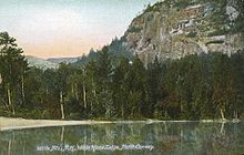
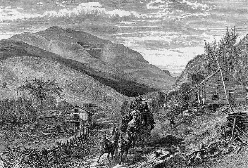
 Mount Washington in 1872
Chartered in 1765 by Colonial Governor Benning Wentworth, the town is named for Henry Seymour Conway, ambitious son of a prominent English family, who was elected to the House of Commons at age twenty, fought at Culloden, and became Secretary of State. Early settlers called the area Pequawket (known colloquially as Pigwacket), adopting the name of the Abenaki Indian village which stretched down the Saco River to its stockaded center at Fryeburg, Maine.
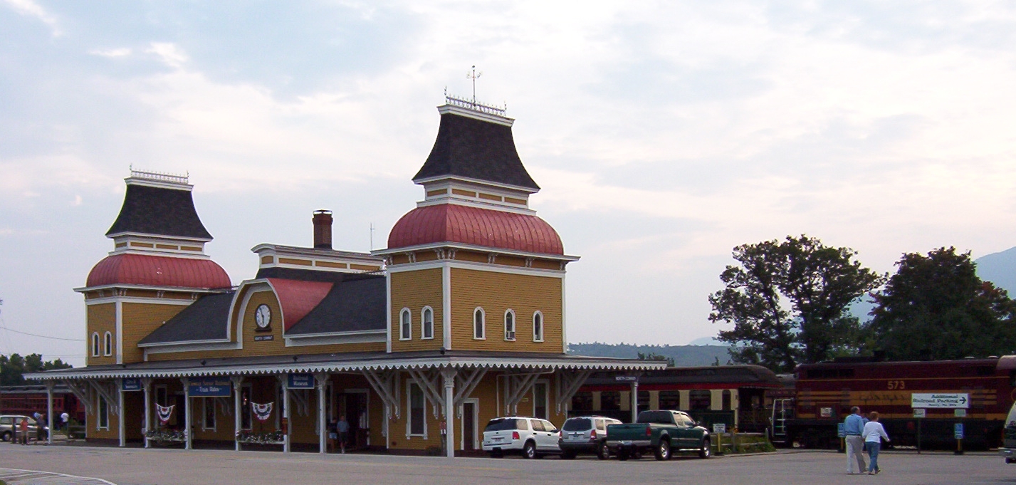
North Conway is located in the White Mountains, with Mount Washington located to the northwest. The rugged terrain became popular in the 19th century with artists. Their paintings were known collectively as White Mountain art, which in turn attracted tourists to the area, particularly after the Portsmouth, Great Falls & Conway Railroad extended service in 1872 to North Conway. In 1874, the line built an Second Empire depot, designed by Nathaniel J. Bradlee. In 1932, "snow trains" began carrying enthusiasts to "the birthplace of American skiing," as North Conway is known.[citation needed]
Increasing automobile travel brought the decline of trains.[citation needed] The railroad, then part of the Boston & Maine, abandoned passenger service to the area in 1961, and freight service in 1972. Subsequently, the Conway Scenic Railroad was established. Today, the line offers visitors a tour of the region, including Crawford Notch. The station is listed on the National Register of Historic Places.
In the late 1980s, the White Mountain Airport closed and was redeveloped as a large outlet mall called Settlers' Green Outlet Village. Continued growth through the 1990s and 2000s in North Conway and the villages nearby made Conway the most populous community in Carroll County. Traffic congestion led to an overhaul of the road system, including widening Route 16 through North Conway village and constructing a road parallel to Route 16 to allow traffic to move between Redstone and Intervale uninterrupted. A bypass of the area is being developed.
North Conway remains a popular destination due to its shopping, recreation, and attractions.[citation needed]
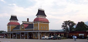 North Conway Station
Recreation
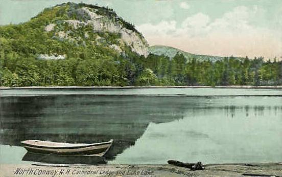
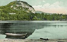 Cathedral Ledge in 1914
North Conway and its surrounding towns offer hiking in the White Mountain National Forest. The area is a major rock climbing destination in the northeastern United States,[2] particularly Cathedral Ledge in Echo Lake State Park. The 500-foot (150 m) cliff overlooks Echo Lake and North Conway from the west. Unlike nearby White Horse Ledge, another rock climbing site, Cathedral Ledge has an automobile road to the summit, which provides fine views of the Saco River Valley.
In late September through early October, tourists arrive to see the autumn colors on the surrounding mountains and forests. The Conway Scenic Railroad features train rides that leave from the village's Victorian station.[citation needed] In the winter, the village is the nighttime destination for skiers visiting the area resorts, including North Conway's own Cranmore Mountain as well as nearby Attitash Resort, Black Mountain and Wildcat Mountain.
Geography
North Conway is located at 44°3′6″N 71°7′22″W / 44.05167°N 71.12278°W (44.051534, -71.122752),[3] in the northern part of the town of Conway.
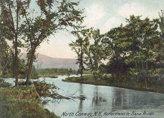
According to the United States Census Bureau, the village, a census-designated place (CDP), has a total area of 4.3 square miles (11 km2), of which 0.04 sq mi (0.10 km2) (0.70%) is water. North Conway is drained by the Saco River.
Demographics
 White Horse Ledge and Echo Lake c. 1908
As of the census[4] of 2000, there were 2,069 people, 1,002 households, and 487 families residing in the CDP. The population density was 483.9 people per square mile (186.6/km²). There were 1,602 housing units at an average density of 374.7 per square mile (144.5/km²). The racial makeup of the CDP was 95.07% White, 0.39% African American, 0.29% Native American, 2.27% Asian, 0.72% from other races, and 1.26% from two or more races. Hispanic or Latino of any race were 0.58% of the population.
There were 1,002 households out of which 22.0% had children under the age of 18 living with them, 33.2% were married couples living together, 11.3% had a female householder with no husband present, and 51.3% were non-families. 41.0% of all households were made up of individuals and 15.7% had someone living alone who was 65 years of age or older. The average household size was 2.02 and the average family size was 2.75.
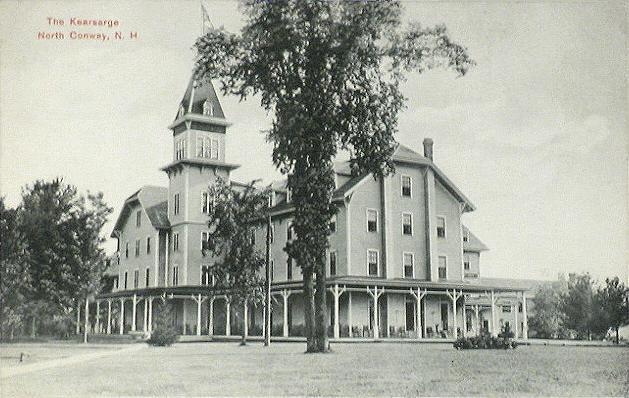
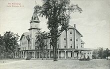 The Kearsarge House c. 1910, an early grand hotel
In the CDP the population was spread out with 20.5% under the age of 18, 8.2% from 18 to 24, 32.1% from 25 to 44, 24.1% from 45 to 64, and 15.1% who were 65 years of age or older. The median age was 38 years. For every 100 females there were 92.8 males. For every 100 females age 18 and over, there were 91.3 males.
The median income for a household in the CDP was $31,406, and the median income for a family was $40,294. Males had a median income of $27,679 versus $23,017 for females. The per capita income for the CDP was $20,493. About 17.1% of families and 17.1% of the population were below the poverty line, including 26.0% of those under age 18 and 24.0% of those age 65 or over.
Notable residents
- Ed Ashnault, college football and basketball coach, grew up in North Conway.[5]
- Benjamin Champney, artist
- Gordon Clapp, actor
- E. E. Cummings, major 20th century poet, had a summer home nearby and died (of a stroke) in North Conway, on September 3, 1962
- John Shea, actor
- Julia Ruth Stevens, daughter of Babe Ruth[6]
Sites of interest
- Echo Lake State Park
- Mount Washington Valley Children's Museum
- Mount Washington Valley Theatre Company
Sites on the National Register of Historic Places:
See also
North Conway is a village within the town of Conway. The other villages within Conway are:
- Conway village
- Center Conway
- East Conway
- Kearsarge
- Redstone
References
- ^ United States Census Bureau, American FactFinder, 2010 Census figures. Retrieved March 23, 2011.
- ^ "Cathedral and Whitehorse Ledges". Dartmouth Outing Club. http://www.dartmouth.edu/~doc/climbing/cathedralwhitehorse/. Retrieved June 22, 2010.
- ^ "US Gazetteer files: 2010, 2000, and 1990". United States Census Bureau. 2011-02-12. http://www.census.gov/geo/www/gazetteer/gazette.html. Retrieved 2011-04-23.
- ^ "American FactFinder". United States Census Bureau. http://factfinder.census.gov. Retrieved 2008-01-31.
- ^ Plymouth State Athletics: 2002 HOF Inductees. Accessed May 10, 2008
- ^ "Babe Ruth's Daughter, Julia Ruth Stevens, Represents TW Museum at 2008 Eastern League All-Star Game". www.tedwilliamsmuseum.com. http://www.tedwilliamsmuseum.com/events/docs/juliaruthstevens.html. Retrieved 2011-02-02. Quote: "Years of living in North Conway, NH, and watching the Red Sox on local TV have made her a true Boston fan."
External links
- Town of Conway, New Hampshire
- Conway Historical Society
- Conway Public Library
- The Conway Daily Sun - local newspaper
- Mount Washington Valley Chamber of Commerce
- North Conway NH Area Guide
Municipalities and communities of Carroll County, New Hampshire Towns Albany | Bartlett | Brookfield | Chatham | Conway | Eaton | Effingham | Freedom | Hart's Location | Jackson | Madison | Moultonborough | Ossipee | Sandwich | Tamworth | Tuftonboro | Wakefield | Wolfeboro
Township Villages Center Conway | Center Ossipee | Center Sandwich | Chocorua | Conway | East Wakefield | Ferncroft | Glen | Intervale | Kearsarge | Melvin Village | North Conway | Redstone | Sanbornville | Silver Lake | Suissevale | Union | Wonalancet
Categories:- Populated places in Carroll County, New Hampshire
- Census-designated places in New Hampshire
- Unincorporated communities in New Hampshire


Wikimedia Foundation. 2010.