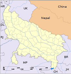
- Tikri, Uttar Pradesh
-
For other places with the same name, see Tikri (disambiguation).
Tikri — city — Coordinates 29°14′N 77°21′E / 29.23°N 77.35°ECoordinates: 29°14′N 77°21′E / 29.23°N 77.35°E Country India State Uttar Pradesh District(s) Baghpat Population 13,429 (2001[update]) Time zone IST (UTC+05:30) Area
• 233 metres (764 ft)
Codes-
• Pincode • 250625
Tikri is a town and a nagar panchayat in Baghpat district in the Indian state of Uttar Pradesh.
Contents
Geography
Tikri is located at 29°14′N 77°21′E / 29.23°N 77.35°E.[1] It has an average elevation of 233 metres (764 feet). It is about 25 km away from Baraut.
Demographics
As of 2001[update] India census,[2] Tikri had a population of 13,429. Males constitute 54% of the population and females 46%. Tikri has an average literacy rate of 52%, lower than the national average of 59.5%: male literacy is 64%, and female literacy is 38%. In Tikri, 17% of the population is under 6 years of age.
Educational facilities
Tikri was an Educational hub in the early 1960s. At that time the only Inter College (Har Chand Mal Jain Inter College) of that area had hostel facilities. HMJIC, Tikri was established in the name of Lala Har Chand Mal Jain ji, an industrialist and social worker of Tikri. So many big officials studied at HMJIC during their school days. Some of them are: Dr. Harpal Singh (Ex-Vice Chancellor, GBPUAT, Pantnagar); Dr. Sanjeev Kumar Verma [3], ICAR Scientist; Dr. Sunil Kumar Verma, CSIR, Scientist; Dr. Shyampal Singh Rathi (Prof& Scientist); Praveen Rathi; Manish Rathi; Pradeep Rathi, Kuldeep Rathi; Amarpal Rathi; Sandeep Rathi; KR Rathi, Squadron Leader Subhash Rathi, Indian AirForce and many more.[citation needed]
References
- ^ Falling Rain Genomics, Inc - Tikri
- ^ "Census of India 2001: Data from the 2001 Census, including cities, villages and towns (Provisional)". Census Commission of India. Archived from the original on 2004-06-16. http://web.archive.org/web/20040616075334/http://www.censusindia.net/results/town.php?stad=A&state5=999. Retrieved 2008-11-01.
- ^ Dr. Sanjeev Kumar Verma
Categories:- Cities and towns in Bagpat district
- Towns and Villages in Baghpat District
- Uttar Pradesh geography stubs
-
Wikimedia Foundation. 2010.


