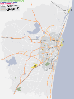
- Nerkundram
-
Nerkundram — city — Coordinates 13°04′15″N 80°11′05″E / 13.0707°N 80.1846°ECoordinates: 13°04′15″N 80°11′05″E / 13.0707°N 80.1846°E Country India State Tamil Nadu District(s) Thiruvallur Population 39,544 (2001[update]) Time zone IST (UTC+05:30) Area
• 18 metres (59 ft)
Nerkundram(Tamil: நெற்குன்றம்) is a census town in Thiruvallur district in the Indian state of Tamil Nadu. It is located 2 miles (3.2 km) west of Chennai Corporation Limits.
Contents
Geography
Nerkundram is located at 13°04′15″N 80°11′05″E / 13.0707°N 80.1846°E[1]. It has an average elevation of 18 metres (59 feet).
Areas 
Maduravoyal Koyambedu 
Valasaravakkam 
Saligrammam  Nerkundram

Alwarthirunagar Nesapakkam Virugambakkam Demographics
As of 2001[update] India census[2], Nerkundram had a population of 39,544. Males constitute 52% of the population and females 48%. Nerkundram has an average literacy rate of 72%, higher than the national average of 59.5%: male literacy is 78%, and female literacy is 65%. In Nerkundram, 14% of the population is under 6 years of age.
Localities
Now Nerkundram is a Part of Chennai Corporation.It Belongs to 145 th circle in Chennai corporation.Previously Nerkundram is in Suburban Panchayat near Chennai.Now no more Panchayat.Now it is purely under City Control.
Ward 1
P.H. Road, People Flats, Pallavan Nagar, Nerkundram, Church St, Mandaveli St
Ward 2
Celliyamman Nagar, Senthamizh Nagar, Santha Avenue, Agathiyar Nagar, Sakthi Nagar, RJR Nagar, Muthumariyamman Koil St, Sivasakthi Nagar, Kanniyamman Nagar, Nethaji Avenue, Azhagammal Nagar, Thmarai Avenue, Rajiv Ganthi Nagar, Krishna Nagar, Kothandaramar Nagar, Jayalakshmi Nagar, Moogambigai Nagar, Balakrishna Nagar, Dhanalakshmi Nagar, Thiramalai Nagar, Muniyappa Nagar, Annammal Nagar, Thiruvalluvar Colony, Saraswathi Colony, Janakiraman Colony
Ward 3
Mettukuppam, Goverthana Nagar, Rajiv Nagar, Nesammal Nagar, Jayaram Nagar, Dhanalakshmi Nagar, Sri Kadambadi Amman Nagar, CDN Nagar, Ramalinga Nagar, Nesammal Nagar, Buvaneswari Nagar, Senthil Nagar, Balavinayagar Nagar, Sakthivel Nagar, Abirami Nagar, Vadavenniyamman Nagar
Ward 4
Periyar Nagar, Sri Lakshmi Nagar, Bakaji Nagar
Ward 5
Saraswathi Nagar, Meenatchiyamman Nagar,Dhidilnagar, Nekundram New Colony, Perumal Koil St.
Schools & Colleges
- MR Matric High School
- Lbeaar Matriculation School
- Jain Joseph Nursery and Primary School
- Sri Devi Matriculation School
- Sri Sastha Matriculation School
- Thai Moogambigai Polytechnic College
- maa school of hotel management
- Nathan Girls Higher Secondary Schoo
- Krishna Matriculation School
- Marys Nursery & Primary School
- Dr MGR University
- Canan School of Catering and Hotel Management
- GUNDU sion college of walking.
Areas Near Nerkundram
Postal Code
The PIN-Code for Nerkundram is 600107
References
- ^ Falling Rain Genomics, Inc - Nerkundram
- ^ "Census of India 2001: Data from the 2001 Census, including cities, villages and towns (Provisional)". Census Commission of India. Archived from the original on 2004-06-16. http://web.archive.org/web/20040616075334/http://www.censusindia.net/results/town.php?stad=A&state5=999. Retrieved 2008-11-01.
Categories:- Tiruvallur district geography stubs
- Neighbourhoods of Chennai
- Chennai suburbs
- Cities and towns in Tiruvallur district
Wikimedia Foundation. 2010.


