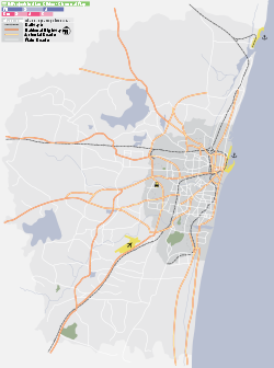
- Mambalam
-
Mambalam — neighbourhood — Coordinates 13°02′29″N 80°13′59″E / 13.0414°N 80.2330°ECoordinates: 13°02′29″N 80°13′59″E / 13.0414°N 80.2330°E Country India State Tamil Nadu District(s) Chennai Parliamentary constituency Chennai South Time zone IST (UTC+05:30) Codes-
• Pincode • 600033 • Vehicle • TN-09
Mambalam (Tamil: மாம்பலம்) is a working class residential and commercial area in the heart of Chennai (Madras), India. It is best known for its shops, bazaars and Hindu temples. It is bounded by Kodambakkam to the north and Saidapet to the south. T. Nagar and Nandanam stretch all along its eastern frontiers while K. K. Nagar lies to its west. The Ayodhya Mandapam is an important landmark.
History
Mambalam derives its name from "Mabilam" meaning of forest of Mango trees in Sanskrit. Mambalam used to covered with Mango trees, till very recently.
Prior to its inclusion in the then city of Madras, Mambalam was a village in the Saidapet taluk of Chingleput district.[1] The oldest surviving reference to Mambalam is believed to be in a 1726 stone plaque commemorating the construction of the Marmalong Bridge (now known as Maraimalai Adigal bridge) across the Adyar river by the merchant Coja Petrus Uscan. The bridge is believed to have been named after the village of Marmalong or Marmalan identified with Mambalam. The village was, then, a zamindari administered by zamindars belonging to a Telugu-speaking Reddi family, tikkavarapu krishnaveni ammal.
Urbanisation of Mambalam was started in 1911 with the construction of the Mambalam railway station on the Madras-Kanchipuram railroad.[2] The Long Tank, which formed the western frontier of Madras city, was drained out in 1923.[2] The same year, the administration of Mambalam was handed over to the British by its zamindar.[3]The township of Theagaraya Nagar, popularly known as T. Nagar, was constructed in the southern part of the zamindari during 1923-25. The townships of Mambalam and Theagaraya Nagar covering an area of 1.008 sq. miles were included in the Mambalam division of Madras city.[4] These outlying residential suburbs were connected to the rest of the city by an effective bus service.[4]The areas surrounding Arya Gowda Road were obtained from Badaga leader and politician H. B. Ari Gowder.It has wide range of eateries where people storm up to have their piece of share . The most popular one's are 1) Venkaramana Poli stall ( one of the oldest ) 2) Venkateshwara Poli Stall 3) Moms soup (original trend setter one Near city stationeries ) 4) Mamis soup 5) Hot 'N' Chat (Jubilee Road corner) . Coming to hotels it has many noticeable hotels which provide hygienic food 1) Data udipi hotel ( near subway ) 2) Bhakya hotel ( near railway station ). For bachelors they can find their food at reasonable rates 3) Gnanambiga mess 4) Tanjore mess.It houses many schools which produce excellent results 1) SBSM Jain School, 2) Ahobila Mutt Oriental School 3) JGHV school 4) Sitaram vidhyalaya 5) Anjugam 6) little oxford ( all the above mentioned are state board ) 7) Sri Narayana Mission Sr Sec School (Co-ed CBSE) 8) SB Motha School (Girls CBSE) and 9) SRM Nightingale. You can also find students busy running to tuition. To mention a few masters in the vicinity are T. M. Soundarajan (Maths -aho princi ) and Rasarasan (Physics ) Swaminathan (Chemistry ) to name a few .West Mambalam contains a railway station(most busiest station after central and tambaram ) , providing access to Chennai Central and tambaram . Many buses travel through West Mambalam. They have to goto tnagar for bus terminus ( one can go by 11g 11h and get down at panagal park and walk to bus terminus in 15 minutes ) Arya Gowda Road and Thambiah Reddy Road both host many shops.This area contains a large vegetable market. There are many historical temples which are more than 100 years old and ayodhya mandapam which is said to be the place of vocalist offers place for many cultural events and many more for those who find to be religious. Temples 1. Sathya Narayana Kovil,2. Kasi Viswanathar Koil3. muragashramam4. Kali bari temple are few remarkable landmarks in West Mambalam.
Notes
- ^ Alphabetical list of villages in taluks and districts of Madras Presidency. 1930. p. 103.
- ^ a b Varghese, Nina (August 29, 2006). "T.Nagar: Shop till you drop, and then shop some more". The Hindu Business Line. http://www.thehindubusinessline.com/2006/08/29/stories/2006082903011900.htm.
- ^ The Journal of Asian studies, Volume 58. Association of Asian Studies. 1999. p. 658.
- ^ a b Srinivasachari, C. S.; Runganadhan, S. E. (1939). History of the City of Madras: Written for the Tercentenary Celebration Committee. Madras: P. Varadachary and Co. p. 287.
References
- Ashoka Mithran (March 7, 2009). "The Glorious West Mambalam". Chennai Online.
- Article on T. Nagar in The Hindu Business Line
Mambalam Next station northbound:
KodambakkamSouth Line, Chennai Suburban Next station southbound:
SaidapetStop number: 8 KM from starting: 11.29 These are the stations of South Line of Chennai Suburban Railway Chennai Beach · Chennai Fort · Park Town · Chennai Egmore · Chetpet · Nungambakkam · Kodambakkam · Mambalam · Saidapet · Guindy · St. Thomas Mount · Palavanthangal · Meenambakkam · Tirusulam · Pallavaram · Chromepet · Tambaram Sanatorium · Tambaram · Perungalathur · Vandalur · Urapakkam · Guduvancheri · Potheri · Kattangulathur · Maraimalai Nagar · Singaperumal Koil · Paranur · Chengalpattu · Tirumani · Ottivakkam · Padalam · Karunguzhi · Madurantakam · Paakkam · Melmaruvathur · Acharapakkam · Tozhuppedu · Karasangal · Olakur · Panchalam · Tindivanam · Mailam · Perani · Vikravandi · Mundiyampakkam · Villupuram Categories:- Neighbourhoods of Chennai
- Stations of Chennai Suburban Railway
-
Wikimedia Foundation. 2010.


