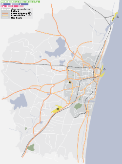
- Nandambakkam
-
Nandambakkam — suburb — Coordinates 13°01′00″N 80°11′23″E / 13.01660°N 80.18985°ECoordinates: 13°01′00″N 80°11′23″E / 13.01660°N 80.18985°E Country India State Tamil Nadu District(s) Kancheepuram Population 9,093 (2001[update]) Time zone IST (UTC+05:30) Area
• 21 metres (69 ft)
Nandambakkam (Tamil: நந்தம்பாக்கம்) is a suburb of Chennai and a town in the Tambaram taluk of Kanchipuram district in the Indian state of Tamil Nadu. It is renowned for the Chennai Trade Centre and the Surgical Instruments Factory. In 2011 Nandambakkam has included in Chennai city by the government of TamilNadu.
Contents
Geography
Nandambakkam is situated at a distance of 13 kilometres south-west of Chennai on the Mount-Poonamallee Road. It is bound by Alandur and St Thomas Mount to the east and Manapakkam to the west. It is bound by Ramapuram to the north and north-west and Pallavaram to the south. The township extends from the Madras War Cemetery on the east to the banks of the Adyar River on the west.
Demographics
As of 2001[update] India census[1], Nandambakkam had a population of 9093. Males constitute 51% of the population and females 49%. Nandambakkam has an average literacy rate of 81%, higher than the national average of 59.5%: male literacy is 85%, and female literacy is 77%. In Nandambakkam, 10% of the population is under 6 years of age.
History
The village of Nandambakkam has been in existence as a part of the then Chingleput district at least since India's independence in 1947. In 1948, a proposal was floated to settle tappers in Nandambakkam and imparting training in hand weaving to them.[2] The shrine of St Thomas Mount located nearby contains relics that are over two millennia old.
The growth of Nandambakkam dates from the post-independence era. In 1952, the Madras War Cemetery was constructed on the eastern fringes of Nandambakkam.[3] During the 1950s and early 1960s, a number of social welfare schemes were launched here. During the Chief Ministership of K. Kamaraj, proposals were made for establishing a surgical instruments factory at Nandambakkam with Russian collaboration.[4][5] This project undertaken by the Indian Drugs and Pharmceuticals Limited culminated in the inaugration of the factory constructed at the cost of Rs. 52.5 million and expected to manufacture 2.5 million pieces of surgical instruments[6] on September 1, 1965.[7]
India Trade Promotion Organisation (ITPO)'s first fair infrastructure outside Delhi, the Chennai Trade Centre was inaugurated at Nandambakkam in January 2001.[8] Spread over an area of 25 acres (100,000 m2), the Chennai Trade Centre, a joint venture of ITPO and Tamil Nadu Industrial Development Corporation (TIDCO), was designed to conduct trade fairs in the city.[8]
References
- ^ "Census of India 2001: Data from the 2001 Census, including cities, villages and towns (Provisional)". Census Commission of India. Archived from the original on 2004-06-16. http://web.archive.org/web/20040616075334/http://www.censusindia.net/results/town.php?stad=A&state5=999. Retrieved 2008-11-01.
- ^ The Madras Journal of Co-operation, Volumes 40-41. 1948. pp. 490.
- ^ "Are all memorials really throbbing with life?". The Hindu. July 17, 2007. http://www.hindu.com/2007/07/17/stories/2007071759050300.htm.
- ^ Madras labour gazette, Volume 4. Commissioner of Labour & Director of Employment. 1962. pp. 964.
- ^ Southern economist, Volume 5. Mrs. Susheela Subrahmanya. 1966. pp. 39.
- ^ G. R. Rao (1967). Progressive Madras State: a saga of integrated development. Hindusthan Chamber of Commerce. pp. 95.
- ^ Research and industry, Volume 10. Council of Scientific and Industrial Research. 1965. pp. 380.
- ^ a b "Chennai Trade Centre". India Trade Promotion Organisation. http://www.indiatradefair.com/corp/channai.asp.htm.
Areas of Chennai 
Ramapuram Jafferkhanpet Guindy 
Manapakkam 
St Thomas Mount  Nandambakkam

Pallavaram Alandur Categories:- Cities and towns in Kanchipuram district
- Chennai suburbs
- Kanchipuram district geography stubs
Wikimedia Foundation. 2010.


