- N-5 National Highway
-
N-5
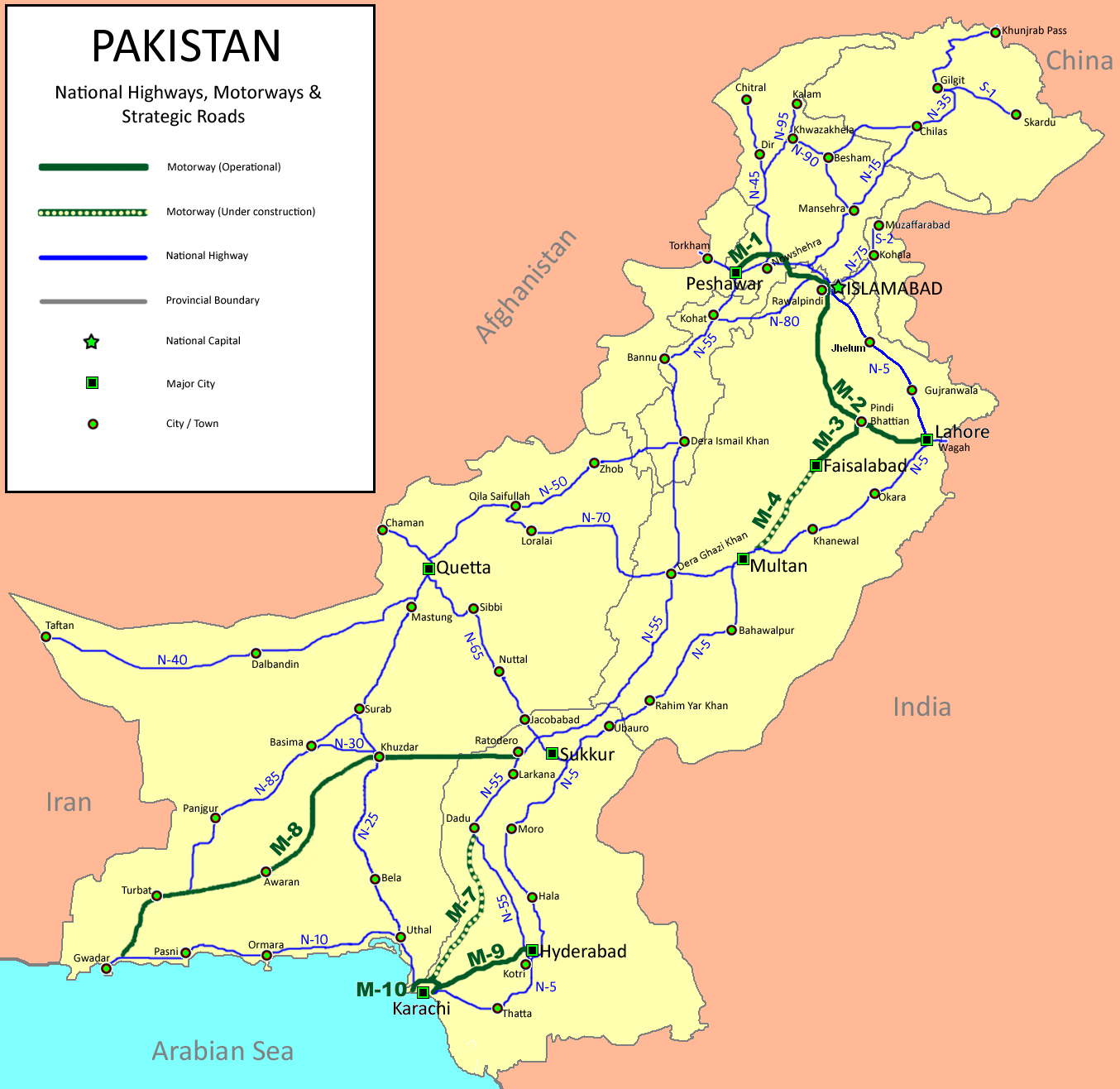
Route information Maintained by NHA Length: 1,756 km[1] (1,091 mi) Major junctions From: Karachi M-1, N-55, N-45, N-35, N-75, M-2, M-4, N-70, M-9 To: Torkham Location Major cities: Hyderabad, Multan, Lahore, Sheikhupura Rawalpindi, Peshawar Highway system 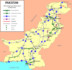 Map of National Highways of Pakistan also indicating N5
The National Highway 05 or the N-5 is Pakistan's longest highway running from the port city of Karachi to the border crossing at Torkham. Its total length is 1756 km[2] and it runs north from Karachi located in Sindh province to Hyderabad, Moro and Khairpur before crossing into Punjab province where it passes through Multan, Sahiwal, Lahore, Sheikhupura District, Gujranwala, Gujrat, Jhelum and Rawalpindi. At Rawalpindi, it turns eastwards and passes through Attock Khurd before crossing the Indus River into Khyber Pakhtunkhwa to continue through Nowshera and Peshawar before entering the Khyber Pass and reaching the border town of Torkham. Its total length is divided into 1021 km in Punjab, 671 km in Sindh, 127 km in Khyber Pakhtunkhwa and the remaining 38 km in the Federally Administered Tribal Areas (FATA). It is managed by National Highway Authority.
Contents
History
Main article: Grand Trunk RoadPart of the highway was built on the ancient Grand Trunk Road (commonly known as G.T. Road) which came under jurisdiction of the new state after the partition of India. Thus developments of this road took place and in 1990s, the road was converted in an international standard highway.
New G.T. Road
In Pakistan, the old GT Road ends at Peshawar in Khyber Pakhtunkhwa. There were some routes in Pakistan which were known as GT Road Multan Road (Lahore to Multan), Rahim Yar Road (Bahawalpur to Rahim Yar Khan) and Karachi road (Sukkur to Karachi). NHA planned to combine these roads into one highway, thus N-5, or NEW G.T. Road came into existence. A huge upgrade took place on these routes in mid-1990s and N-5 was converted into a 4 lane, 1819 km long highway. N-5 is now Pakistan's longest and most important highway.
Locations
Sindh
Number Location Km marker no 1 Karachi 0 2 Thatta 94 3 Kotri 145 4 Hyderabad 163 5 Hala 211 6 New Saeedabad 229 7 Sabu Rahu 240 8 Sakrand 250 9 Sukho Manahijo 264 10 Kazi Ahmed 275 11 Daulatpur 302 12 Shahpur Jehanian 310 13 Moro 320 14 Naushahro Feroze 345 15 Bhiria 356 16 Kandiaro 373 17 Kotri Kabir 391 18 Ranipur 413 19 Kot Diji 437 20 Khairpur 458 21 Rohri 483 22 Pano Akil 515 23 Ghotki 543 24 Sarhad 554 25 Mirpur Mathelo 568 26 Daharki 582 27 Ubauro 596 Punjab
Number Location Km marker no 28 Kot Sabzal 612 29 Sanjarpur 620 30 Sadiqabad 637 31 Rahim Yar Khan 655 32 Shaikh Wahan 677 33 Mianwali Quraishan 687 34 Sardar Garh 693 35 Zahir Pir 707 36 Fatehpur Kamal 719 37 Khan Bela 734 38 Tarinda Muhammad Panah 756 39 Ahmadpur East 792 40 Deran 794 41 Nurpur Nauranga 814 42 Khanqah Sharif 829 43 Bahawalpur 844 44 Lodhran 860 45 Shah Naal 872 46 Jella Arian 883 47 Basti Maluk 896 48 Lar 915 49 Multan 937 50 Khanewal 980 51 Musa Virk 1020 52 Mian Channu 1026 53 Harappa 1082 54 Sahiwal 1102 55 Qadirabad 1114 56 Okara 1134 57 Renala Khurd 1151 58 Akhtarabad 1161 59 Wan Radha Ram 1168 60 Pattoki 1180 61 Bhai Pheru 1204 62 Manga 1220 63 Chung 1239 64 Lahore 1260 65 Shahdara 1268 66 Sheikhupura District 1285 67 Kamoke 1307 68 Gujranwala 1328 69 Ghakhar 1347 70 Wazirabad 1362 71 Gujrat 1380 72 Lala Musa 1397 73 Kharian 1412 74 Sarai Alamgir 1426 75 Jhelum 1432 76 Dina 1448 77 Sohawa 1473 78 Gujar Khan 1491 79 Mandra 1505 80 Rewat 1522 81 Islamabad Highway Junction 1524 82 Rawalpindi 1540 83 Road junction to Islamabad 1551 84 Tarnol and New Islamabad Airport 1555 85 Sangjani 1561 86 John Nicholson's oblisk 1565 87 Taxila and business loop to Wah Cantt 1569 88 Wah Cantt 1579 89 Hasan Abdal 1585 90 Burhan 1595 91 Sanjwal Cantt 1601.012 92 Road junction to Attock 1601.014 93 Lawrencepur 1602 94 Road junction to Ghazi Barotha and Tarbela Dam 1603 95 Hattian 1609 96 Road junction to Hazro and Ghazi Barotha 1610 97 Road junction to Attock 1610.014 98 Kamra 1611 99 Goundal 1618 100 Haji Shah 1619 101 Attock Khurd 1621 Khyber Pakhtunkhwa
Number Location Km marker no 102 Jehangira 1638 103 Nowshera 1657 104 Pabbi 1678 105 Peshawar 1700 FATA
Number Location Km marker no 106 Jamrud 1718 107 Shagai Fort 1725 108 Landi Kotal 1750 109 Torkham 1756 Images
References
National Highways of Pakistan S-1 | S-2 | S-3 | E-3 | E-4 | E-5
Categories:- Roads in Pakistan
- Asia road stubs
- Pakistan transport stubs

Wikimedia Foundation. 2010.