Muddy Creek Mill

Muddy Creek Mill
Muddy Creek Mill
Muddy Creek Mill is located in Virginia
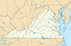
Nearest city: Tamworth, Virginia
Coordinates: 37°38′54″N 78°4′59″W / 37.64833°N 78.08306°W / 37.64833; -78.08306Coordinates: 37°38′54″N 78°4′59″W / 37.64833°N 78.08306°W / 37.64833; -78.08306
Area: 17 acres (6.9 ha)
Built: 1785
Governing body: Private
NRHP Reference#:

74002114

[1]
Added to NRHP: October 09, 1974

Muddy Creek Mill is a historic mill and historic district located in Tamworth, Virginia. It was built in 1785, and was added to the National Register of Historic Places in 1974.

References


Wikimedia Foundation. 2010.

Игры ⚽ Нужно сделать НИР?

Look at other dictionaries:

  • Muddy Creek (Conestoga River) — For the Muddy Creek in York County, see Muddy Creek (Susquehanna River). Muddy Creek is a 15.7 mile long (25.3 km)[1] tributary of the Conestoga River in Lancaster County, Pennsylvania in the United States. Muddy Creek was formerly spanned… …   Wikipedia

  • Muddy Creek (Susquehanna River) — For the Muddy Creek in Lancaster County, see Muddy Creek (Conestoga River). Muddy Creek is a tributary of the Susquehanna River in York County, Pennsylvania in the United States. Muddy Creek, formed by the confluence of the North and South… …   Wikipedia

  • Muddy Branch — is a tributary stream of the Potomac River in Montgomery County, Maryland, located about 14 miles (23 km) northwest of Washington, D.C. The headwaters of the stream originate in Gaithersburg, and the stream flows southwest for 11.9 miles (19 …   Wikipedia

  • Mill Creek (South Branch Potomac River) — Mill Creek at Mechanicsburg Gap viewed from the Core Road (County Route 50/53) bridge near Romney Mill Creek is a 14.0 mile long (22.5 km)[1] tributary stream of the South Branch Potomac Rive …   Wikipedia

  • Mill Creek (Patterson Creek) — Mill Creek is an 8.7 mile long (14.0 km)[1] tributary stream of Patterson Creek in Mineral County, West Virginia. It is also known as Mill Run. Headwaters and course Mill Creek s headwaters is located between New Creek Mountain and Knobly… …   Wikipedia

  • Mill Creek (Opequon Creek) — Mill Creek is a 14.5 mile long (23.3 km)[1] tributary of Opequon Creek, belonging to the Potomac River and Chesapeake Bay watersheds, located in Berkeley County in West Virginia s Eastern Panhandle. Its name reflects its past as a popular… …   Wikipedia

  • Mill Branch (Cacapon River) — Mill Branch is a 9.1 mile long (14.6 km)[1] tributary stream of the Cacapon River, belonging to the Potomac River and Chesapeake Bay watersheds. The stream is located in eastern Hampshire County in West Virginia s Eastern Panhandle.… …   Wikipedia

  • Mill Run (South Branch Potomac River) — File:Mill Run at Hampshire Park.jpg Mill Run by the Council Circle at Hampshire Park, Romney Mill Run is a 9.1 mile long (14.6 km)[1] tributary stream of the South Branch Potomac River, belonging to the Potomac River and Chesapeake Bay… …   Wikipedia

  • Mill Creek (North Fork South Branch Potomac River) — Coordinates: 38°47′16″N 79°24′24″W / 38.7878903°N 79.406713°W / 38.7878903; 79.406713 Mill Creek …   Wikipedia

  • Mill Creek (Conestoga River) — Mill Creek is a 26.7 mile long (43.0 km)[1] tributary of the Conestoga River in Lancaster County, Pennsylvania in the United States. Mill Creek joins the Conestoga River near the community of Lyndon. See also List of rivers of Pennsylvania… …   Wikipedia

Share the article and excerpts

Direct link
Do a right-click on the link above
and select “Copy Link”