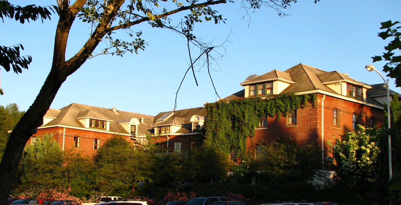
- Multnomah County Poor Farm
-
Multnomah County Poor Farm

Location: Troutdale, Oregon Coordinates: 45°32′19″N 122°24′29″W / 45.53861°N 122.40806°WCoordinates: 45°32′19″N 122°24′29″W / 45.53861°N 122.40806°W Built: 1911 Architect: Bridges and Webber Architectural style: Georgian[2] NRHP Reference#: 90000844[1] Added to NRHP: June 1, 1990[1] The Multnomah County Poor Farm is a historic site in Troutdale, Oregon, United States. The former county poor farm is listed on the National Register of Historic Places. Today the site is operated as an entertainment and lodging complex under the name McMenamins Edgefield, one of many historic properties owned, restored, and operated by McMenamins.
History
In 1854 the territorial legislature gave the counties the responsibility of caring for the poor.[3] 1868 saw the first pauper's farm open in the west hills of Portland. This facility, called Hillside Farm, was located near Canyon Road in Portland's West Hills; the site is now part of Washington Park.[3] Hillside Farm was closed down due to the "deplorable" condition of the building, and the Multnomah County Poor Farm was built to replace it. In November 1911, 211 residents moved to the new farm in Troutdale.[3] This new facility was the largest county-funded relief institution in Oregon.[3]
In 1934 an infirmary wing was built to care for the aging population of the farm. In 1935, its population peaked at 614.[3] The farm would eventually encompass 345 acres (140 ha). During 1939, a doctor's duplex was built by the Works Progress Administration (WPA). The WPA also added an incinerator, sprinkler system, and sun porch in 1940.[3] In 1947, the name of the institution was changed to the Multnomah County Home and Farm.[3] In the late 1950s, the farming operation ceased and the name was changed to the Edgefield Manor.[3] 1964, the former tuberculosis hospital's name was changed to Edgefield Lodge for emotionally disturbed children.[3] The main building became a nursing home, which was named Edgefield Manor. Farm operations also were discontinued during this time. The entire complex was declared as the Edgefield Center by county commissioners in 1964.[3]
In 1972, the county proposed closing the entire Edgefield facilities down.[3] 1982 saw the last three patients being relocated somewhere else.[3] During 1985, county committees decided to remove all buildings from the area except for the jail.[3] The reason was to market the land to potential buyers. In 1986, the Troutdale Historical Society challenged the decision to destroy all the buildings.[3] They claimed that the buildings had historical importance and needed to be preserved. In 1990 Edgefield was named to the National Register of Historic Places. That same year, the facility was purchased by McMenamins.[3]
References
- ^ a b "National Register Information System". National Register of Historic Places. National Park Service. 2009-11-24. http://nrhp.focus.nps.gov/natreg/docs/All_Data.html.
- ^ Edgefield History From rags to riches, http://www.mcmenamins.com/index.php?loc=3&id=56, retrieved 2009-11-30
- ^ a b c d e f g h i j k l m n o Vintage Edgefield: A history of the Multnomah County Poor Farm and McMenamins Edgefield. Tigard: B&B Print Source. 2002. p. 6.
External links
- McMenamins Edgefield (official website)
- Listing at nationalregisterofhistoricplaces.com
U.S. National Register of Historic Places Topics Lists by states Alabama • Alaska • Arizona • Arkansas • California • Colorado • Connecticut • Delaware • Florida • Georgia • Hawaii • Idaho • Illinois • Indiana • Iowa • Kansas • Kentucky • Louisiana • Maine • Maryland • Massachusetts • Michigan • Minnesota • Mississippi • Missouri • Montana • Nebraska • Nevada • New Hampshire • New Jersey • New Mexico • New York • North Carolina • North Dakota • Ohio • Oklahoma • Oregon • Pennsylvania • Rhode Island • South Carolina • South Dakota • Tennessee • Texas • Utah • Vermont • Virginia • Washington • West Virginia • Wisconsin • WyomingLists by territories Lists by associated states Other  Category:National Register of Historic Places •
  Portal:National Register of Historic PlacesCategories:
- National Register of Historic Places in Multnomah County, Oregon
- Buildings and structures completed in 1911
- Restaurants in Oregon
- Hotels in Oregon
- Farms in Oregon
- Works Progress Administration in Oregon
- Buildings and structures in Multnomah County, Oregon
- McMenamins
Wikimedia Foundation. 2010.