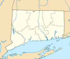
- Main Street Bridge (Stamford, Connecticut)
-
Main Street Bridge
Location: Carries Main St. over the Rippowam River, Stamford, Connecticut Coordinates: 41°3′14″N 73°32′44″W / 41.05389°N 73.54556°WCoordinates: 41°3′14″N 73°32′44″W / 41.05389°N 73.54556°W Area: less than one acre Built: 1888 Architect: Berlin Iron Bridge Company Architectural style: lenticular pony truss Governing body: Local NRHP Reference#: 87000801[1] Added to NRHP: May 21, 1987 The Main Street Bridge in Stamford, Connecticut carries Main Street over the Rippowam River (also known as Mill River). It was built in 1888. It was designed and manufactured by the Berlin Iron Bridge Company.
It was listed on the National Register of Historic Places in 1987.[1]
By 1981 it was "Connecticut's only wrought-iron lenticular truss remaining on a major artery in an urban center" and one of only 17 pony truss bridges in the state.[2]:11
References
- ^ a b "National Register Information System". National Register of Historic Places. National Park Service. 2009-03-13. http://nrhp.focus.nps.gov/natreg/docs/All_Data.html.
- ^ Stephen Bedford and John Herzan (September 2, 1998). "National Register of Historic Places Inventory-Nomination: Main Street Bridge". National Park Service. http://pdfhost.focus.nps.gov/docs/NRHP/Text/87000801.pdf. and Accompanying eight photos from 1986
U.S. National Register of Historic Places Topics Lists by states Alabama • Alaska • Arizona • Arkansas • California • Colorado • Connecticut • Delaware • Florida • Georgia • Hawaii • Idaho • Illinois • Indiana • Iowa • Kansas • Kentucky • Louisiana • Maine • Maryland • Massachusetts • Michigan • Minnesota • Mississippi • Missouri • Montana • Nebraska • Nevada • New Hampshire • New Jersey • New Mexico • New York • North Carolina • North Dakota • Ohio • Oklahoma • Oregon • Pennsylvania • Rhode Island • South Carolina • South Dakota • Tennessee • Texas • Utah • Vermont • Virginia • Washington • West Virginia • Wisconsin • WyomingLists by territories Lists by associated states Other  Category:National Register of Historic Places •
  Portal:National Register of Historic PlacesCategories:
- National Register of Historic Places in Connecticut
- Bridges completed in 1888
- Bridges in Fairfield County, Connecticut
- Buildings and structures in Stamford, Connecticut
- Road bridges in Connecticut
- Connecticut Registered Historic Place stubs
Wikimedia Foundation. 2010.

