- Turpan Depression
-
Coordinates: 42°47′N 89°20′E / 42.78°N 89.34°E
Turpan Depression 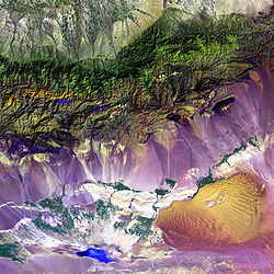
The Turpan Depression, nestled at the foot of China’s Bogda Mountains. Chinese name Traditional Chinese 吐魯番盆地 Simplified Chinese 吐鲁番盆地 Transcriptions Mandarin - Hanyu Pinyin Tǔlǔfán Péndì Uyghur name Uyghur تۇرپان ئويمانلىقى
Turpan OymanliqiThe Turpan Depression or Turfan Depression is a fault-bounded trough located around and south of the city-oasis of Turpan, in the Xinjiang Autonomous Region in far western China, about 150 km southeast of the provincial capital Ürümqi. It includes the third lowest exposed point on the Earth's surface (dry Lake Ayding, -154m), after the Dead Sea and Lake Assal (Djibouti). It is entirely below sea level.[1] By some measures, it is also the hottest and driest area in China.[2]
Contents
Geology and relief
The Turpan Basin is a fault-bounded trough located in the eastern part of the Tian Shan. It covers an area of 50,000 km². The surrounding mountain ranges are: the central Tian Shan in the west, the Bogda Shan in the north-west, the Haerlike Shan in the north-west, and the Jueluotage Shan in the south. Beyond the surrounding mountain ranges lie the Junggar Basin in the north and the Tarim Basin in the south.
Some geographers also use the term Turpan-Hami Basin, which is understood as including the Turpan Depression along with the Hami Depression (located to the east of the Turpan Depression, and to the southwest of the city of Hami) and the Liaodong Uplift separating the two depressions. A source using this terminology gave the area of the Turpan Depression proper as 28,600 km², that of the Hami Depression as 19,300 km², and for the entire Turpan-Hami Basin, as 48,000 km².[3]

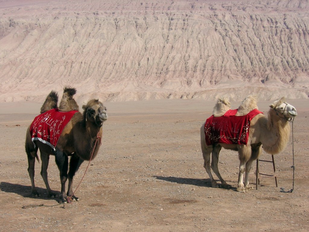
The Turpan Basin formed in a shear zone during the Late Permian due to motion between the East European and the Angaran craton. It was subsequently deformed by the collision of the Indian and Eurasian plates in the Cenozoic. In the latter deformation, a thrust fault belt running from east to west, the Flaming Mountains, was formed in the center of the basin. The Flaming Mountains are 98 km long and 9 km wide; the highest peak reaches an elevation of 831.7 m above sea level.
Also in the center of the basin lies the Ayding Lake (Moonlight Lake) which has an elevation of 154.5 m below sea level (see the list of places on land with elevations below sea level).[3] Its shores mark the third lowest exposed elevation on the Earth's land surface (after the Dead Sea which reaches down to more than 400 meters below sea level, and Lake Assal (Djibouti) at 155 m below sea level). It is the lowest surface point in China.
The Shihongtan uranium ore deposit is located at the southwestern margin of the Turpan Depression, some 35 km south-southwest from Turpan city.[3]
Climate
The Turpan Basin has a hot and arid continental climate in which the precipitation is far less than the potential evaporation. July is the hottest month with an average maximum temperature of 39.7°C (103.5°F) and January the coolest with an average maximum temperature of -2.2°C (28°F). Monthly rainfall is highest in June (3.3 mm) and lowest in February (0.2 mm). The annual average precipitation is less than 2 cm (data from the Global Historical Climatology Network, collected between 1951 and 1990 from the Turpan weather station). In contrast to this, the potential annual evaporation rate reaches 3 m. Because of its climate, the area is sometimes counted as one of the Furnaces of China, although the locations included under this heading vary.
Vegetation and agriculture
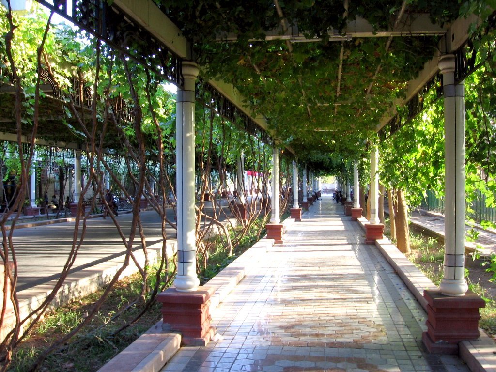
 Qingnian Lu, a Turpan city street shaded by grapevine trellises
On the shores of Aydingkol Lake, reeds, tamarisks, saxauls, as well as other shrubs and weeds can be found. Away from sources of water, the Turpan Basin is not covered by vegetation. Consequently, agriculture is limited to oasis and depends on a sophisticated irrigation system known as the Karez System. The irrigation water comes from the surrounding mountain ranges, in particular from the annual melting of the snow. The Karez System consists of wells, underground channels, ground canals, and small reservoirs, which use the natural slope of the terrain to sustain the water flow and guide the water right to the plants while minimizing evaporation all along the way. The historical record of the system extends back to the Han Dynasty. The number of Karez systems in the area is slightly below 1,000 and the total length of the canals is about 5,000 km in length. The Karez System is therefore considered as one of the three great ancient projects in China along with the Great Wall and the Grand Canal. Farming in the Turpan Basin is particularly famous for its fruit. Because of the dry and hot conditions, the fruits grown in the depression have very high concentrations of sugar. They are traditionally processed by drying in open drying barns. The cultivated fruit include: mulberry, peach, apricot, apple, pomegranate, pear, fig, walnut, as well as grapes, watermelons and muskmelons. Among the fruit, the grapes stand out: more than 100 varieties of grape are cultivated in the area and it accounts for 90% of China's seedless grape crop. Other specialty agricultural products of the region are Donghu Hami melons and long-staple cotton.
History
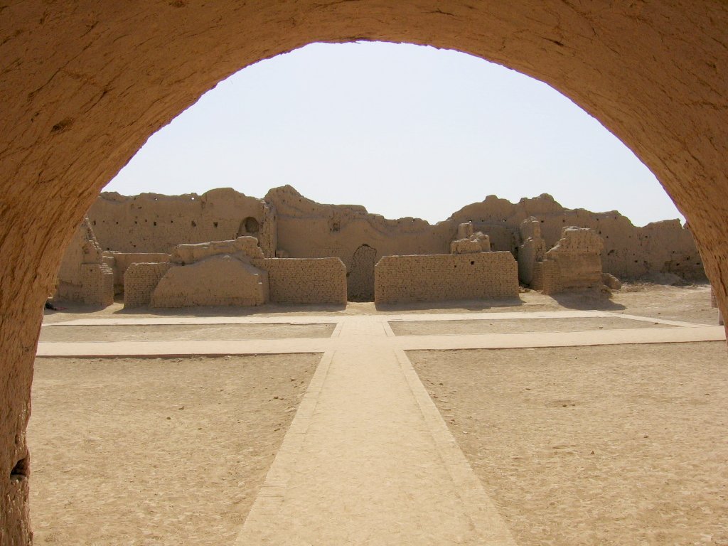
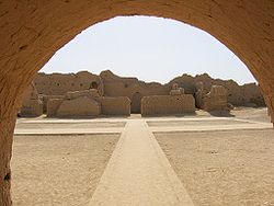 Ruins of Gaochang
The ancient city of Gaochang was a key point on the ancient Silk Road and dates back to the 1st century BC. It was burnt down in wars in the 14th century. The Bezeklik Thousand Buddha Caves, which are located in the Flaming Mountains' Mutou Valley, about 30 km (19 mi) east of the city of Turpan, have been hewn into the rock from the Tang Dynasty era up to the time of the Yuan Dynasty (13th century). The caves are famous for their murals, which can still be found in about 40 of the 77 known caves. The desert climate has favored preservation of the content of the Astana-Karakhoja ancient tombs, which are located about 6 km from the ancient city of Gaochang. The tombs are the burial place for nobles, officials, and others who were interred there from the times of the Western Jin Dynasty until the middle of the Tang Dynasty era.
Sources
- Shao Leia, Karl Statteggerb, Wenhou LI, and Bernd J. Haupt (1999), "Depositional style and subsidence history of the Turpan Basin (NW China)", Sedimentary Geology, Vol. 128, No. 1-2, pp. 155–169
- Allen MB, AMC Scedilengör, BA Natal'in (1995), "Junggar, Turpan and Alakol basins as Late Permian to ?Early Triassic extensional structures in a sinistral shear zone in the Altaid orogenic collage, Central Asia", Journal of the Geological Society, Vol. 152, No. 2, pp. 327–338
Notes
- ^ "NASA - Bogda Mountains". www.nasa.gov. http://www.nasa.gov/multimedia/imagegallery/image_feature_533.html. Retrieved 2009-10-09.
- ^ "If you can stand the heat, then the Turpan Basin is the place to be". Shanghai Daily. 4-5-2010. http://www.shanghaidaily.com/sp/article/2010/201004/20100405/article_433203.htm.
- ^ a b c Dahlkamp, Franz J., Uranium Deposits of the World: Asia, Springer, pp. 40–41, ISBN 3540785574, http://books.google.com/books?id=ShzwRGs5mDYC&pg=PA40
External links
Xinjiang topics General Geography Cities • Tian Shan • Dzungarian Basin • Tarim Basin • Gurbantünggüt Desert • Kumtag Desert • Taklimakan Desert • Turpan Depression • Karakoram Mountains • Altai Mountains • Tian Shan • Kunlun Shan • Pamir Mountains • Torugart Pass • Karakoram PassEducation Culture Cuisine Dapanji • Sangza • Samsa • Youtazi • Pamirdin • Xurpa • Tohax • Tunurkawab • Chinese Islamic cuisineVisitor attractions Apak Khoja and Xiang Fei Tomb • Flaming Mountains • Jiaohe Ruins • Gaochang • Grand Bazaar, Ürümqi • Id Kah Mosque • Karakul Lake • Kizil Caves • Ruins of NiyaCategories:- Turpan
- Landforms of China
- Depressions (geology)
- Geography of Xinjiang
- Lowest points

Wikimedia Foundation. 2010.