- Martin Creek
-
This article is about the Bear Creek that flows into San Francisquito Creek in the San Francisco Bay Area. For other Bear Creeks in California, see Bear Creek (California).
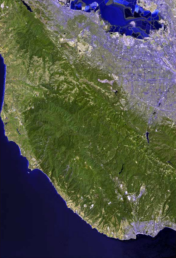
Martin Creek Dennis Martin Creek[1] stream Country United States State California Region San Mateo County City Woodside, California Source Northeast slope of the Santa Cruz Mountains - location Woodside - elevation 1,400 ft (427 m) - coordinates 37°22′49″N 122°15′31″W / 37.38028°N 122.25861°W [2] Mouth Confluence with Corte Madera Creek - location Portola Valley, California - elevation 358 ft (109 m) [2] - coordinates 37°24′36″N 122°14′18″W / 37.41°N 122.23833°W [2] Martin Creek, known locally as Dennis Martin Creek, is a 1.4-mile-long (2.3 km)[3] north by northeastward-flowing stream originating just east of Skyline Boulevard in the Santa Cruz Mountains, near the community of Skylonda in San Mateo County, California, United States. It flows through the town of Woodside before entering Corte Madera Creek in Portola Valley. Corte Madera Creek in turn enters San Francisquito Creek below Searsville Reservoir and flows to San Francisco Bay.
Contents
History
The namesake of Dennis Martin Creek has a fascinating history. Dennis Martin was the Canadian-American son of William Martin, who with his parents and siblings, began a cross-country trek from Missouri to California in 1844. At the urging of a Jesuit priest, the Martin family had joined two other Irish families--the Murphys and the Sullivans—to leave Missouri in search of “Catholic institutions” in the West. The Stephens-Townsend-Murphy Party party became the first pioneers to cross the Sierra Nevada into California. Their route was the same as that chosen by the ill-fated Donner Party two years later.[4] Upon reaching Truckey's Lake (now Donner Lake) on November 14, 1844, the party left six of their eleven wagons because of difficulties getting the wagons over what would become Donner Pass. Eighteen year old Moses Schallenberger spent the winter there alone watching over the wagons, surviving the impassably deep snows only by trapping High Sierra foxes for food. The rest of the party spent the winter in the upper Yuba River valley, until most of the men were enticed to fight with Captain John Sutter for Mexican California Governor Manuel Micheltorena in exchange for promises of land grants. Instead of joining them, Dennis Martin returned to the upper Yuba with supplies for the women and children. Upon learning of the plight of Moses Schallenberger, twenty-three year old Martin crossed the snowbound Sierras in mid-winter to rescue Schallenberger at Donner Lake in February, 1845.[5] Martin showed Schallenberger how to construct proper snowshoes and successfully the two recrossed the Sierras to the Central Valley.[6]
Martin worked for Captain John A. Sutter in the summer of 1845, who sent him to supervise three Indians cutting redwood on the San Francisco Peninsula. While so employed, Dennis Martin met a fellow Irishman, John Coppinger.[4] Then Martin sought and found gold on the Mokelumne and Stanislaus Rivers in partnership with Daniel Murphy, his transcontinental companion, and Charles Maria Weber, the founder of Stockton. Quickly making his fortune in gold, Martin bought 1,500 acres of land north of San Francisquito Creek from his friend John Coppinger, the grantee of Rancho Cañada de Raymundo, for $1,500. This property is now marked by the Stanford Linear Accelerator Center. Then he purchased the wooded slopes of the creek he named for himself from the Rancho Corte de Madera including much of the modern day Jasper Ridge Biological Preserve, the Ladera subdivision and the Webb Ranch. Martin established an upper and lower sawmill on Dennis Martin Creek, the lower mill about a half-mile downstream from Schilling Lake.[7] Martin encouraged his relatives and friends in Canada and Missouri to join him, and many of these made up the early population of the historic mill town of Searsville, inundated by Searsville Dam in 1892. After financial misfortune and land disputes typical of the era[8], his lands were bought by Leland Stanford in November, 1882. Dennis Martin died in June 1890 and was buried at the St. Dennis Cemetery (Martin had built his own church) on his former property (by then Stanford's).[9]
The creek's watershed includes the historic Thornewood House, a 1920's estate built by Julian Thorne and surrounded by 3.5 acres of landscaping and gorgeous valley views. This 87-acre estate was willed to the Sierra Club Foundation and later given to the Midpeninsula Regional Open Space District. Currently, the house and 10-acre private leasehold are closed and under restoration.[10]
Schilling Lake is named for August Schilling, the “King of Spice”, who founded A. Schilling & Company in San Francisco in 1881. Schilling purchased the land from Julian Thorne, who purchased it from Edward Preston (attorney), who purchased it from the pioneer and lumberman, Dennis Martin.[4]
Ecology
Dennis Martin Creek and the other Corte Madera Creek tributaries and mainstem were historically Steelhead trout (Oncorhynchus mykiss) streams; however, access to the creek has been blocked since 1890 by Searsville Dam.[11][12] In the spring of 1991, an adult steelhead (0.74m) was observed jumping at the base of Searsville Dam. According to local historian Dorothy Regnery's notes from her 1966 interview with Edgar H. Batchelder, who was 2 years old when his father became caretaker of Searsville dam in 1897, his "favorite place to fish for trout was in Dennis Martin Creek."[13]
Watershed
Dennis Martin Creek drains second growth Redwood (Sequoia sempervirens) forest as it descends the northeastern slope of the Santa Cruz Mountains. It traverses the Thornewood Open Space Preserve where it is met by an ephemeral stream that drains Schilling Lake. Shortly after crossing under Old La Honda Road the creek reaches the San Andreas Fault zone and crosses Portola Road where the ground becomes nearly level and it is one of a nexus of half a dozen creeks that coalesce in a large freshwater marsh to form Corte Madera Creek. Old maps suggest that Dennis Martin Creek and Alambique Creek were tributary to Sausal Creek.[14]
Recreation
Hiking trails are available in the 167 acre Thornewood Open Space Preserve, part of the Midpeninsula Regional Open Space District system, including the Bridal Trail and an easy walk to Lake Schilling along the wooded 3/4 mile Schilling Lake Trail. The preserve is accessed from the south side of La Honda Road (Highway 84), 1.6 miles past its intersection with Portola Road in Woodside.[10]
See also
References
- ^ Mildred B. Hoover (1966). Historic Spots in California, 3rd edition. Stanford, California: Stanford University Press. p. 400.
- ^ a b c U.S. Geological Survey Geographic Names Information System: Martin Creek
- ^ U.S. Geological Survey. National Hydrography Dataset high-resolution flowline data. The National Map, accessed September 18, 2011
- ^ a b c Tom Davids. "A Short Hike to Schilling Lake and Dennis Martin Creek, Thornewood Open Space Preserve (In Search of Sawmills on the Peninsula)". http://www.weeklywalker.com/Walks%20by%20county/San%20Mateo/Thornewood_Schilling-Dennis%20Martin%20Cr..htm. Retrieved 2011-09-18.
- ^ Dorothy Regnery (September, 1983). "Dennis Martin once owned Stanford's backlands, including SLAC, Jasper Ridge, and Webb Ranch". Stanford Historical Society Newsletter. http://histsoc.stanford.edu/pdfST/ST7no3.pdf. Retrieved 2011-09-18.
- ^ Moses Schallenberger (2007). Charles H. Todd. ed. Moses Schallenberger at Truckey's Lake, 1844-1845. Winters, California: 19th Century Publications.
- ^ Frank Merriman Stanger (1967). Sawmills in the Redwoods: Logging on the San Francisco Peninsula, 1849-1967. San Mateo County Historical Association. p. 28. http://books.google.com/books?ei=AJt2TtCXJOXViALYutCzAg&ct=result&id=EvbWAAAAMAAJ&dq=Sawmills+in+the+Redwoods&q=dennis+martin#search_anchor. Retrieved 2011-09-18.
- ^ "Sheriff Sale". San Mateo County Gazette News. 1861-10. http://www.sfgenealogy.com/sanmateo/history/gazette/smnews44.htm. Retrieved 2011-09-18.
- ^ Dorothy Regnery (September, 1983). "Dennis Martin once owned Stanford's backlands, including SLAC, Jasper Ridge, and Webb Ranch". Stanford Historical Society Newsletter. http://histsoc.stanford.edu/pdfST/ST7no3.pdf. Retrieved 2011-09-18.
- ^ a b "Thornewood Open Space Preserve". Midpeninsula Regional Open Space District. http://www.openspace.org/preserves/pr_thornewood.asp. Retrieved 2011-09-18.
- ^ Skinner, John E. (1962). The Freshwater Fish and Fisheries of the San Francisco Bay Area. California Department of Fish and Game, Water Projects Branch Report no. 1. Sacramento, California: California Department of Fish and Game. http://www.estuaryarchive.org/archive/skinner_1962/7/. Retrieved 2010-09-20.
- ^ Leidy, R.A., G.S. Becker, B.N. Harvey (2005). "Historical distribution and current status of steelhead/rainbow trout (Oncorhynchus mykiss) in streams of the San Francisco Estuary, California.". Center for Ecosystem Management and Restoration, Oakland, CA.. http://www.cemar.org/pdf/sanmateoandsanfrancisco.pdf. Retrieved 2011-09-18.
- ^ Regnery, Dorothy (1966). M0479, box 6, folder 13. Interview. Department of Special Collections, Stanford University Libraries. p. 5. Dorothy F. Regnery papers.
- ^ Janet M. Sowers (2005). "San Francisquito Watershed and Alluvial Fan, in Creek & Watershed Map of Palo Alto & Vicinity". Oakland Museum of California. http://museumca.org/creeks/1460-SFrancisquitoWS-Big.html. Retrieved 2011-09-18.
External links
- San Francisquito Watershed & Alluvial Fan at Oakland Museum of California website
- San Francisquito Watershed Council
- Upper Watershed San Francisquito Creek Watershed prepared by the Oakland Museum of California
- The Creeks that Flow through Woodside by the Bear Creek League of Advocates for the Watershed (Bear CLAW)
Santa Cruz Mountains Peaks Black Mountain · Loma Prieta · Long Ridge · Montara Mountain · Mount Bielawski · Mount Thayer · Mount Umunhum · San Bruno Mountain · Santa Teresa Hills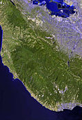
Rivers and creeks Adobe Creek · Bean Creek · Branciforte Creek · Butano Creek · Carbonera Creek · Guadalupe River · Little Boulder Creek · Loch Lomond · Los Alamitos Creek · Los Gatos Creek · Naples Creek · Permanente Creek · Pescadero Creek · Peters Creek · Pilarcitos Creek · San Bruno Creek · San Francisquito Creek · San Lorenzo River · San Pedro Creek · San Vicente Creek · Stevens Creek · Tip Toe Falls · Uvas Creek · Waddell Creek · Waterman Creek · Zayante CreekParks Hiking trails Other Categories:- Woodside, California
- Portola Valley, California
- Rivers of San Mateo County, California
Wikimedia Foundation. 2010.