- Corte Madera Creek (San Mateo County, California)
-
For the creek in Marin County, see Corte Madera Creek (Marin County, California).
Corte Madera Creek Corte De Madera Creek[1] stream 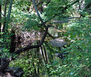 Corte Madera Creek just below Searsville Dam July 22, 2011
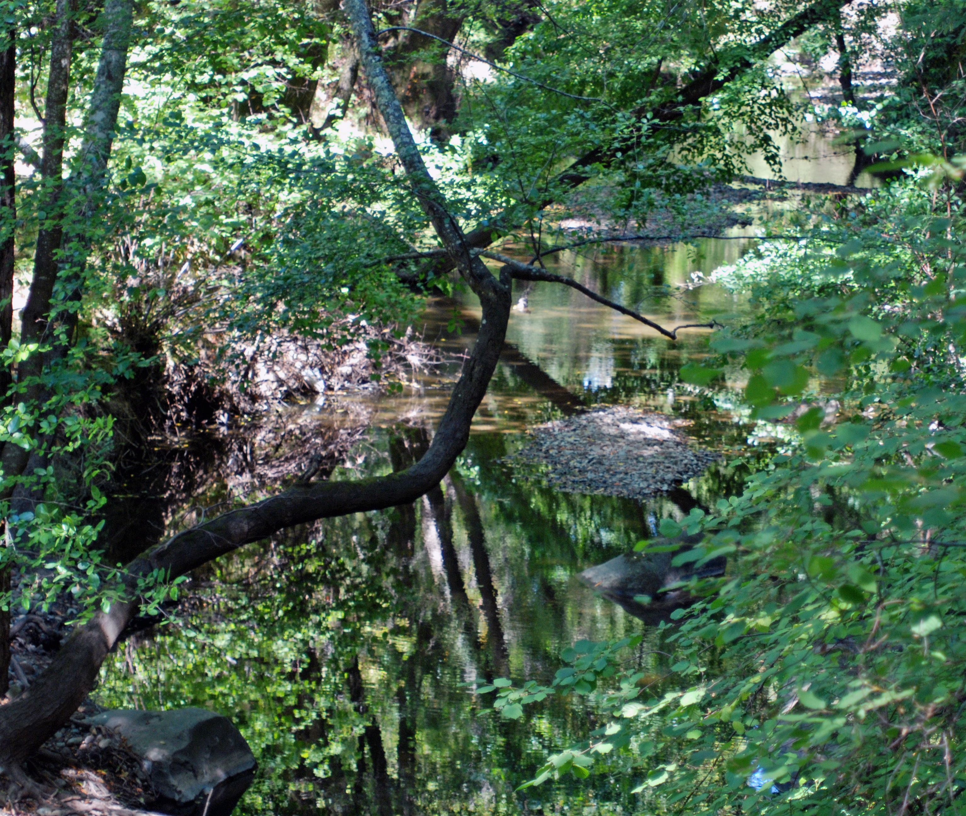
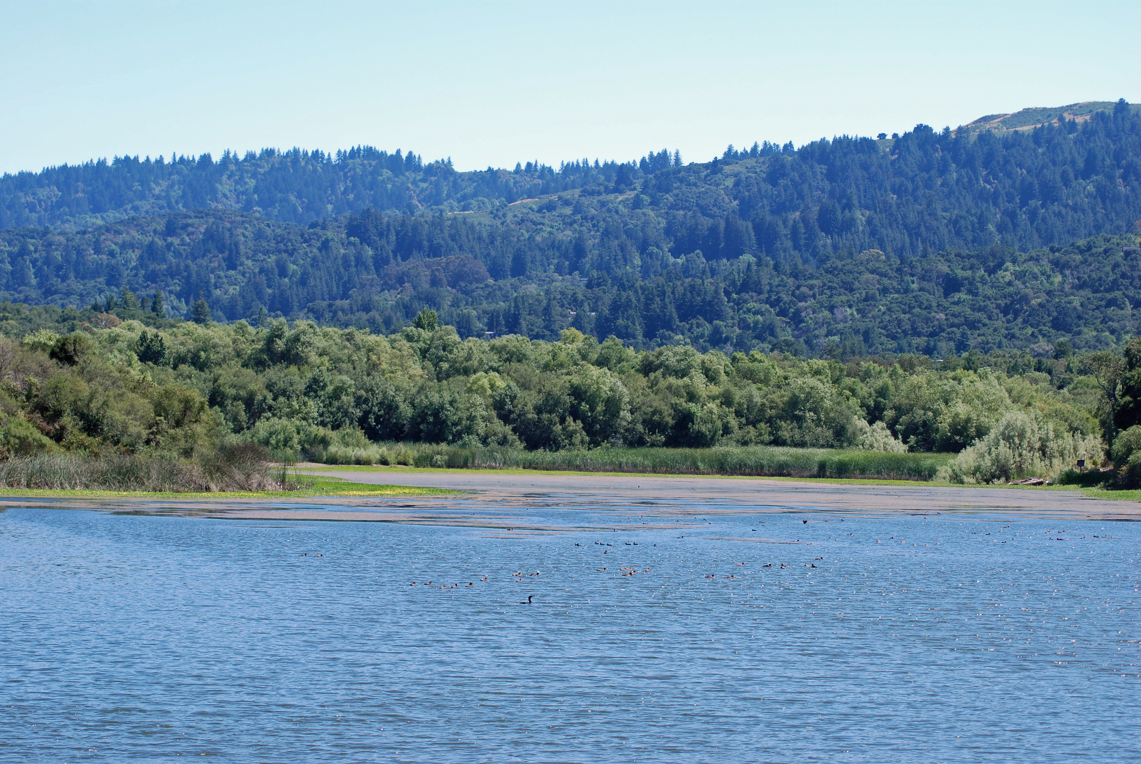
Name origin: Spanish language Country United States State California Region Southeastern San Mateo County Tributaries - left Coal Creek, Gulch Creek, Rengstorff Gulch, Damiani Creek, Jones Gulch, Hamms Gulch, Alambique Creek, Dennis Martin Creek, Sausal Creek - right Westridge Creek City Portola Valley, California Source - location Russian Ridge Open Space Preserve. - elevation 1,950 ft (594 m) - coordinates 37°19′26″N 122°11′24″W / 37.32389°N 122.19°W [1] Mouth Searsville Lake - location Portola Valley, California - elevation 351 ft (107 m) - coordinates 37°24′03″N 122°14′18″W / 37.40083°N 122.23833°W [1]  Looking south across Searsville Reservoir from the dam on Corte Madera Creek
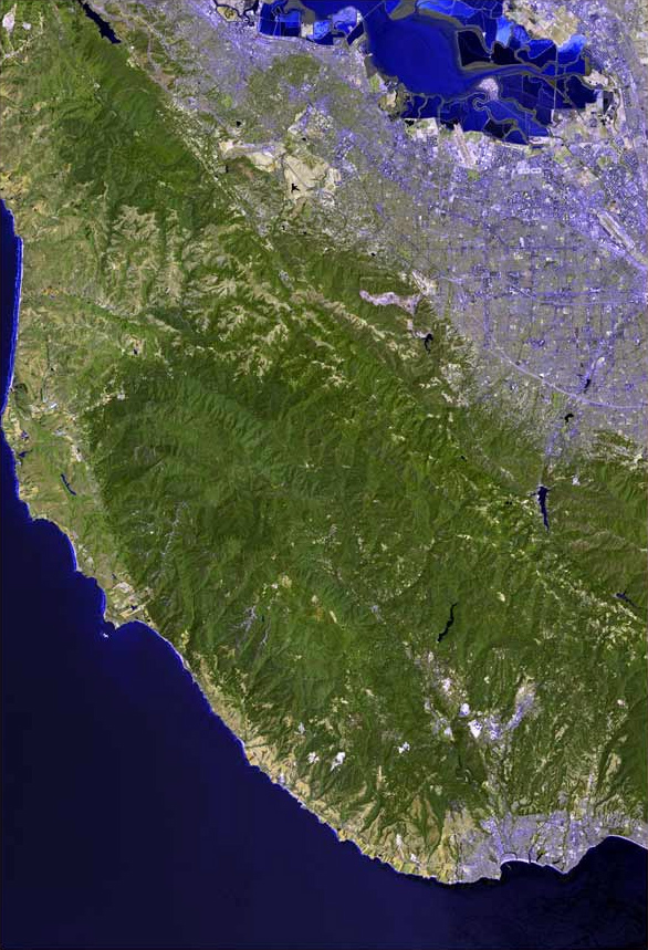
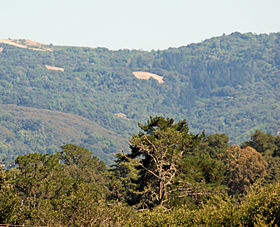 Shot looking southeast from Jasper Ridge's Sun Field Station up the Corte Madera Creek watershed with Russian Ridge on the right and Montebello Ridge on the left.
Corte Madera Creek (Spanish for "a place where wood is cut") is a 7.3-mile-long (11.7 km)[2] creek that flows north-northwest to Searsville Dam and then joins with Bear Creek to form San Francisquito Creek in California. Historically it was called the Corte de Madera Creek and ran through Rancho Cañada del Corte de Madera and Rancho Corte de Madera land grants (the latter surrounding the former).[3][4]
Contents
Ecology
Corte Madera Creek was historically a Steelhead trout (Oncorhynchus mykiss) stream; however, access to the creek has been blocked since 1890 by Searsville Dam.[5][6] In the spring of 1991, an adult steelhead (0.74m) was observed jumping at the base of Searsville Dam. In May 2002, the San Francisquito Watershed Council released a barrier survey including Corte Madera Creek. A private bridge apron adjacent to Willowbrook Drive and another downstream of the confluence with Damiani Creek were described as impassable barriers to upstream migrating Steelhead. The rainbow form of Steelhead trout is considered Critically Endangered in all Corte Madera Creek tributaries.[6]
Illegal fishing of rainbow trout (rainbows are the landlocked descendants of steelhead trout) has occurred in several places along Corte Madera Creek with significant damage to the surviving populations of native landlocked rainbows. In addition, there are also several private ponds stocked with warm weather non-native species, such as Smallmouth Bass, Redear Sunfish and Bluegill that threaten the surviving native trout population fry and eggs. The most notable pond is on Iroquois Trail and empties into Corte Madera Creek through a single outlet which floods during El Niño, or a wet winter.
Watershed
Corte Madera Creek has its origin just northeast of Borel Hill in the Coal Creek Open Space Preserve (part of the Midpeninsula Regional Open Space District, and follows Alpine Road northwesterly along the San Andreas Fault to pick up Coal Creek, Rengstorff Gulch, Damiani Creek, Jones Gulch, Hamms Gulch - all draining the northeastern slope of the Santa Cruz Mountains. It levels out upon reaching Portola Valley and crosses under Portola Road at Brookside Drive. Before reaching Searsville Reservoir it arrives in a large laguna or freshwater marsh formed by the nexus of several creeks, including Westbridge Creek, Sausal Creek, Dennis Martin Creek, and Alambique Creek. Old maps suggest that Dennis Martin Creek and Alambique Creek were tributary to Sausal Creek.[7] Below Searsville Dam it joins with Bear Creek to form San Francisquito Creek.
See also
Searsville Dam San Francisquito Creek
References
- ^ a b c U.S. Geological Survey Geographic Names Information System: Corte Madera Creek
- ^ U.S. Geological Survey. National Hydrography Dataset high-resolution flowline data. The National Map, accessed March 15, 2011
- ^ Erwin G. Gudde, William Bright (2004). California Place Names: The Origin and Etymology of Current Geographical Names. University of California Press. p. 92. ISBN 9780520242173. http://books.google.com/books?id=Kqwt5RlMVBoC&pg=PA92&lpg=PA92&dq=gudde+corte+madera+creek&source=bl&ots=3sudgcf-oY&sig=O76XLp8aiFxayzNOCshErUU4NCc&hl=en&ei=Lax8TMXDJ4iesQOJ_vyCBw&sa=X&oi=book_result&ct=result&resnum=6&ved=0CCwQ6AEwBQ#v=onepage&q&f=false. Retrieved 2010-09-20.
- ^ Durham, David L. (1998). Durham's Place Names of California's San Francisco Bay Area: Includes Marin, San Francisco, San Mateo, Contra Costa, Alameda, Solano & Santa Clara counties. Word Dancer Press, Sanger, California. p. 44. ISBN 78-1884995149. http://books.google.com/books?id=3MkxoL0X7xYC&printsec=frontcover&dq=durham%27s+place+names+of+san+francisco&source=bl&ots=fKbPbIj0Tt&sig=ShN0e9MBd90fvTs_Ycxhho9IaHE&hl=en&ei=K6R8TO-7BIGqsAO1j_SCBw&sa=X&oi=book_result&ct=result&resnum=3&ved=0CBoQ6AEwAg#v=onepage&q=corte%20madera%20creek&f=false. Retrieved 2010-08-30.
- ^ Skinner, John E. (1962). The Freshwater Fish and Fisheries of the San Francisco Bay Area. California Department of Fish and Game, Water Projects Branch Report no. 1. Sacramento, California: California Department of Fish and Game. http://www.estuaryarchive.org/archive/skinner_1962/7/. Retrieved 2010-09-20.
- ^ a b Leidy, R.A., G.S. Becker, B.N. Harvey (2005). "Historical distribution and current status of steelhead/rainbow trout (Oncorhynchus mykiss) in streams of the San Francisco Estuary, California.". Center for Ecosystem Management and Restoration, Oakland, CA.. http://www.cemar.org/pdf/sanmateoandsanfrancisco.pdf. Retrieved 2009-12-28.
- ^ Janet M. Sowers (2005). "San Francisquito Watershed and Alluvial Fan, in Creek & Watershed Map of Palo Alto & Vicinity". Oakland Museum of California. http://museumca.org/creeks/1460-SFrancisquitoWS-Big.html. Retrieved 2011-09-18.
External links
- San Francisquito Watershed & Alluvial Fan at Oakland Museum of California website
- Oakland Museum Map of San Francisquito Creek Watershed
- Beyond Searsville Dam
- San Francisquito Watershed Council
See also
Santa Cruz Mountains Peaks Black Mountain · Loma Prieta · Long Ridge · Montara Mountain · Mount Bielawski · Mount Thayer · Mount Umunhum · San Bruno Mountain · Santa Teresa Hills
Rivers and creeks Adobe Creek · Bean Creek · Branciforte Creek · Butano Creek · Carbonera Creek · Guadalupe River · Little Boulder Creek · Loch Lomond · Los Alamitos Creek · Los Gatos Creek · Naples Creek · Permanente Creek · Pescadero Creek · Peters Creek · Pilarcitos Creek · San Bruno Creek · San Francisquito Creek · San Lorenzo River · San Pedro Creek · San Vicente Creek · Stevens Creek · Tip Toe Falls · Uvas Creek · Waddell Creek · Waterman Creek · Zayante CreekParks Hiking trails Other Categories:- Rivers of San Mateo County, California
- Palo Alto, California
- Santa Cruz Mountains

Wikimedia Foundation. 2010.