- Montara Mountain
-
Montara Mountain 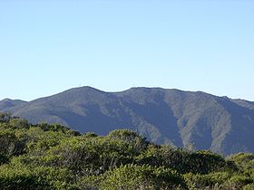
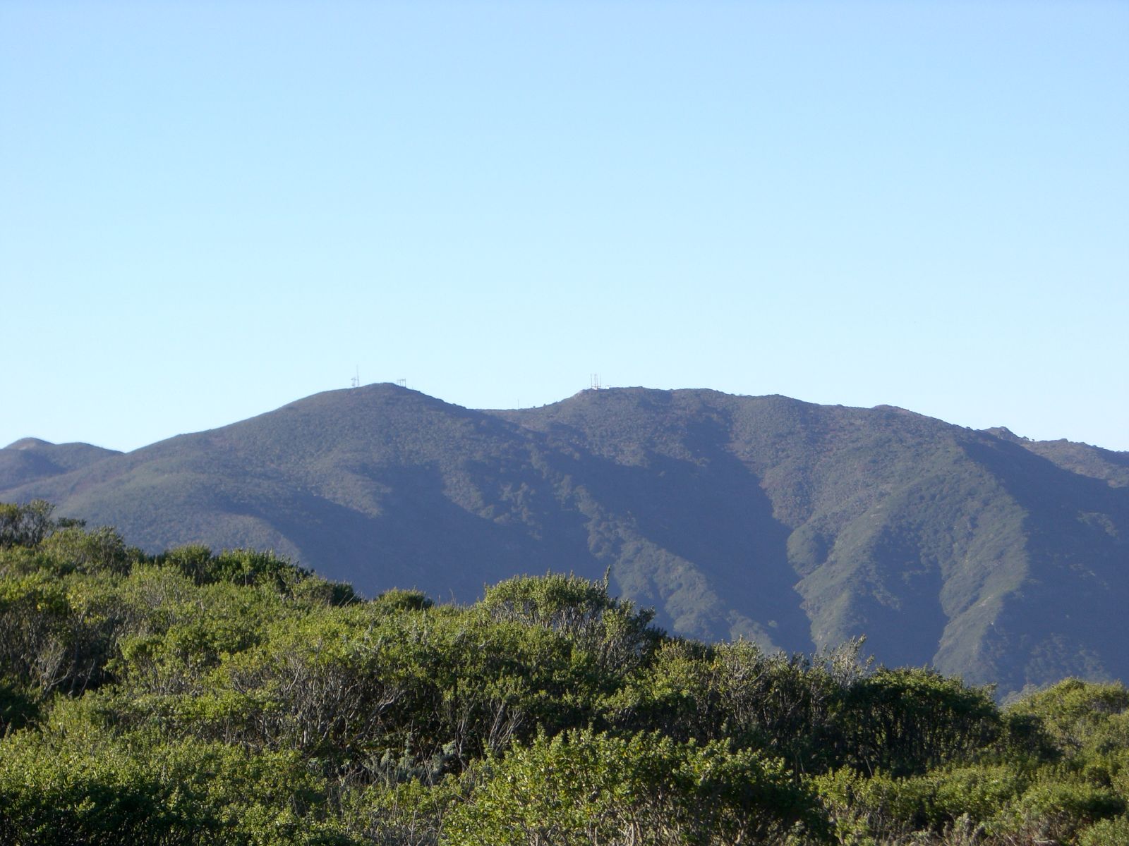
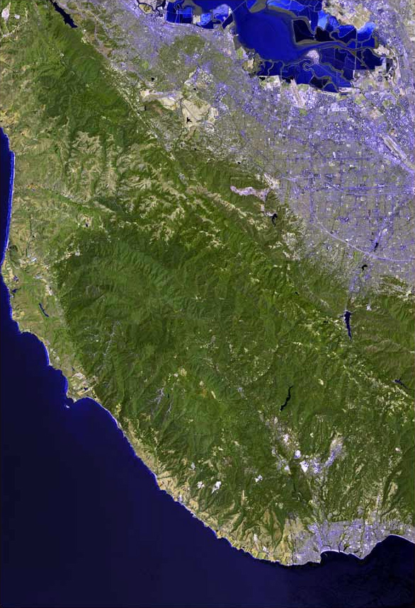
Elevation 1,898 ft (579 m) NGVD 29[1] Prominence 486 ft (148 m) [1] Location Location San Mateo County, California, USA Range Santa Cruz Mountains Coordinates 37°31′43″N 122°25′37″W / 37.5285501°N 122.4269189°WCoordinates: 37°31′43″N 122°25′37″W / 37.5285501°N 122.4269189°W[2] Topo map USGS Montara Mountain Climbing Easiest route Hike Montara Mountain, positioned between the unincorporated community of Montara, California to the southwest and the city of Pacifica, California to the north, forms the northern spur of the Santa Cruz Mountains, a narrow mountain range running the length of the San Francisco Peninsula that separates San Francisco Bay from the Pacific Ocean.[3] Its highest point rises to 1,898 feet (579 m)[1] above sea level. An unpaved fire road, the North Peak Access Road, accessible from the Pedro Mountain Road in McNee Ranch State Park, provides access to the summit by hikers from the south. From the north, Montara Mountain Trail, Hazelnut Trail and Brooks Creek Trail provide access to the mountain with trailheads in San Pedro Valley County Park.[4]
Due in part to its biologically isolated location near the end of a peninsula, the mountain has an extensive and unique biodiversity especially on the serpentine soils of the lower slopes. A number of plant endangered species are only found on this mountain, including Hickman's potentilla and San Mateo thornmint, Acanthomintha duttonii.[5] The rare endemic manzanita Arctostaphylos montaraensis was named for this mountain.
On occasions light snow has dusted the summit. On clear days the summit provides spectacular views of much of the San Francisco Bay Area. Denniston Creek, Arroyo de en Medio and San Pedro Creek rise on Montara Mountain, with San Pedro Creek being habitat for endangered Steelhead Trout. Brooks Creek, a tributary of San Pedro Creek originates on the north face of the mountain and forms a tall thin waterfall, Brooks Falls, which is the tallest in San Mateo County at 207 feet.[6]
Historic Crossings of Montara Mountain include the Spanish Explorer Gaspar de Portolà in October of 1769, traveling along the prehistoric Indian Trail which traverses the ridgeline between Willow Brook Estates towards Saddle Pass following the high ridgeline above Green Valley and winding down towards Martini Creek. Remnants of this trail remain visible today. During the Mexican Rancho era, a road known as Camino Pedro Cuesta also traversed Saddle Pass and connected the Sanchez Adobe in Rancho San Pedro in San Pedro Valley with Rancho Corral de Tierra Palomares in Montara. Following the Mexican-American War of 1848, this routing was known as "Road Trail" and was considered to be nearly impassible to wheeled vehicles. In 1879 this steep and rutted Road Trail crossing of Montara Mountain was replaced by the marginally improved road known as the Half Moon Bay - Colma Road, which included road grades of 24%. This road which routed closer to the ocean and Devil's Slide terminated in Shamrock Ranch and persisted until 1915.[7]
Notes
- ^ a b c "Montara Mountain, California". Peakbagger.com. http://www.peakbagger.com/peak.aspx?pid=1192. Retrieved 2009-08-09.
- ^ "Montara Mountain". Geographic Names Information System, U.S. Geological Survey. http://geonames.usgs.gov/pls/gnispublic/f?p=gnispq:3:::NO::P3_FID:1659761. Retrieved 2009-08-09.
- ^ VanderWerf, p. 7.
- ^ VanderWerf, p. 24.
- ^ VanderWerf, p. 9.
- ^ Leon Turnbull Photography. "Brooks Falls". waterfallswest.com. http://www.waterfallswest.com/waterfall.php?id=340. Retrieved 2010-02-19.
- ^ VanderWerf, pp. 121–125.
References
- VanderWerf, Barbara (1994). Montara Mountain. El Granada, Calif: Gum Tree Lane Books. ISBN 0-9632922-2-6.
External links
- "Montara Mountain Overview". Native Plants of Montara Mountain. http://plants.montara.com/mmoverview.html. Retrieved 2010-05-17.
Santa Cruz Mountains Peaks Black Mountain · Loma Prieta · Long Ridge · Montara Mountain · Mount Bielawski · Mount Thayer · Mount Umunhum · San Bruno Mountain · Santa Teresa Hills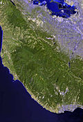
Rivers and creeks Adobe Creek · Bean Creek · Branciforte Creek · Butano Creek · Carbonera Creek · Guadalupe River · Little Boulder Creek · Loch Lomond · Los Alamitos Creek · Los Gatos Creek · Naples Creek · Permanente Creek · Pescadero Creek · Peters Creek · Pilarcitos Creek · San Bruno Creek · San Francisquito Creek · San Lorenzo River · San Pedro Creek · San Vicente Creek · Stevens Creek · Tip Toe Falls · Uvas Creek · Waddell Creek · Waterman Creek · Zayante CreekParks Hiking trails Other Categories:- Mountains of San Mateo County, California
- Mountains of the San Francisco Bay Area
Wikimedia Foundation. 2010.