- Mount Thayer
-
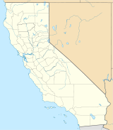
Mount Thayer Location in California Elevation 3,479 ft (1,060 m) NAVD 88[1] Location Location Santa Clara County, California, USA Range Santa Cruz Mountains Coordinates 37°09′50″N 121°55′07″W / 37.163855539°N 121.918707136°WCoordinates: 37°09′50″N 121°55′07″W / 37.163855539°N 121.918707136°W[1] Topo map USGS Los Gatos Mount Thayer is a mountain in the Santa Cruz Mountains located in Santa Clara County, California. The summit is in a section of the abandoned Almaden Air Force Station, about 1 mile west of Mount Umunhum. The elevation of the summit is at 3,479 feet (1,060 m) feet. An old derelict building, surrounded by telephone poles, is located on the summit. Mount Thayer, along with the surrounding property is off limits to the public.[2]
See also
References
- ^ a b "Thayer 2 reset". NGS data sheet. U.S. National Geodetic Survey. http://www.ngs.noaa.gov/cgi-bin/ds_mark.prl?PidBox=HS4915.
- ^ "Sierra Azul Open Space Preserve — map showing restricted access areas". Midpeninsula Regional Open Space District. http://www.openspace.org/preserves/maps/pr_sierra_azul.pdf. Retrieved 2009-08-16.
External links
- "Mount Thayer". Geographic Names Information System, U.S. Geological Survey. http://geonames.usgs.gov/pls/gnispublic/f?p=gnispq:3:::NO::P3_FID:236142. Retrieved 2009-08-16.
- "Mt.Thayer". MountainZone. http://www.mountainzone.com/mountains/detail.asp?fid=798445. Retrieved 2009-08-16.
Santa Cruz Mountains Peaks Black Mountain · Loma Prieta · Long Ridge · Montara Mountain · Mount Bielawski · Mount Thayer · Mount Umunhum · San Bruno Mountain · Santa Teresa Hills
Rivers and creeks Adobe Creek · Bean Creek · Branciforte Creek · Butano Creek · Carbonera Creek · Guadalupe River · Little Boulder Creek · Loch Lomond · Los Alamitos Creek · Los Gatos Creek · Naples Creek · Permanente Creek · Pescadero Creek · Peters Creek · Pilarcitos Creek · San Bruno Creek · San Francisquito Creek · San Lorenzo River · San Pedro Creek · San Vicente Creek · Stevens Creek · Tip Toe Falls · Uvas Creek · Waddell Creek · Waterman Creek · Zayante CreekParks Hiking trails Other Categories:- Mountains of Santa Clara County, California
- Mountains of the San Francisco Bay Area
- Santa Cruz Mountains
Wikimedia Foundation. 2010.

