- Midpeninsula Regional Open Space District
-
The Midpeninsula Regional Open Space District (MROSD) is a special-purpose district that manages over 50,000 acres (20,000 ha) of open space in 25 preserves in the San Francisco Bay Area. It includes parts of Santa Clara, San Mateo and Santa Cruz Counties. The District was created by voter initiative in 1972. The mission of the District is "to acquire and preserve a continuous greenbelt of protected open space lands for public use and enjoyment." It is a member of the Bay Area Open Space Council.
The District's tax and voter base consists of about 550 square miles (1,400 km2) and 741,000 people, mostly in Santa Clara and San Mateo counties. District revenues for fiscal year 2008-2009 were $38.0 million, with $26.4 million coming directly from a portion of property taxes. It also occasionally receives state and federal grants, as well as private donations.
Recreation
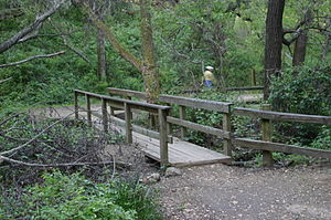
Most of the preserves are open to recreation. Popular activities are hiking, cycling, and horseback riding. Camping is generally prohibited, though the Monte Bello Open Space Preserve does have a backpacking camp available by permit only. Of the 26 preserves, 24 are fully open to the public: Mills Creek Open Space Preserve and Tunitas Creek Open Space Preserve are not open; the Bear Creek Redwoods Open Space Preserve and La Honda Creek Open Space Preserve require a permit for use, and portions of Sierra Azul Open Space Preserve are closed to the public due to toxic contamination at the summit of Mount Umunhum.
In total, the district has 226 mi. (364 km) of hiking trails, of which 150 mi. (241 km) is open to bicycles, 182 mi. (293 km) to equestrians, and 63 mi. (101 km) to leashed dogs. Preserves are relatively undeveloped, with most having only a parking area, trail signs, and possibly an outhouse. All preserves are open from dawn to one-half hour after sunset.
Open space preserves
The following open space preserves are managed by MROSD:
- Bear Creek Redwoods Open Space Preserve
- Coal Creek Open Space Preserve
- El Corte de Madera Creek Open Space Preserve (see also El Corte de Madera Creek)
- El Sereno Open Space Preserve
- Foothills Open Space Preserve
- Fremont Older Open Space Preserve
- La Honda Creek Open Space Preserve
- Long Ridge Open Space Preserve
- Los Trancos Open Space Preserve
- Mills Creek Open Space Preserve
- Monte Bello Open Space Preserve
- Picchetti Ranch Open Space Preserve (see also Picchetti Brothers Winery)
- Pulgas Ridge Open Space Preserve
- Purisima Creek Redwoods Open Space Preserve
- Rancho San Antonio Open Space Preserve
- Ravenswood Open Space Preserve
- Russian Ridge Open Space Preserve
- St. Joseph's Hill Open Space Preserve
- Saratoga Gap Open Space Preserve
- Sierra Azul Open Space Preserve
- Skyline Ridge Open Space Preserve
- Steven's Creek Shoreline Nature Study Area Open Space Preserve
- Teague Hill Open Space Preserve
- Thornewood Open Space Preserve
- Tunitas Creek Open Space Preserve
- Windy Hill Open Space Preserve
External links
Categories:- Midpeninsula Regional Open Space District
- Parks in the San Francisco Bay Area
- Nature reserves in California
- Parks in Santa Clara County, California
- Parks in San Mateo County, California
- Parks in Santa Cruz County, California
- Special districts of California
- Park districts in the United States
- Non-profit organizations based in California
- San Mateo County, California geography stubs
- Santa Clara County, California geography stubs
- San Francisco Bay Area geography stubs
- California geography stubs
Wikimedia Foundation. 2010.


