- Dąbie, Szczecin
-
Dąbie — Municipal neighbourhood — Church of the Immaculate Conception in Dąbie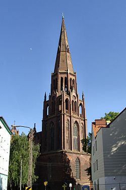

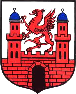
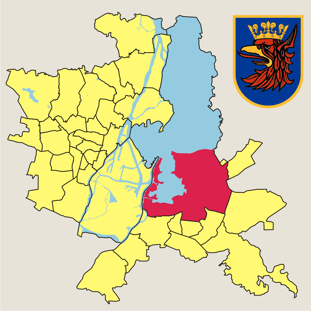
Coat of armsLocation of Dąbie within Szczecin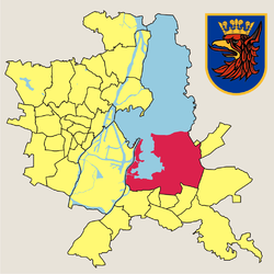
Coordinates: 53°22′52″N 14°39′16″E / 53.38111°N 14.65444°ECoordinates: 53°22′52″N 14°39′16″E / 53.38111°N 14.65444°E Country  Poland
Voivodeship West Pomeranian County/City Szczecin Population (2011) – Total 13,275 Time zone CET (UTC+1) – Summer (DST) CEST (UTC+2) Postal code Area code(s) +48 91 Car plates ZS Dąbie (German: Altdamm or Stettin-Altdamm) is a municipal neighbourhood of the city of Szczecin in Poland, situated on the Płonia river, on the south coast of Dąbie Lake, on the right bank of Oder river, east of the Szczecin Old Town and Middle Town. As of January 2011 it had a population of 13,275.[1]
Contents
Dąbie name
The name of Dąbie is of Slavonic origin and comes from the words like dąb (English: Oak), dąbie, dębina (English: Oak Forest). The early Latin documents show the name as: 1121 Vadam, 1174 Dam, 1157 Dambe, 1179 Damba, 1242 Dambe, 14th century Damnis, and in German documents as: Damn, later Alt Damn (old Dąbie). Before 1945 when Stettin was a part of Germany, the German name of this suburb was Stettin-Altdamm. In 1945 the Polish name was temporarily: Dąb, Dąb Stary and later fixed to Dąbie, based on the earliest documents.
History
In the early 10th century a settlement of the Pomeranians, destroyed in 1121 in the war between Bolesław III of Poland with the Pomeranians. The village was rebuilt and in 1176 it was awarded by duke Warcislaw II to the Cistercian monastery in Kołbacz. In the following years Dąbie became the main trading post for the rich Cistersian land properties.
In 1249 duke Barnim I established a ducal municipality next to the village, and granted it autonomy under Magdeburg rights in 1260, changed to Lübeck rights in 1293.
During World War II a POW camp was erected there. Dąbie was eventually incorporated into Szczecin on 29 April 1948.
Administrative divisions
- 1249–1816 - separate town
- 1816–1826 - part of Stettin City
- 1826–1939 - separate town in Randow County
- 1939–1945 - part of Stettin City
- 1945–1948 - separate town in Gryfino County
- after 1948 - part of Szczecin City
References
- ^ "Zestawienie informacyjne o liczbie osób zameldowanych w Szczecinie" (in Polish). Urząd Miasta Szczecin. http://bip.um.szczecin.pl/umszczecinbip/chapter_50049.asp. Retrieved 2011-01-23.
Szczecin Districts Śródmieście
(Centre)Centrum • Drzetowo-Grabowo • Łękno • Międzyodrze-Wyspa Pucka • Niebuszewo-Bolinko • Nowe Miasto • Stare Miasto • Śródmieście-Północ • Śródmieście-Zachód • TurzynPółnoc
(North)Bukowo • Golęcino-Gocław • Niebuszewo • Skolwin • Stołczyn • Warszewo • ŻelechowaZachód
(West)Arkońskie-Niemierzyn • Głębokie-Pilchowo • Gumieńce • Krzekowo-Bezrzecze • Osów • Pogodno • Pomorzany • Świerczewo • Zawadzkiego-KlonowicaPrawobrzeże
(Right bank)
Geography of Pomerania Regions CurrentVorpommern (Western or Hither Pomerania) · Zachodniopomorskie · Pomerelia (Kashubia) · Pomerania euroregionAdministration Towns ListsList of towns in Vorpommern · List of towns in Farther Pomerania · Pomeranian cities, towns and villages · List of placenames in the Province of Pomerania (A-H · I-P · Q-Z)Largest>100,000>50,000Islands Peninsulae Rivers Lakes Bays, lagoons National parks Categories:- Neighbourhoods of Szczecin


Wikimedia Foundation. 2010.