- Continental Divide Air Force Station
-
Continental Divide Air Force Station 
Part of Air Defense Command (ADC) Type Air Force Station Coordinates 35°23′21″N 108°21′12″W / 35.38917°N 108.35333°W Built 1951 In use 1951-1961 Controlled by  United States Air Force
Garrison 769th Aircraft Control and Warning Squadron 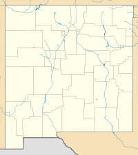
 Continental Divide AFSLocation of Continental Divide AFS, New Mexico
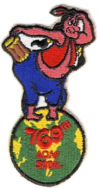 Emblem of the 769th Aircraft Control and Warning Squadron
Continental Divide Air Force Station (ADC ID: P-7) is a closed United States Air Force General Surveillance Radar station. It is located 7.4 miles (11.9 km) west of Thoreau, New Mexico. It was closed in 1961.
Contents
History
In late 1951 Air Defense Command selected this mountainous site near Thoreau, New Mexico as one of twenty-eight radar stations built as part of the second segment of the permanent radar surveillance network. Prompted by the start of the Korean War, on July 11, 1950, the Secretary of the Air Force asked the Secretary of Defense for approval to expedite construction of the second segment of the permanent network. Receiving the Defense Secretary’s approval on July 21, the Air Force directed the Corps of Engineers to proceed with construction.
On 1 January 1951 the 769th Aircraft Control and Warning Squadron was activated at the site, designated as Gonzales Air Force Station. The initial assignment of personnel was four officers and forty-three airmen. The radars consisted of AN/FPS-3 and AN/FPS-5 sets, and initially the station functioned as a Ground-Control Intercept (GCI) and warning station. As a GCI station, the squadron's role was to guide interceptor aircraft toward unidentified intruders picked up on the unit's radar scopes. On 1 December 1953, the site was renamed Continental Divide Air Force Station.
Facilities on the station consisted of a multi-purpose building containing a Barbershop, a Day Room/Library, a Gymnasium with a single basketball backboard which doubled as an auditorium for Commander's Call, training lectures, and movies. An outdoor tennis court and also an Airman's barracks was constructed, along with a 16 place trailer park was also available.
In 1955 an AN/FPS-4 height-finder radar was installed, only to be replaced a year later by an AN/FPS-6 model. At the end of 1960, this radar was transferred to the Federal Aviation Administration pending deactivation of the 769th on 1 July 1961 due to budget reductions.
After the station was closed, the site was turned over to the General Services Administration for disposal. The United States Forest Service used the facilities until 1974 when it was provided to the Bureau of Indian Affairs for their use. In December 1985 the site was closed and the five buildings remaining on the site were torn down, the site restored to a natural state.
Today, what once was Continental Divide AFS has been razed. The streets of the station remain, and a few buildings are in very decrepit condition. It has largely returned to the elements.
Air Force units and assignments
Units:
- 769th Aircraft Control and Warning Squadron, Activated on 1 January 1951 at Gonzales AFS, New Mexico
- Site re-designated Continental Divide Air Force Station, 1 December 1953
- Discontinued on 1 July 1961
Assignments:
- 540th Aircraft Control and Warning Group, 1 January 1951
- 34th Air Division, 1 May 1951
- Albuquerque Air Defense Sector, 1 January 1960
- Oklahoma City Air Defense Sector, 15 September 1960-1 July 1961
See also
- List of USAF Aerospace Defense Command General Surveillance Radar Stations
References
 This article incorporates public domain material from websites or documents of the Air Force Historical Research Agency.
- A Handbook of Aerospace Defense Organization 1946 - 1980, by Lloyd H. Cornett and Mildred W. Johnson, Office of History, Aerospace Defense Center, Peterson Air Force Base, Colorado
- Winkler, David F. (1997), Searching the skies: the legacy of the United States Cold War defense radar program. Prepared for United States Air Force Headquarters Air Combat Command.
- for Continental Divide AFS, NM
External links
Bases CONUSAdair · Beale · Bong (unbuilt) · Charleston · Davis-Monthan · Dobbins · Dover · Dow · Duluth · England · Ent · Ethan Allen · Fairfax · Fort Lee · Geiger · George · Glasgow · Grand Forks · Grenier · Griffiss · Gunter · Hamilton · Hancock · Homestead · Hurlburt · Imeson · K.I. Sawyer · Kincheloe · Kingsley · Kirtland · Larson · Luke · March · Malmstrom · McCoy · McChord · McClellan · McGhee Tyson · McGuire · Minneapolis-St. Paul · Minot · Mitchel · New Castle · Niagara Falls · Norton · O'Hare · Oklahoma City · Otis · Oxnard · Paine · Perrin · Peterson · Pittsburgh · Pope · Portland · Presque Isle · Richards-Gebaur · Selfridge · Seymour Johnson · Sioux City · Snelling · Stead · Stewart · Suffolk County · Tinker · Travis · Truax · Tyndall · Vandenburg · Webb · Westover · Willow Run · Wright-Patterson · Wurtsmith · Youngstown
OverseasErnest Harmon · Frobisher Bay · Goose Bay · Keflavik · Pepperrell · Thule · Topsham

Stations CONUSAlmaden · Charleston · Clear · Cross City · Benton · Empire · Mill Valley · Montauk · Mount Hebo · North Truro · Point Arena · Rye · Thomasville · Watertown
OverseasAlbrook
Air
Defense
unitsForcesAir
DivisionsSectorsAlbuquerque · Bangor · Boston · Chicago · Detroit · Duluth · Goose · Grand Forks · Great Falls · Iceland · Kansas City · Los Angeles · Minot · Montgomery · New York · Oklahoma City · Phoenix · Portland · Reno · Sault Sainte Marie · San Francisco · Seattle · Sioux City · Spokane · Stewart · Syracuse · Washington
WingsGroups1st · 4th · 10th · 14th · 15th · 23rd · 32nd · 33rd · 50th · 52nd · 53rd · 54th · 56th · 57th · 73rd · 78th · 79th · 81st · 82nd · 84th · 325th · 326th · 327th · 328th · 329th · 337th · 355th · 408th · 412th · 414th · 473rd · 475th · 476th · 478th · 500th · 501st · 502d · 503d · 507th · 514th · 515th · 516th · 517th · 518th · 519th · 520th · 521st · 525th · 527th · 528th · 529th · 530th · 533d · 534th · 564th · 566th · 567th · 568th · 575th · 678th · 701st · 4676th · 4700th · 4721st · 4722d · 4727th · 4728th · 4729th · 4730th · 4731st · 4732d · 4733d · 4734th · 4735th · 4756th
SquadronsAerospace Defense Command Fighter Squadrons · Aircraft Control and Warning Squadrons
Major
weapon
systemsElectronicFightersMissiles1 · 2 · 3 · 4 · 5
ShipsGuardian · Interceptor · Interdictor · Interpreter · Investigator · Locator · Lookout · Outpost · Pickett · Protector · Scanner · Searcher · Skywatcher · Tracer · Watchman · Vigil
Miscellaneous Air Defense Command Emblem Gallery (On Wikimedia Commons) · General Surveillance Radar StationsCategories:- Radar stations of the United States Air Force
- Aerospace Defense Command
- Closed facilities of the United States Air Force
- Military facilities in Texas

Wikimedia Foundation. 2010.