- Coldharbour, Tower Hamlets
-
- This entry concerns the area of East London known as Coldharbour. For other places, please see Coldharbour (disambiguation)
Coordinates: 51°30′10″N 0°00′27″W / 51.5028°N 0.0075°W
Coldharbour 
Isle House at the northern end of Coldharbour
 Coldharbour
Coldharbour shown within Greater LondonOS grid reference TQ383908 London borough Tower Hamlets Ceremonial county Greater London Region London Country England Sovereign state United Kingdom Post town LONDON Postcode district E14 Dialling code 020 Police Metropolitan Fire London Ambulance London EU Parliament London UK Parliament Poplar and Limehouse London Assembly City and East List of places: UK • England • London Coldharbour is an area in the Docklands of London which lies on the north bank of the River Thames, east of Canary Wharf and south of Blackwall. The area is said to be "[t]he sole remaining fragment of the old hamlet of Blackwall" and "one of the last examples of the narrow streets which once characterised the river’s perimeter".[1]
Contents
History
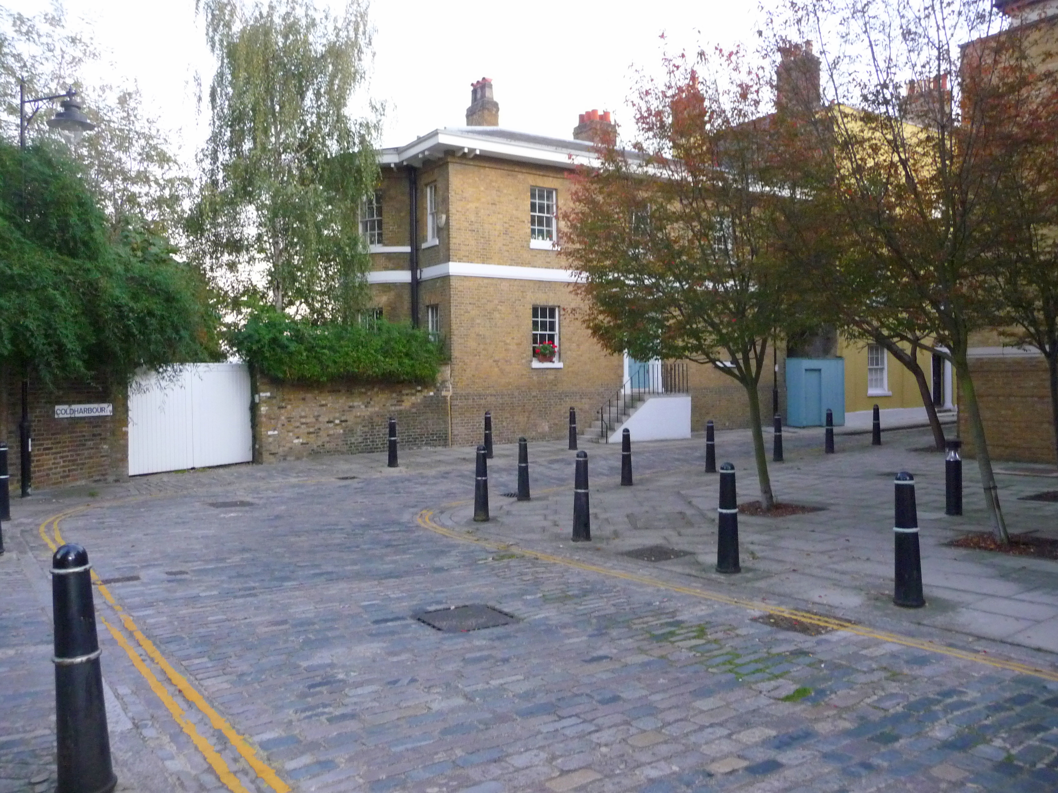
Coldharbour was originally a path on the top of the late Mediaeval embankment of the Thames[2] connecting Blackwall Stairs to "somewhere near the present entrance to the South Dock of the West India Docks".[3] The opening of the West India Docks (in 1802) and the City Canal (in 1805) cut off Coldharbour from the rest of the riverside road, with traffic being diverted to a newly-built Bridge Road (later New Road, now Preston's Road) in 1817.[3]
These changes gave Coldharbour its present layout as "a tiny loop road off Preston's Road"[4], upon which architectural critic Ian Nairn remarked: "You will know a bit about East End topography by the time you find this one."[4]
 North Wharf, Coldharbour
The first buildings on Coldharbour appeared by the second decade of the seventeenth century, probably as part of the activities spreading on the Thames riverfront after the opening of the East India Company's shipbuilding yard at Blackwall in 1614.[3]
Evidence of land reclamation, probably related to the digging of the docks and canals in the early 19th century, was identified by an archeological survey in 1995.[5]
In 1997 as part of the revival of the Docklands, the land of 17-19 Coldharbour was redeveloped by the Bethnal Green and Victoria Park Housing Association with a £370,000 grant from the social housing programme[6] of the London Docklands Development Corporation in 1997.[7]
Origins of the name
The placename Coldharbour came in use from the early seventeenth century[8] and its origins have been debated since the 1850s.[9] Conflicting etymologies are given by authorities, with Ernest Weekley contending that “[t]his name is very frequently, and very unnecessarily, discussed. Its origin is quite well known, and it means what it appears to mean."[10]
Those accepting the plainest derivation[10][11] argue that a cold harbour was a "shelter of bare walls... used by travellers who carried their own bedding and provisions"[11], often along a well-known route and similar to a modern bothy.
In alternative, a "coldharbour" could indicate ancient boundary marks in the form of artificial mounds of earth from Roman times, often filled with crockery or charcoal. The word could be derived either from the Latin collis arborum, meaning "hill with trees", or from the Anglo-Saxon col, meaning "coal" or "charcoal", har, "hoary" or "ancient", and bearth, a mound.[12]
The link with Roman roads has been vigorously contested[13] on the basis that the proximity of Roman roads provides a statistically weak explanation and the fact that the name is not recorded before 1590. It is suggested that most Coldharbour sites could have been named in a mocking manner after a dilapidated London aristocratic house.[13]
Other interpretations include "a place where goods were once... assembled for inland water transport or for portage."[14]
Character
An investigator compiling Booth's poverty maps noted the following about the Isle of Dogs and Coldharbour: "A great many more people work there than live there, though many of those who live there would like to work there. Those who live there seldom leave. From week to week and year to year the men who are islanders remain there."[15]
Heritage
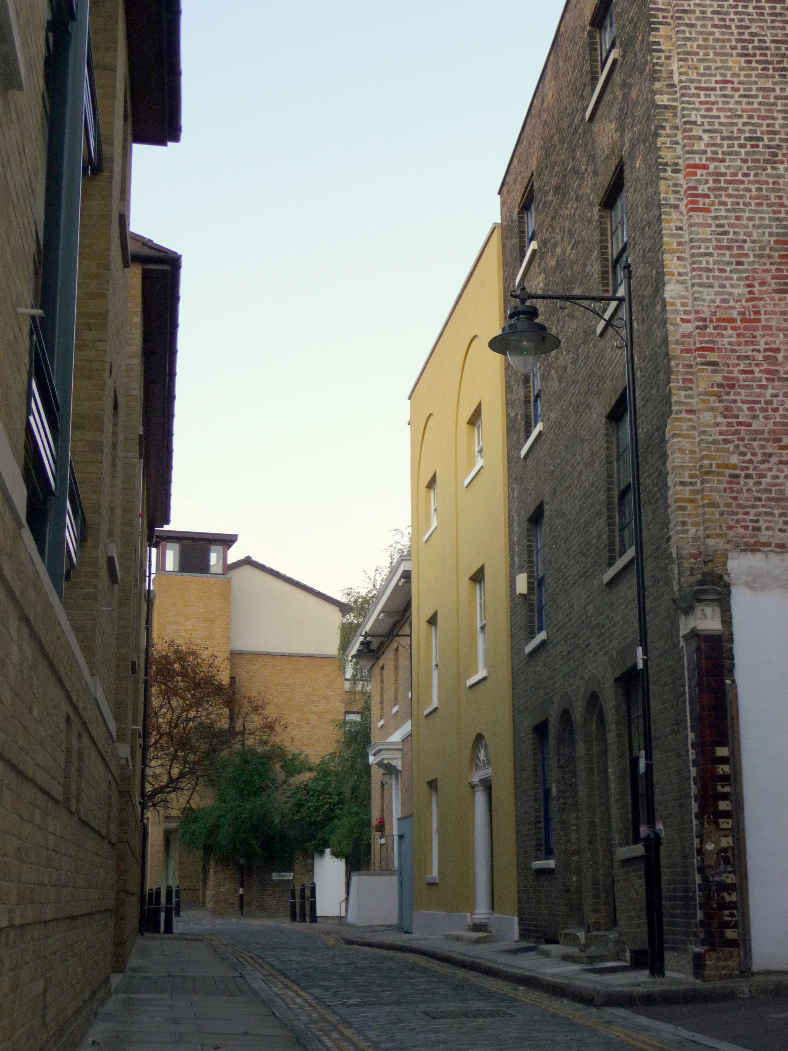
 Coldharbour, looking north
The industrial and maritime activities of Coldharbour's past are no more and today the area is largely residential. The Coldharbour conservation area, designated in 1975 and expanded in 2008,[1] comprehends several historic buildings as well as engineering structures pertaining to the former docks.
Listed buildings
The area is said to be "[t]he sole remaining fragment of the old hamlet of Blackwall" and "one of the last examples of the narrow streets which once characterised the river’s perimeter".[1] The modern surroundings, which include Canary Wharf and the 02 Arena, contribute to "making this surviving pocket all the more valuable and remarkable."[1]
Several buildings in the conservation area, dating mostly to the late 18th and early 19th century, have listed status:[1]
- Blackwall Basin (Grade I)
- 24 Prestons Road (Grade II)
- 1 Cold Harbour (Grade II)
- 3 Cold Harbour (Grade II)
- 5 Cold Harbour (Grade II)
- 7 Cold Harbour (Grade II)
- 15 Cold Harbour (Grade II)
- 19 Cold Harbour (Grade II)
- Gun Tavern Public House, 27 Cold Harbour
Notable engineering structures include the northern entrance to the West India Basin and the entrance to the former City Canal, which cut across the peninsula and gave the "Isle" of Dogs its insular title. Public access to the street, entrance locks and to the perimeter of the Blackwall Basin and Graving Dock is maintained.[1]

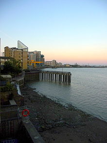
The riverside
An extension of the Thames Path runs along Coldharbour[16], where the river view is obstructed by a series of buildings, some listed, constituting the historical "ribbon of development" already marked on Joel Gascoyne's map of the Parish of St Dunstan's of 1703.[3]
Public access to the riverside is possible at the former entrance to Blackwall Basin, now sealed, and by Lockeryard Pier, where the path rejoins the Thames waterfront at the height of Stewart St.[16] The architectural critic Ian Nairn noted that this "particular bit of the riverside is the sharpest part of the curve around Blackwall Point. Nowhere is the muddy horizontal excitement of the Thames more urgent than here, [...] the curvature making sure that the maximum amount of swift-running water stays in view."[4]
Notable residents
- Horatio Nelson's association with the area is preserved in the name of Horatio Place. Local tradition claims that Nelson stayed at the house at 3 Coldharbour "during a fleet refit"[17], though the connection is open to doubt given that the name "Nelson House" was first associated with the building only in 1881.[3] An upstairs room of the Gun pub was supposedly used to meet Emma, Lady Hamilton.[18]
- Walter Raleigh had a house at Blackwall. His exploration of Guyana in 1595 is commemorated by Raleana Road - Raleana being the name he gave to the territory.[19]
- Thomas Spert, Controller of the Navy to Henry VIII and first Master of Trinity House, lived in a wooden manor house at 152 East India Dock Road at a time when the Coldharbour stretched farther towards Blackwall.[20]
Geography
Coldharbour is situated in the London Borough of Tower Hamlets and is bounded by Landons Close to the north, by Marsh Wall to the south, by Preston Road and Wood Wharf to the west and by the river Thames to the east.
Neighbouring areas of London 
Canary Wharf Blackwall East India Dock Wood Wharf 
Greenwich Peninsula  Coldharbour

Millwall Cubitt Town East Greenwich Transport
The nearest Docklands Light Railway stations are Blackwall and South Quay. Canary Wharf tube station and the future Canary Wharf Crossrail station are also close-by.
- Nearest places
Notes
- ^ a b c d e f London Borough of Tower Hamlets. 2009. Coldharbour Conservation Area.
- ^ Ford, Steve. 1995. North Wharf, Coldharbour, Blackwall, Tower Hamlets: Archeological Evaluation, Thames Valley Archeological Services Report 95/42. P. 1] Accessed: 22 October 2011
- ^ a b c d e Porter, Stephen. 1994. Southern Blackwall: Coldharbour. Survey of London: Volumes 43 and 44: Poplar, Blackwall and Isle of Dogs. London: The Athlone Press for the Royal Commission on the Historical Monuments of England. Pp. 607-624. Accessed: 23 October 2011.
- ^ a b c Nairm, Ian. 1966. The Gun, Coldharbour. In Nairn's London. Harmondsworth: Penguin Books. Pp. 163-164.
- ^ No author. 1995. Fieldwork Round-Up, London Archeologist 08, Supplement 1. p. 23. Accessed: 22 October 2011
- ^ LDDC. 1996. [www.lddc-history.org.uk/other/96housingbrochure.pdf Housing in London Docklands.] London: London Docklands Development Corporation. P. 4. Accessed: 25 October 2011.
- ^ 1999. Housing: Appendix - Tables: TABLE 3 LDDC New Build Social Housing Programme. LDDC History Pages. Accessed: 25 October 2011.
- ^ Gover, John Eric Bruce; Mawer, Allen; Stenton, Frank Merry. 1942. The Place-Names of Middlesex apart from the City of London. Cambridge: Cambridge University Press. P. 136.
- ^ C. M. J. 1850. Cold Harbour. Notes and Queries s1-II 51.
- ^ a b Weekley, Ernest. 1927. More Words Ancient and Modern. London: John Murrey. P. 162n.
- ^ a b Taylor, Isaac. 1865. Words and places; or, Etymological illustrations of history, ethnology, and geography. London and Cambridge: Macmillan and Co. Pp. 255-256.
- ^ Sharpe, Montagu. 1922. Coldharbour (Letters to the Editor). The Times, May 23.
- ^ a b Coates, Richard. 1984. Coldharbour - for the Last Time? Nomina 8: 73-78.
- ^ Rendel, Vincent. 1967. The meaning of "Coldharbour". Kent Archeological Review 7
- ^ Booth, Charles. 1897. Walk with Mr Carter, District Inspector of Police, District 11 (Poplar and Limehouse), 28 May 1897. LSE Archives, Booth B346. Pp. 18-19.
- ^ a b WalkLondon. 2011. Thames Path Walk: Section 4 north bank (Island Gardens to East India).
- ^ St George, Genevieve. 2009. Trafalgar Day Walk in London October 21st 2009. Nelson Society, Sep 04.
- ^ 2011. History. The Gun Pub.
- ^ Royall, Arthur. 1999. The Streets of Poplar. Prebendary Arthur Royall's Articles. Accessed: 25 October 2011.
- ^ Sir Thomas Spert (died 1541). PortCities London. Accessed: 25 October 2011.
External links
- Coldharbour in paintings (copyrighted)
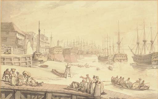
- Thomas Rowlandson. 1810. Entrance to Blackwall Docks. (Looking northwards towards the entrance to the City Canal and Coldharbour; showing dockers at rest.) Tinted drawing. ©British Museum
- Thomas Rowlandson. 1824. The West India Docks, Blackwall, with warships lying on the stocks. (Looking northwards towards the entrance to the City Canal and Coldharbour; showing dockers at work.) Tinted drawing. ©Christie’s, London.
- Charles Napier Hemy. 1872. Blackwall. (Facing south-west towards Coldharbour and Cubitt Town) Oil on canvas. ©Museum of London.
- Charles Napier Hemy. 1896. Cold Harbour, Blackwall. ©Christie’s, London. Sale 5386, Lot 121.
- PLA Staff Photographer. 1929. South East India Dock. ©Museum of London.
Categories:- Districts of Tower Hamlets
- Districts of London
- Port of London


Wikimedia Foundation. 2010.