- Coldharbour, Surrey
-
Coordinates: 51°10′53″N 0°21′27″W / 51.181350°N 0.35749957°W
Coldharbour
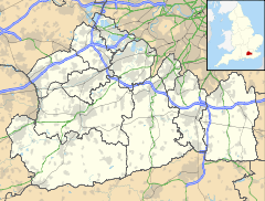
 Coldharbour shown within Surrey
OS grid reference TQ1490043739 District Mole Valley Shire county Surrey Region South East Country England Sovereign state United Kingdom Post town DORKING Postcode district RH5 6 Police Surrey Fire Surrey Ambulance South East Coast EU Parliament South East England List of places: UK • England • Surrey Coldharbour is a village in Surrey UK. It is situated on Leith Hill in the Surrey Hills Area of Outstanding Natural Beauty.
Europa Oil & Gas has submitted a planning application to Surrey County Council to explore for oil and gas in Coldharbour.
External links
 Media related to Coldharbour, Surrey at Wikimedia Commons
Towns, villages and hamlets in the Mole Valley District of Surrey, England  Abinger · Abinger Common · Abinger Hammer · Ashtead · Beare Green · Betchworth · Brockham · Buckland · Capel · Charlwood · Coldharbour · Dorking · Fetcham · Friday Street · Great Bookham · Headley · Holmbury · Holmwood · Leatherhead · Leigh · Little Bookham · Mickleham · Newdigate · Ockley · Westcott · Westhumble ·Categories:
- Villages in Surrey
- Surrey geography stubs
Wikimedia Foundation. 2010.

