- Ockley
-
Coordinates: 51°08′52″N 0°21′46″W / 51.1477°N 0.3627°W
Ockley 
Ockley Green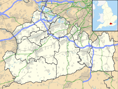
 Ockley
Ockley shown within SurreyPopulation 852 [1] OS grid reference TQ146399 District Mole Valley Shire county Surrey Region South East Country England Sovereign state United Kingdom Post town Dorking Postcode district RH5 Dialling code 01306 Police Surrey Fire Surrey Ambulance South East Coast EU Parliament South East England UK Parliament Mole Valley List of places: UK • England • Surrey For other uses, see Ockley (disambiguation).Ockley is a historic village in Surrey, built on Stane Street, a Roman Road stretching from Chichester to London. Situated between Dorking and Horsham, close to the Sussex/Surrey border, Ockley nestles in the shadows of Leith Hill, the highest point in South east England. Neighbouring villages include Capel, Ewhurst Green and Rusper. It is a linear settlement running along the A29 and lying about 3 km west of the A24. Ockley is also a civil parish covering 1,374 hectares (5.3 sq mi).[2]
There are four pubs in Ockley: Cricketer's Arms, Inn on the Green, King's Arms and Bryce's Restaurant (also known as the Old School House). In addition to the pubs, Ockley has a Post Office & village shop and garage, and a local veg shop out towards the station. There is also a golf course called 'Gatton Manor' on the outskirts of the village.
The village is served by Ockley railway station which lies over two miles to the East of the settlement. Yet the trains are few and far between with absolutely no trains on a Sunday. With no bus stop, the public transport in Ockley is poor.
Nicholas Culpeper, the famous Herbalist, was born here on 18th October 1616.
Ockley could be the location of a battle described in the entry for the year 851 of the Anglo-Saxon Chronicle. According to the chronicler, king Æthelwulf and his son Æthelbald, together with the West-Saxon army, fought against an invading Danish army of 350 ships that had plundered London and Canterbury previously, and had also put king Beorhtwulf of Mercia to flight. The chronicler refers to the battle field as Aclea, Oak Field, and the Danish army was defeated suffering “the greatest slaughter… we have heard tell of up to this present day”.
Ockley appears in Domesday Book of 1086 as Hoclei. It was held by Radulf (Ralph) from Richard Fitz Gilbert. Its domesday assets were: 1 hide. It had 5 ploughs, woodland worth 20 hogs. It rendered £3 10s 0d.[3]
References
External links
Towns, villages and hamlets in the Mole Valley District of Surrey, England 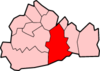 Abinger · Abinger Common · Abinger Hammer · Ashtead · Beare Green · Betchworth · Brockham · Buckland · Capel · Charlwood · Coldharbour · Dorking · Fetcham · Friday Street · Great Bookham · Headley · Holmbury · Holmwood · Leatherhead · Leigh · Little Bookham · Mickleham · Newdigate · Ockley · Westcott · Westhumble ·Categories:
- Villages in Surrey
- Mole Valley
- Civil parishes in Surrey
- Surrey geography stubs


Wikimedia Foundation. 2010.