- Mickleham, Surrey
-
Coordinates: 51°16′05″N 0°19′16″W / 51.268°N 0.321°W
Mickleham 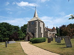
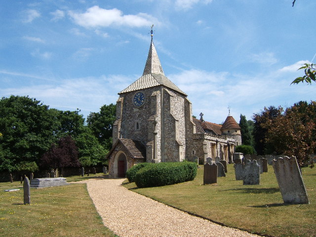
St. Michaels church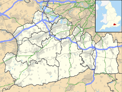
 Mickleham
Mickleham shown within SurreyPopulation 570 [1] OS grid reference TQ171534 District Mole Valley Shire county Surrey Region South East Country England Sovereign state United Kingdom Post town Dorking Postcode district RH5 Dialling code 01372 Police Surrey Fire Surrey Ambulance South East Coast EU Parliament South East England UK Parliament Mole Valley List of places: UK • England • Surrey Mickleham is a village and civil parish[2] between the towns of Dorking and Leatherhead in Surrey, England covering 731 hectares (1,810 acres). The parish includes the hamlet of Fredley.
Contents
History
Mickleham lies near to the old Roman road known as Stane Street. It lay within the Copthorne hundred, an administrative division devised by the Saxons.
Mickleham appears in Domesday Book of 1086 as Michelham and Micleham. It was partly held by Nigel from the Bishop of Bayeux and partly by Oswald from Richard de Tonbrige. Its domesday assets were: 7 hides; 1 church, 7 ploughs, 3 acres (12,000 m2) of meadow, woodland worth 4 hogs. It rendered £10.[3]
Village
 Box Hill School Old mansion in Mickleham village, now a boarding school. It follows Kurt Hahn principles.
The village has a very old church, two pubs (The Running Horses and The King William IV) and a village shop. Box Hill School is located in the village, close to the village shop.
The A24 bypasses Mickleham with what is said to be the first dual-carriageway bypass to be built in the United Kingdom. Across the A24, and towards Dorking, Westhumble is also part of the parish. There is a chapel there, originally a barn converted into a place of worship for the benefit of those building the railway over 100 years ago. Ninety navvies died in an accident when a tunnel they were working on collapsed; it has been posited that God was displeased with the barn conversion. Box Hill & Westhumble station provides a link to London and Horsham.
Due south of the village, at grid reference TQ169526, is the manor and hamlet of Fredley. There is also the Field Studies Council's Juniper Hall centre. Further to the south of the village is the Burford Bridge Hotel that was frequented by Lord Nelson. Across the A24 in Norbury Parks is 'Druids Grove' which is an area of mature Yew trees indicating an ancient place of worship for Druids.[citation needed]
The village gave its name to HMS Mickleham, a Ham class minesweeper.
Area
The surrounding area contains many Sites of Special Scientific Interest (SSSI) including the popular beauty spot of Box Hill.
The River Mole flows nearby and indeed as its name suggests the river in places goes underground due to the chalk bed being dissolved in places forming Swallow holes or Sinkholes. Ian Middleton tells of his father, sometime in the 1950s, the village police officer P.C. Middleton, looking past his bathroom mirror one morning whilst shaving to see a mature oak tree disappear into the ground. It turned out that the river flowing underground had been gradually wearing away the supporting ground under the tree forming a giant Swallow Hole which had collapsed. The subsequent pit was not filled in until 1968 approx when it was still 30 ft deep and 30 ft across. P.C. Middleton also reportedly removed parts from an unexploded V2 which fell in the village during WW2. The adjacent River Mole is well known for its Swallow Holes.
Famous people
- Richard Bedford Bennett, Prime Minister of Canada from 1930 to 1935, retired here after his life in politics. He is buried in St Michael's Churchyard, the only former Prime Minister of Canada not buried in that country.
- Lt-Col Sir John Norton-Griffiths, "Empire Jack", was buried at Mickleham Church on 18 October 1930.
- Mystery writer Cyril Hare was born here in 1900.
- Mrs. Maria Drummond lived at Fredley and was buried here
- Conversation Sharp, politician lived at Fredley.
- William Wingfield (MP), was born here.
References
External links
Towns, villages and hamlets in the Mole Valley District of Surrey, England 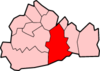 Abinger · Abinger Common · Abinger Hammer · Ashtead · Beare Green · Betchworth · Brockham · Buckland · Capel · Charlwood · Coldharbour · Dorking · Fetcham · Friday Street · Great Bookham · Headley · Holmbury · Holmwood · Leatherhead · Leigh · Little Bookham · Mickleham · Newdigate · Ockley · Westcott · Westhumble ·Categories:
- Villages in Surrey
- Mole Valley
- Civil parishes in Surrey


Wikimedia Foundation. 2010.