- St Bartholomew's Church, Sealand
-
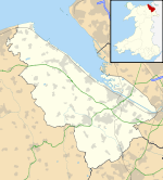
St Bartholomew's Church, Sealand 53°12′46″N 2°58′15″W / 53.2128°N 2.9709°WCoordinates: 53°12′46″N 2°58′15″W / 53.2128°N 2.9709°W Location Sealand, Flintshire Country Wales Denomination Anglican History Dedication St Bartholomew Consecrated 15 October 1867 Architecture Heritage designation Grade II Designated 29 March 1993 Architect(s) John Douglas Architectural type Church Style Gothic Revival Groundbreaking 1865 Completed 1867 Specifications Nave width 26 feet (8 m) Other dimensions Nave length 62 feet (19 m), Chancel width 17 feet (5 m), length 24 feet (7 m) Spire height 65 feet (20 m) Materials Sandstone Administration Deanery Hawarden Archdeaconry Wrexham Diocese St Asaph Province Wales St Bartholomew's Church, Sealand is in Sealand, Flintshire, Wales (grid reference SJ352688). It is a constituent church in the Anglican Rectorial Benefice of Hawarden, the archdeaconry of Wrexham and the diocese of St Asaph.[1] The church is a Grade II listed building.[2]
Contents
History
The church was built between 1865 and 1867 to a design by John Douglas.[3] It was one of Douglas' earliest churches and is in the High Victorian style of Gothic Revival architecture. The site for the church was given by the River Dee Company who also partly paid for it.[4] It was consecrated on 15 October 1867.[5]
Architecture and contents
The church is built in sandstone from Helsby, Cheshire. Its plan consists of a nave and a chancel, with a small north transept to contain the organ and a tower on the south side of the chancel containing a vestry.[5] The church is without aisles and is "not large, but expensively done" with an ashlar interior.[4] The tower has a pyramid spire and a turret against its lower part. The stained glass in the east window of 1867 is by Hardman & Co. and was donated by Douglas. The stained glass in the west window dates from 1880 and is by Kempe.[4]
See also
- List of new churches by John Douglas
References
- ^ The Deanery of Hawarden, Diocese of St Asaph, http://www.churchinwales.org.uk/asaph/local/deaneries/hawarden.html, retrieved 20 May 2009
- ^ Listed Buildings in Wales: Flintshire, Cadw
- ^ Hubbard, Edward (1991), The Work of John Douglas, London: The Victorian Society, p. 239, ISBN 0 901657 16 6
- ^ a b c Hubbard, Edward (1986), The Buildings of Wales: Clwyd, London: Penguin, p. 420, ISBN 0 14 071052 3
- ^ a b Sealand, GENUKI, http://www.genuki.org.uk/big/wal/FLN/Hawarden/Sealand/index.html, retrieved 20 May 2009
Further reading
- Hubbard, Edward (1991), The Work of John Douglas, London: The Victorian Society, pp. 48, 50, ISBN 0 901657 16 6
Categories:- 1867 architecture
- 19th-century church buildings
- Anglican congregations established in the 19th century
- Gothic Revival architecture in Wales
- Anglican churches in Wales
- John Douglas buildings
- Churches in Flintshire
- Grade II listed churches
- Grade II listed buildings in Flintshire
Wikimedia Foundation. 2010.

