Leeswood

Leeswood

Coordinates: 53°07′59″N 3°05′42″W / 53.133°N 3.095°W / 53.133; -3.095

Leeswood
Welsh: Coed-llai
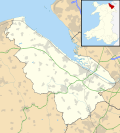
Leeswood is located in Flintshire
Leeswood

 Leeswood shown within Flintshire
Population 2,143 (2001 Census)[1]
OS grid reference SJ267601
Principal area Flintshire
Ceremonial county Clwyd
Country Wales
Sovereign state United Kingdom
Post town MOLD
Postcode district CH7
Dialling code 01352
Police North Wales
Fire North Wales
Ambulance Welsh
EU Parliament Wales
UK Parliament Delyn
Welsh Assembly Delyn
List of places: UK • Wales • Flintshire

Leeswood (Welsh: Coed-llai) is a small village and community in Flintshire, North Wales, about four miles from the historic market town of Mold. At the 2001 Census, the population was 2,143.[1]

It was the centre of attention during the Mold Riot of 1869, where the owners of the mine refused to allow the speaking of the Welsh language in the mines.

Around a quarter of Leeswood’s resident population has some knowledge of the Welsh language, exceeding the county’s average of 21.4%. In all categories of linguistic competency, the ward performs around the Flintshire average, although the proportion of those able only to understand spoken Welsh is higher than the county and national average.

References

External links


Wikimedia Foundation. 2010.

Игры ⚽ Поможем сделать НИР

Look at other dictionaries:

  • Leeswood — Original name in latin Leeswood Name in other language State code GB Continent/City Europe/London longitude 53.13347 latitude 3.09466 altitude 163 Population 2243 Date 2011 03 03 …   Cities with a population over 1000 database

  • Davies brothers of Wrexham — The Davies brothers of Wrexham, north Wales, were a family of smiths active in the 18th century. They were particularly known for their high quality work in wrought iron, of which several examples still survive in country homes and churchyards… …   Wikipedia

  • Mold, Flintshire — Coordinates: 53°09′58″N 3°07′59″W / 53.166°N 3.133°W / 53.166; 3.133 …   Wikipedia

  • Coed Talon — Former Calvinistic Methodist chapel in Coed Talon Coed Talon (also spelt Coed talon ) is a small, formerly industrial village between Leeswood and Treuddyn in Flintshire, North Wales. Its name is derived from the Welsh word coed ( wood ) and the… …   Wikipedia

  • Flintshire (historic) — Flintshire Welsh: Sir y Fflint Ancient extent of Flintshire Geography Status Ceremonial county (until 1974) Administr …   Wikipedia

  • Moel Famau — The Jubilee Tower at the summit of Moel Famau. Elevation …   Wikipedia

  • Mostyn — For other uses, see Mostyn (disambiguation). Coordinates: 53°18′50″N 3°16′08″W / 53.314°N 3.269°W / 53.314; 3.269 …   Wikipedia

  • List of communities in Wales — This is a list of communities in Wales sorted by principal area. The community is the lowest tier of local government in Wales and is usually represented by a community council. Contents 1 Blaenau Gwent 2 Bridgend 3 Caerphilly …   Wikipedia

  • Northop Hall — Coordinates: 53°12′04″N 3°05′10″W / 53.201°N 3.086°W / 53.201; 3.086 …   Wikipedia

  • Delyn (district) — Coordinates: 53°16′01″N 3°10′34″W / 53.267°N 3.176°W / 53.267; 3.176 …   Wikipedia

Share the article and excerpts

Direct link
Do a right-click on the link above
and select “Copy Link”