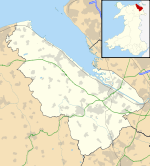
Maelor Rural District

Maelor Rural District

Coordinates: 53°03′50″N 2°52′19″W / 53.064°N 2.872°W / 53.064; -2.872

Overton / Maelor
Geography
Status rural district
1911 area 29,750 acres (120.4 km2)
1961 area 29,749 acres (120.39 km2)
HQ Overton
History
Origin rural sanitary district
Created 1894
Abolished 1974
Succeeded by Wrexham Maelor
Demography
1901 population 5,057
1971 population 4,698
Politics
Governance Overton Rural District Council (1894–1953)
Maelor Rural District Council (1953–1974)
Subdivisions
Type Civil parishes

Maelor was a rural district in the administrative county of Flintshire, Wales, from 1894 to 1974. The area approximated to the hundred of Maelor or Maelor Saesneg, and was notable for forming a detached part of the county, surrounded by Cheshire, Denbighshire and Shropshire.

The district was formed as Overton Rural District by the Local Government Act 1894 from the Flintshire parishes of Ellesmere, Whitchurch and Wrexham Rural Sanitary Districts. It was renamed as Maelor Rural District in 1953. It consisted of eleven civil parishes:

The district was abolished in 1974 by the Local Government Act 1972, when it was merged into Wrexham Maelor, one of six districts of the new County of Clwyd.

External links


Wikimedia Foundation. 2010.

Игры ⚽ Поможем написать курсовую

Look at other dictionaries:

  • Wrexham Rural District — Wrexham was a rural district in the administrative county of Denbighshire from 1894 and 1974.The rural district took over the of the existing Wrexham Rural Sanitary District. It consisted of the following civil parishes:*Abenbury *Acton dagger;… …   Wikipedia

  • Maelor — Coordinates: 53°03′50″N 2°52′19″W / 53.064°N 2.872°W / 53.064; 2.872 Maelor is a border area of north east Wales …   Wikipedia

  • Maelor South — Road through Bettisfield, Maelor South, from bridge over the Llangollen Canal. Maelor South is a local government community, the lowest tier of local government, part of Wrexham County Borough in Wales. It contains the villages of Penley and… …   Wikipedia

  • Wrexham Maelor — infobox historic subdivision Name= Wrexham Maelor HQ= Wrexham Status= Borough Start= 1974 End= 1996 Replace= Wrexham county borough Arms= Wrexham Maelor ( cy. Wrecsam Maelor) was one of six local government districts of the county of Clwyd, north …   Wikipedia

  • Delyn (district) — Coordinates: 53°16′01″N 3°10′34″W / 53.267°N 3.176°W / 53.267; 3.176 …   Wikipedia

  • Monmouth (district) — Monmouth Welsh: Trefynwy Geography Status Borough …   Wikipedia

  • Newport (district) — Coordinates: 51°35′17″N 2°59′53″W / 51.588°N 2.998°W / 51.588; 2.998 …   Wikipedia

  • Neath (district) — Coordinates: 51°39′40″N 3°48′14″W / 51.661°N 3.804°W / 51.661; 3.804 …   Wikipedia

  • Montgomeryshire (district) — Coordinates: 52°38′24″N 3°28′08″W / 52.640°N 3.469°W / 52.640; 3.469 …   Wikipedia

  • List of communities in Wales — This is a list of communities in Wales sorted by principal area. The community is the lowest tier of local government in Wales and is usually represented by a community council. Contents 1 Blaenau Gwent 2 Bridgend 3 Caerphilly …   Wikipedia

Share the article and excerpts

Direct link
Do a right-click on the link above
and select “Copy Link”