- Ogof Nadolig
-
Ogof Nadolig 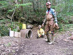
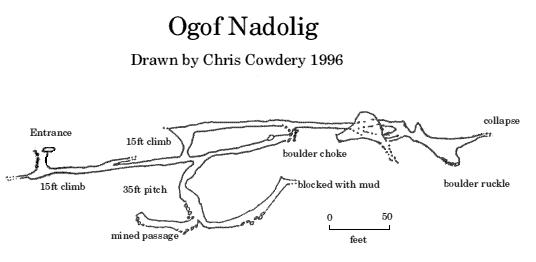
Lower entrance structureLocation Alyn Gorge Length 300 metres (980 ft) Cave survey elevation Discovery North Wales Caving Club 1978 Geology Limestone Hazards None Access Free Translation Christmas Cave (Welsh) Ogof Nadolig is a cave in the Alyn Gorge near Cilcain, Flintshire, North Wales. It is mostly crawling, 300 metres (980 ft) long, and ends with a shaft up to the surface and a locked manhole cover.
Nearby, but closer to the river, are the caves Ogof Hesp Alyn and Ogof Hen Ffynhonnau.
This cave is located at: 53°10.841′N 3°12.638′W / 53.180683°N 3.210633°W. The bridge where you park the car to visit this cave is at 53°10.660′N 3°13.012′W / 53.17767°N 3.216867°W.
External links
Categories:- Caves of Wales


Wikimedia Foundation. 2010.