- Cerro Colorado (volcano)
-
Cerro Colorado 

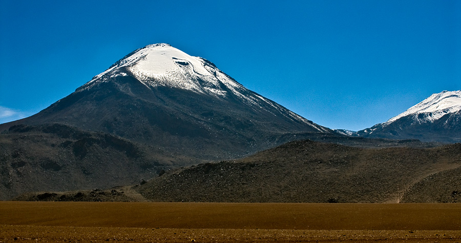
The Cerro Colorado volcano, seen from the west. The right, part of volcán Escalante (El Apagado)Elevation 5,748 m (18,858 ft) Location Location Chile Range Andes Coordinates 22°35.54′S 67°55.33′W / 22.59233°S 67.92217°WCoordinates: 22°35.54′S 67°55.33′W / 22.59233°S 67.92217°W Geology Type Stratovolcano Cerro Colorado is a stratovolcano that lies in northern Chile about 7 km (4 mi) west of the border with Bolivia and approximately the same distance soutwest of the Putana Volcano. Cerro Colorado is located immediately west of Cerro Curiquinca and northwest of volcán Escalante (El Apagado); all three mountains are considered to be part of the Sairecabur volcanic group.
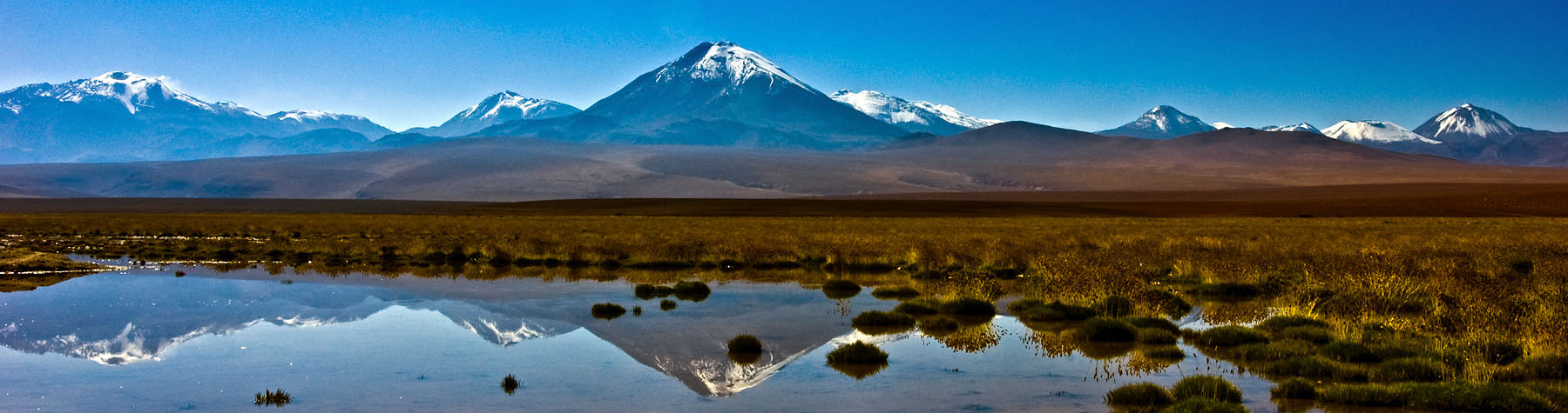
 Seen from the Vado de Putana "bofedal", FLTR: Volcán Putana, Volcán Curiquinca, Cerro Colorado, Volcán Escalante (El Apagado), Cerro Ojos del Toro, Cerro Saciel and Volcán Sairécabur. Camera location: 22°35'30.31"S 68° 0'19.89"W. heading: 115º
See also
References
- "Sairecabur". Global Volcanism Program, Smithsonian Institution. http://www.volcano.si.edu/world/volcano.cfm?vnum=1505-091.
- González-Ferrán, Oscar (1995). Volcanes de Chile. Santiago, Chile: Instituto Geográfico Militar. p. 640 pp. ISBN 956-202-054-1.(Spanish)
External links
- SI Google Earth Placemarks - Smithsonian Institution Global Volcanism Program: Download placemarks with SI Holocene volcano-data.
Andean volcanoes Northern Volcanic Zone (6° N–3° S) Nevado del Ruiz · Nevado del Huila · Galeras · Cayambe · Reventador · Pichincha · Antisana · Illiniza · Cotopaxi · Quilotoa · Tungurahua · SangayCentral Volcanic Zone (15°–27° S) Ampato · Coropuna · Sabancaya · Chachani · El Misti · Ubinas · Huaynaputina · Parinacota · Irruputuncu · Azufre · Sairecabur · Pacana · Licancabur · Lascar · Llullaillaco · Galán · San Francisco · Ojos del SaladoSouthern Volcanic Zone (33°–46° S) Tupungato · Tupungatito · Maipo · Calabozos · Descabezado Grande · Cerro Azul · Nevado de Longaví · Nevados de Chillán · Antuco · Copahue · Callaqui · Lonquimay · Llaima · Sollipulli · Villarrica · Quetrupillán · Lanín · Mocho-Choshuenco · Carrán-Los Venados · Puyehue-Cordón Caulle · Osorno · Calbuco · Hornopirén · Michinmahuida · Chaitén · Corcovado · Cay · Macá · HudsonAustral Volcanic Zone (49°–55° S) Note: volcanoes are ordered by latitude from north to southCategories:- Volcanoes of Antofagasta Region
- Stratovolcanoes
- Antofagasta Region geography stubs
Wikimedia Foundation. 2010.