- Curiquinca
-
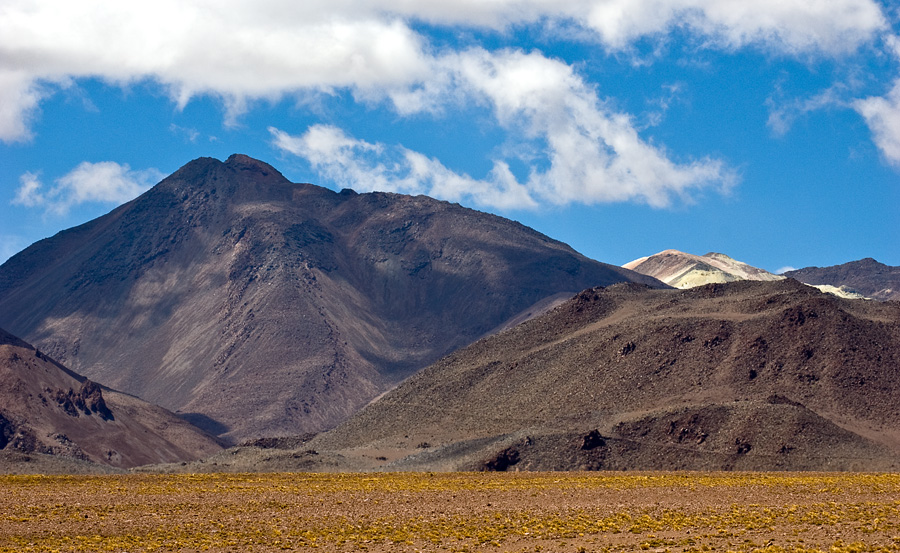
Cerro Curiquinca 
Cerro (Volcán) Curiquinca seen from the NNW.Elevation 5,722 m (18,773 ft) Location Location Chile Range Andes Coordinates 22°35.834′S 67°51.680′W / 22.597233°S 67.86133°WCoordinates: 22°35.834′S 67°51.680′W / 22.597233°S 67.86133°W Geology Type Stratovolcano Cerro Curiquinca is a stratovolcano that straddles the border between Bolivia and Chile. It lies immediately E of Cerro Colorado and NE to volcán Escalante (El Apagado), all of which are considered to be part of the Sairecabur volcanic group. The light area behind the mountain is part of a large sulfur deposit, location of the - now abandoned - sulfur mines "Azufrera El Apagado" on the Chilean side and its counterpart "Azufrera Rosita" on the Bolivian side of the border.
See also
References
- "Sairecabur". Global Volcanism Program, Smithsonian Institution. http://www.volcano.si.edu/world/volcano.cfm?vnum=1505-091.
- González-Ferrán, Oscar (1995). Volcanes de Chile. Santiago, Chile: Instituto Geográfico Militar. p. 640 pp. ISBN 956-202-054-1.(Spanish)
External links
- SI Google Earth Placemarks - Smithsonian Institution Global Volcanism Program: Download placemarks with SI Holocene volcano-data.
Andean volcanoes Northern Volcanic Zone (6° N–3° S) Nevado del Ruiz · Nevado del Huila · Galeras · Cayambe · Reventador · Pichincha · Antisana · Illiniza · Cotopaxi · Quilotoa · Tungurahua · SangayCentral Volcanic Zone (15°–27° S) Ampato · Coropuna · Sabancaya · Chachani · El Misti · Ubinas · Huaynaputina · Parinacota · Irruputuncu · Azufre · Sairecabur · Pacana · Licancabur · Lascar · Llullaillaco · Galán · San Francisco · Ojos del SaladoSouthern Volcanic Zone (33°–46° S) Tupungato · Tupungatito · Maipo · Calabozos · Descabezado Grande · Cerro Azul · Nevado de Longaví · Nevados de Chillán · Antuco · Copahue · Callaqui · Lonquimay · Llaima · Sollipulli · Villarrica · Quetrupillán · Lanín · Mocho-Choshuenco · Carrán-Los Venados · Puyehue-Cordón Caulle · Osorno · Calbuco · Hornopirén · Michinmahuida · Chaitén · Corcovado · Cay · Macá · HudsonAustral Volcanic Zone (49°–55° S) Note: volcanoes are ordered by latitude from north to southCategories:- Volcanoes of Antofagasta Region
- Stratovolcanoes of Chile
- Antofagasta Region geography stubs
Wikimedia Foundation. 2010.