- Lascar (volcano)
-
Lascar 
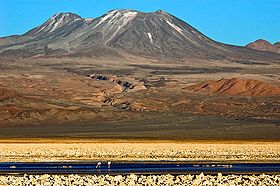
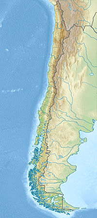
The Lascar volcano, seen from the Chaxas lagoon on the Gran Salar. To the left, in the background, the Aguas Calientes volcano.Elevation 5,592 m (18,346 ft) [1] Location Northern  Chile
ChileRange Andes Coordinates 23°22′S 67°44′W / 23.367°S 67.733°WCoordinates: 23°22′S 67°44′W / 23.367°S 67.733°W[1] Geology Type Stratovolcano Last eruption 2007 Lascar, a stratovolcano, is the most active volcano of the northern Chilean Andes.
Contents
Geographical setting
Lascar is located in the altiplano of the Antofagasta Region of northern Chile, east of the Salar de Atacama, immediately west of the Aguas Calientes volcano, and to the northeast of Laguna Lejía. Other volcanoes in the area include Acamarachi, which is dormant or possibly extinct, and Chiliques, which has developed a new hot spot in its summit crater beginning in 2002 after a period of at least 10,000 years in dormancy.[2]
Geology
The andesitic-to-dacitic stratovolcano contains six overlapping summit craters. Prominent lava flows descend its northwest flanks.
Eruptive history
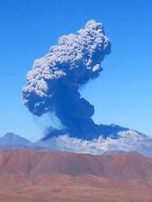
The largest eruption of Lascar took place about 26.500 years ago, and following the eruption of the Tumbres scoria flow about 9.000 years ago, activity shifted back to the eastern edifice, where three overlapping craters were formed. Frequent small-to-moderate explosive eruptions have been recorded from Lascar in historical time since the mid-19th century, along with periodic larger eruptions that produced ash and tephra fall up to hundreds of kilometres away from the volcano.[1]
Modern activity and the current threat
The largest eruption of Lascar in recent history took place in 1993, producing pyroclastic flows as far as 8.5 km (5 mi) northwest of the summit and ash fall in Buenos Aires, Argentina,[1] more than 1,600 km (994 mi) to the southeast. The latest series of eruptions began on 18 April 2006 and were continuing as of 2011.
See also
Notes
- ^ a b c d "Láscar". Global Volcanism Program, Smithsonian Institution. http://www.volcano.si.edu/world/volcano.cfm?vnum=1505-10=. Retrieved 2006-04-28.
- ^ "Chiliques Volcano, Chile". Visible Earth. NASA. http://visibleearth.nasa.gov/view_rec.php?id=2632. Retrieved 2011-01-02.
Further reading
- González-Ferrán, Oscar (1995) (in Spanish). Volcanes de Chile. Santiago, Chile: Instituto Geográfico Militar. ISBN 9562020541.
External links
- Last Frontier Ex- Volcán Lascar
- Atacama Photo Gallery - panoramic view into the crater of Lascar
- SI Google Earth Placemarks - Smithsonian Institution Global Volcanism Program: download placemarks with SI Holocene volcano-data.
Andean volcanoes Northern Volcanic Zone (6° N–3° S) Nevado del Ruiz · Nevado del Huila · Galeras · Cayambe · Reventador · Pichincha · Antisana · Illiniza · Cotopaxi · Quilotoa · Tungurahua · SangayCentral Volcanic Zone (15°–27° S) Ampato · Coropuna · Sabancaya · Chachani · El Misti · Ubinas · Huaynaputina · Parinacota · Irruputuncu · Azufre · Sairecabur · Pacana · Licancabur · Lascar · Llullaillaco · Galán · San Francisco · Ojos del SaladoSouthern Volcanic Zone (33°–46° S) Tupungato · Tupungatito · Maipo · Calabozos · Descabezado Grande · Cerro Azul · Nevado de Longaví · Nevados de Chillán · Antuco · Copahue · Callaqui · Lonquimay · Llaima · Sollipulli · Villarrica · Quetrupillán · Lanín · Mocho-Choshuenco · Carrán-Los Venados · Puyehue-Cordón Caulle · Osorno · Calbuco · Hornopirén · Michinmahuida · Chaitén · Corcovado · Cay · Macá · HudsonAustral Volcanic Zone (49°–55° S) Note: volcanoes are ordered by latitude from north to southCategories:- Volcanoes of Antofagasta Region
- Mountains of Chile
- Stratovolcanoes of Chile
- Active volcanoes
- VEI-4 volcanoes
Wikimedia Foundation. 2010.


