Cerro Colorado Mountains

Cerro Colorado Mountains
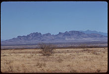
Cerro Colorado Mountains from across Altar valley, 1959

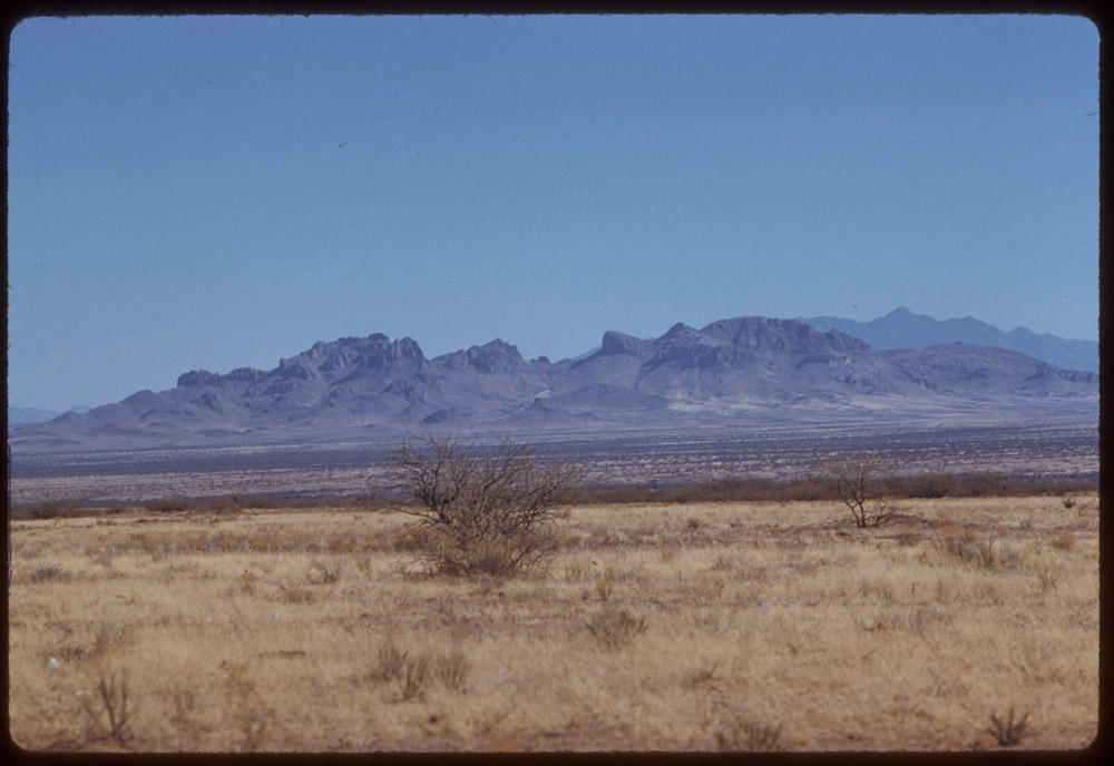
The Cerro Colorado Mountains are a low mountain range in Pima County, Arizona, USA. The highest point of the range is at the Colorado Benchmark (5,319 feet (1,621 m)), at 31°42′43″N 111°15′43″W / 31.712041°N 111.262048°W / 31.712041; -111.262048.

The Cerro Colorado Mine (Heintzelman Mine; Silver Queen Mine) was discovered around 1750 by Spanish explorers. The mine was in production from 1856 to 1884 and from 1901 to 1937. Early production was by the Sonora Exploration & Mining Company, which was then owned by Charles Poston and Samuel Colt.[1] Production was some 3,000 tons of ore averaging about 100 oz. Ag/Ton, 0.1 oz. Au/Ton and minor amounts of Pb & Cu.

The richest ore on record ran over 12,000 oz. Ag per ton. The average ore mined in 1859 was 770 oz/t; the average of all ore mined since then has been about 225 oz/t. No significant quantities of ore were found below 350 feet.[2]

References

  1. ^ 2006, Samuel Colt: Arms, Art, and Invention, ISBN 9780300111330, p. 81
  2. ^ Cerro Colorado Mine data


Wikimedia Foundation. 2010.

Игры ⚽ Поможем сделать НИР

Look at other dictionaries:

  • Cerro Colorado — is Spanish for red mountain/hill. It can refer to several places: North America Cerro Colorado, Arizona, a ghost town in Arizona, USA Cerro Colorado Mountains, a mountain range in Arizona, USA Cerro Colorado, Tijuana, a borough in Baja California …   Wikipedia

  • Cerro Colorado (volcano) — Cerro Colorado The Cerro Colorado volcano, seen from the west. The right, part of volcán Escalante (El …   Wikipedia

  • Cerro Colorados — Not to be confused with Cerro Colorado (disambiguation). Cerro Colorados is a mountain in the Andes about 200 kilometres (120 mi) north of Santiago in Chile. It has a height of 6,080 metres (19,950 ft). See also List of mountains in the …   Wikipedia

  • Colorado mountain passes — The following tables list some important mountain passes in the Rocky Mountains of the U.S. State of Colorado. Contents 1 High elevation Colorado highways not on a pass 2 Colorado mountain passes traversed by paved highways 3 …   Wikipedia

  • Cerro Pátapo ruins — Northern Wari ruins   Ruins   …   Wikipedia

  • List of mountains — Eight thousanders The 14 eight thousanders , 8,000 meters or higher above sea level, all in the Himalayas: *Everest (8,848 m), Nepal Tibet (China), Asia *K2 (8,611 m), Pakistan Xinjiang (China), Asia *Kangchenjunga (8,586 m), Nepal Sikkim (India) …   Wikipedia

  • Sangre de Cristo Mountains — This article is about the greater Sangre de Cristo mountain range. For the northernmost extent of the same name, see Sangre de Cristo Range. Sangre de Cristo Mountains Range …   Wikipedia

  • Southern Rocky Mountains — Range Mount Elbert is the highest peak of the Southern Rocky Mountains …   Wikipedia

  • List of mountains of the United States — This list of mountains of the United States includes significant mountain peaks and high points located in the United States of America arranged alphabetically by state, district, or territory.ignificant mountain peaks and high points Alabama… …   Wikipedia

  • Liste der befahrbaren Pässe in Colorado — Diese Liste befahrbarer Pässe im US Bundesstaat Colorado enthält alle asphaltierten Passstraßen, die einen Namen besitzen. Name Höhe in Meter Erschließung Wasserscheide I Wasserscheide II Cameron Pass 3132 State Route 14 Michigan River Joe Wright …   Deutsch Wikipedia

Share the article and excerpts

Direct link
Do a right-click on the link above
and select “Copy Link”