- Cerro Pátapo ruins
-
Northern Wari ruins — Ruins — Approximate location in Peru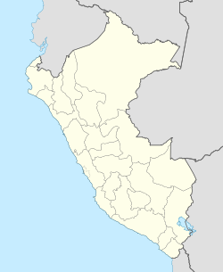
 Northern Wari ruins
Coordinates: 6°43′17″S 79°38′41″W / 6.72139°S 79.64472°WCoordinates: 6°43′17″S 79°38′41″W / 6.72139°S 79.64472°W Country  Peru
PeruRegion Lambayeque Region Province Chiclayo Province Government – Type None Population – Total 0 Time zone PET (UTC-5) The Cerro Pátapo ruins or Northern Wari ruins are the remains of an entire prehistoric city relatively near where site of present-day Chiclayo, Peru. The ruins are primarily of the Wari (Huari) culture. The discovery was announced on 16 December 2008 by the lead archeologist, Cesar Soriano. The ruins present the first evidence of Wari influence found in Northern Peru and show this was an important site.[1] Located 14 miles (23 km) from Chiclayo, the ruins stretch over an area of 3 miles (4.8 km).[2]
The Wari pre-Columbian civilization was predominantly based in south Peru between the 7th and 12th centuries (600 to 1100 CE.) It was known for its network of roads, and had a territory nearly as large as that of the later Inca Empire.[1][3] Scholars note its complex, distinctive architecture, monuments and roadbuilding as evidence that it was an empire.[4]
Contents
Discovery
The city was part of the Wari Empire, which ruled parts of the Andes mountains, mostly in south-central Peru, between the 7th and 12th centuries CE. The site is remarkably well preserved due to the dry desert climate. Among the artifacts are pottery sherds. The site also includes evidence of human sacrifice, with special spots set aside and a pile of bones at the bottom of a cliff. Well-preserved remains have been found of one young woman.[1][2]
The ruins are expected to help scholars fill the gap in knowledge about pre-Columbian South America, which was dominated by the Wari culture and the earlier Moche culture. The Moche began at AD 100 and perished around AD 600.[5]
Earlier in August 2008, archeologists at the Huaca Pucllana ruins in Lima (located some 500 miles / 800 kilometres south of Chiclayo) discovered a mummy that is also thought to be Wari.[2][6] This was a more typical location for such a find, within the territory known to be Wari.
See also
References
- ^ a b c "'Ancient city unearthed' in Peru". BBC. 17 December 2008. http://news.bbc.co.uk/1/hi/world/americas/7787053.stm. Retrieved 2008-12-17.
- ^ a b c "Archeologists in Peru unearth ancient Wari city". Reuters. 16 December 2008. http://uk.reuters.com/article/scienceNews/idUKTRE4BF7NY20081216. Retrieved 2008-12-17.
- ^ "Ancient city ruins found in northern Peru". Guardian. 17 December 2008. http://www.guardian.co.uk/science/2008/dec/17/northern-peru-ancient-city. Retrieved 2008-12-17.
- ^ > Katharine Schreiber, "Wari Empire - Excavations at Wari, Ayachucho, Peru", JRank, accessed 3 Nov 2010
- ^ "Ancient Buried City Showing Signs Of Human Sacrifice Unearthed In Northern Peru". All headlines news. 17 December 2008. http://www.allheadlinenews.com/articles/7013438496. Retrieved 2008-12-17.
- ^ Ford, Dana (27 August 2008). "Pre-Incan female Wari mummy unearthed in Peru". Reuters. http://in.reuters.com/article/entertainmentNews/idINIndia-35186820080827. Retrieved 2008-12-19.
External links
Archaeological sites in Peru  Acaray | Aspero | Bandurria | Buena Vista | Cahuachi | Cajamarquilla | Carajía | Caral | Cerro Pátapo | Chan Chan | Chankillo | Chavín de Huantar | Choquequirao | Coricancha | Cota Coca | Cumbe Mayo | Cusichaca valley | El Brujo | Garagay | Gran Pajáten | Gran Vilaya | Guitarrero Cave | Huaca de la Luna | Huaca del Sol | Huaca Pucllana | Huayna Picchu | Huilcahuain | Incahuasi, Ayacucho | Incahuasi, Cañete | Intihuatana | Jiskairumoko | Kenko | Kuelap | Kuntur Wasi | Llactapata | Machu Picchu | Miculla petroglyphs | Muyucmarca | Ollantaytambo | Pachacamac | Pikillacta | Pikimachay | Piruro | Písac | Puca Pucara | Pumacocha | Puyupatamarca | Qoriwayrachina | Raqchi | Rumicolca | Sacred Valley | Sacsayhuamán | Sayhuite | Sechin, Peru | Sillustani | Sipán | Tambo Colorado | Tambomachay | Tarahuasi | Tipón | Toquepala Caves | Toro Muerto | Túcume | Uchkus–Inkañan | Vilcabamba | Vitcos | Wari ruins | Wiñay Wayna | YanacaCategories:
- Archaeological sites in Peru
- 2008 in Peru
- Lambayeque Region
- Former populated places in Peru


Wikimedia Foundation. 2010.