- Choquequirao
-
Choquequirao 
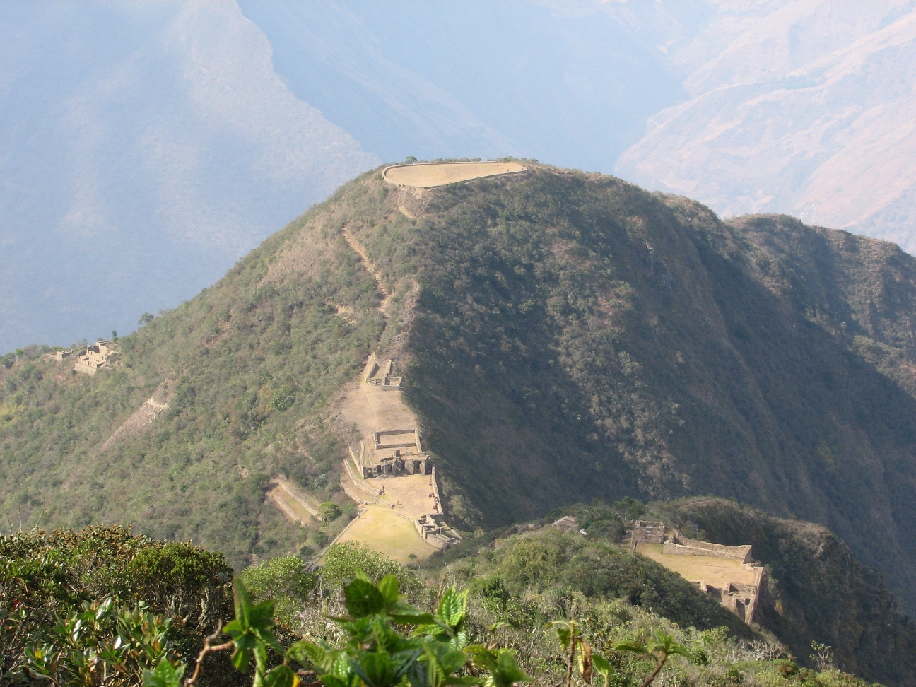
Truncated Hill Top at Choquequirao Location 
 Location of Chquequirao in Peru
Coordinates 13°23′34.1″S 72°52′25.7″W / 13.392806°S 72.873806°WCoordinates: 13°23′34.1″S 72°52′25.7″W / 13.392806°S 72.873806°W Period 1536 – 1572 Country  Peru
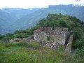
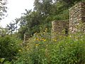
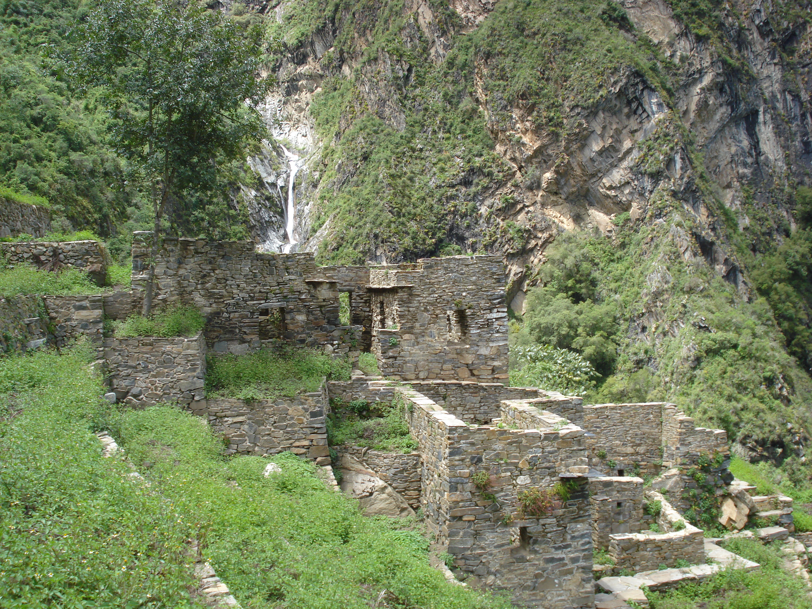
PeruRegion Santa Teresa, La Convención, Cusco Elevation 3,050 m (10,010 ft) Area 18 km2 (6.9 sq mi)  Terraces at Choquequirao
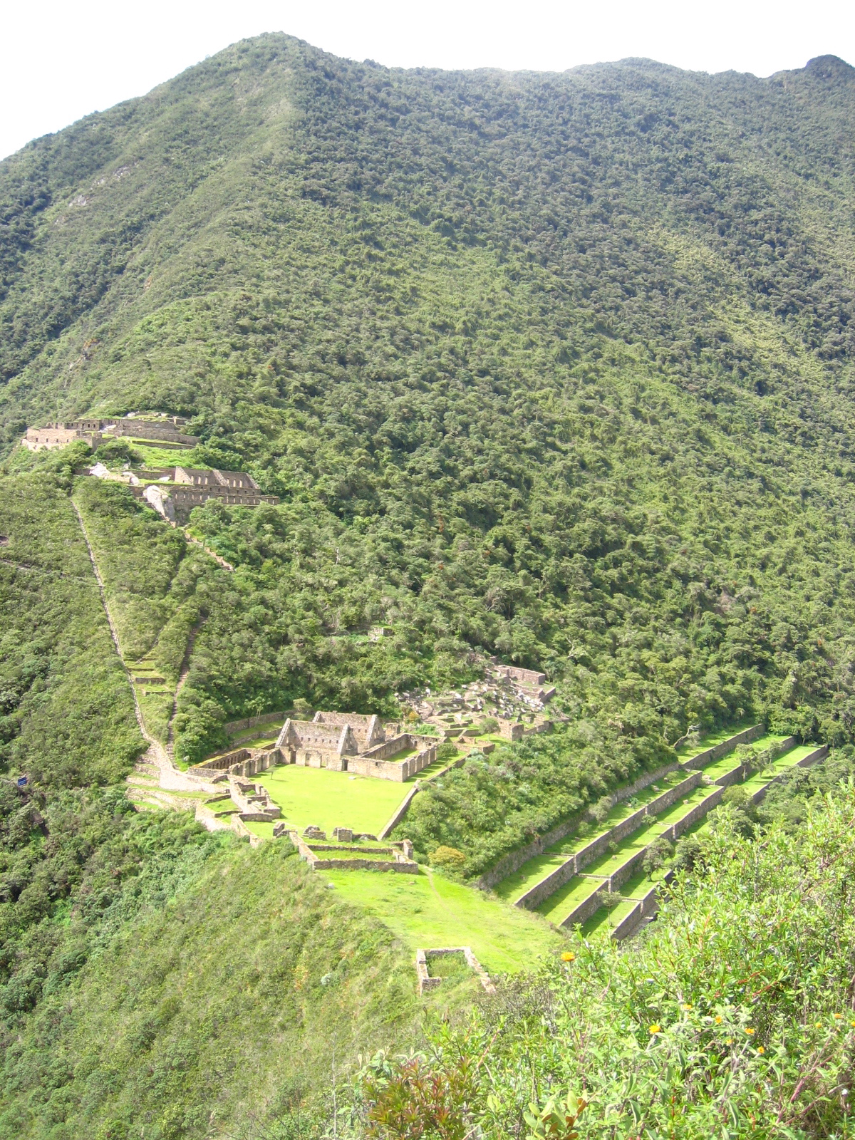
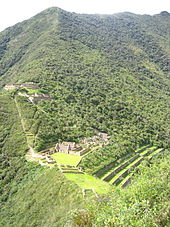 The main structures of Choquequirao
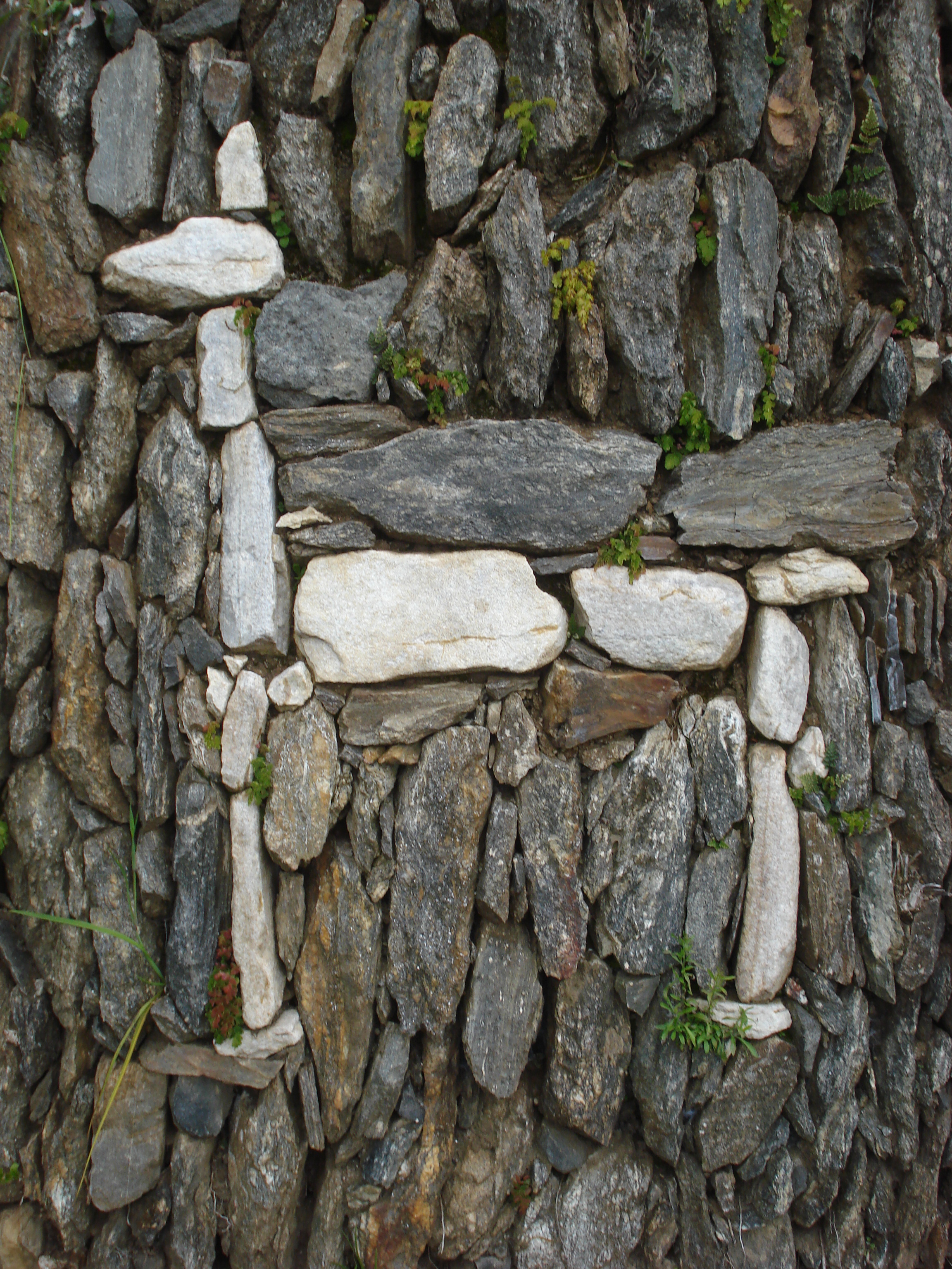
 White stone woman in the terraces of Choquequirao
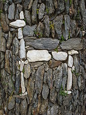 White stone llama in the terraces of Choquequirao
Choquequirao (Southern Quechua: Chuqi K'iraw, Cradle of Gold) is a ruined Inca city in south Peru, similar in structure and architecture to Machu Picchu. The ruins are buildings and terraces at levels above and below Sunch'u Pata, the truncated hill top. The hilltop was anciently leveled and ringed with stones to create a 30x50 platform.
Choquequirao (3,050 m[1]) is in the spurs of the Salkantay Mountain Range in the Province La Convención in the Cusco region above the valley of river Río Apurímac. The complex is 1,800 hectares, of which 30-40% is excavated.[2][3]
The site is reached by a two-day hike from outside Cusco.[2]
Contents
History
The site was built during the reign of the Inca king Pachacuti Inca Yupanqui[1]. It may be the last bastion of resistance and refuge of the Sons of the Sun who fled Cusco when it was under siege in 1535. Led by Manco Inca Yupanqui they took refuge in Choquequirao.
According to the Peruvian Tourism Office, "Choquequirao was probably one of the entrance check point to the Vilcabamba region, and also an administrative hub serving political, social and economic functions. Its urban design has followed the symbolic patterns of the imperial capital, with ritual places dedicated to the Sun (Inti) and the ancestors, to the earth, water and other divinities, with mansions for administrators and houses for artisans, warehouses, large dormitories or kallankas and farming terraces belonging to the Inca or the local people. Spreading over 700 meters, the ceremonial area drops as much as 65 meters from the elevated areas to the main square."[1]
Presumably it was used as a check point for access to the Vilcabamba Area and as a cultural and religious center for the region. The city also played an important role as a link between the Amazon Jungle and the city of Cusco.
Layout
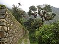
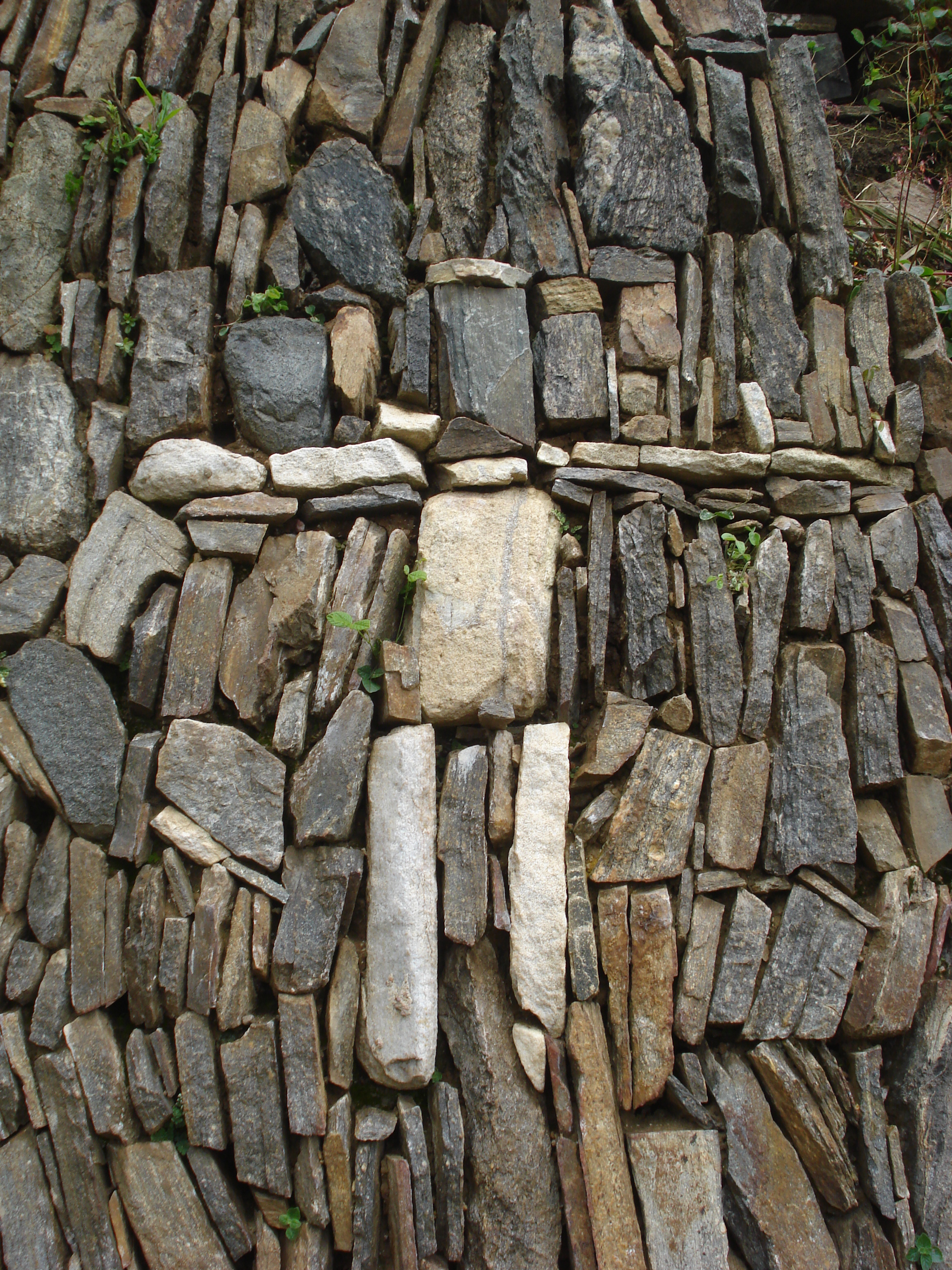
The typical Inca terraces form the largest constructions on site. A temple, some administrative buildings and the living quarters of the aristocrats are situated around the central square. On the outskirts of the site lie the living quarters of the common people grouped together in a small village. There are water channels, aqueducts and water springs. Most buildings are well-preserved and well-restored; restoration continues.
Access
The Peruvian government plans a cable car to reach the ruins. Others have proposed a train similar to that used to Macchu Picchu.[4]
Discovery
According to Ethan Todras-Whitehill of the New York Times, Choquequirao's first non-Incan visitor was the explorer Juan Arias Díaz in 1710.[5] The first written site reference in 1768 was made by Cosme Bueno, but was ignored at the time. In 1834 Eugene de Santiges rediscovered the site. In 1837 Leonce Agrand mapped the site for the first time, but his maps were forgotten. When Hiram Bingham, the discoverer of Machu Picchu, visited Choquequirao in 1909 the site gained more attention. The first excavations started in the 1970s.
See also
- Iperu, tourist information and assistance
- Tourism in Peru
References
- ^ a b c Choquequirao, Peru's Tourism Office, 2011
- ^ a b Trail to Choquequirao, El Comercio Newspaper, Lima, Peru, May 13, 2009, [Spanish]
- ^ Cusco travel guide, September 5, 2011, [Spanish]
- ^ The Other Macchu Picchu, The New York Times, June 3, 2007, written by Ethan Thodras-Whitehill
- ^ Ethan Todras-Whitehill on the New York Times
External links
- The Other Machu Picchu article on Choquequirao (The New York Times, June 3, 2007)
- Debate on the value of publicizing Choquequirao as a travel destination from the author of the New York Times article
- Photos Cachora-Choquequirao Trek
- Images of Choquequirao - High Definition Video
Photo gallery
-
Twin Buildings
-
Large Terraces
-

Terraces, house and cascade
-
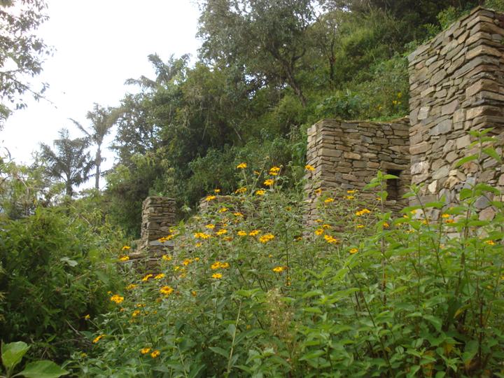
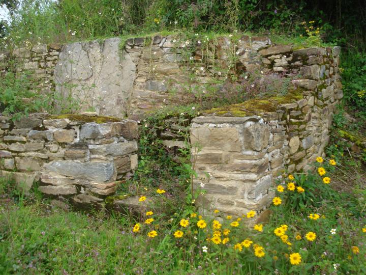
Ruins and Flora
-

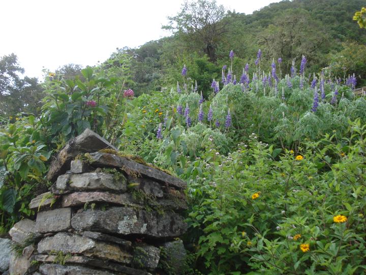
Ruins and Flora
-

Ruins and Flora
Archaeological sites in Peru  Acaray | Aspero | Bandurria | Buena Vista | Cahuachi | Cajamarquilla | Carajía | Caral | Cerro Pátapo | Chan Chan | Chankillo | Chavín de Huantar | Choquequirao | Coricancha | Cota Coca | Cumbe Mayo | Cusichaca valley | El Brujo | Garagay | Gran Pajáten | Gran Vilaya | Guitarrero Cave | Huaca de la Luna | Huaca del Sol | Huaca Pucllana | Huayna Picchu | Huilcahuain | Incahuasi, Ayacucho | Incahuasi, Cañete | Intihuatana | Jiskairumoko | Kenko | Kuelap | Kuntur Wasi | Llactapata | Machu Picchu | Miculla petroglyphs | Muyucmarca | Ollantaytambo | Pachacamac | Pikillacta | Pikimachay | Piruro | Písac | Puca Pucara | Pumacocha | Puyupatamarca | Qoriwayrachina | Raqchi | Rumicolca | Sacred Valley | Sacsayhuamán | Sayhuite | Sechin, Peru | Sillustani | Sipán | Tambo Colorado | Tambomachay | Tarahuasi | Tipón | Toquepala Caves | Toro Muerto | Túcume | Uchkus–Inkañan | Vilcabamba | Vitcos | Wari ruins | Wiñay Wayna | YanacaCategories:
- Archaeological sites in Peru
- Archaeoastronomy
- Former populated places in Peru
- Historical sanctuaries of Peru
- Inca
- National parks of Peru
- Ruins in Peru
- Populated places established in the 15th century


Wikimedia Foundation. 2010.