- Manasbal Lake
-
Manasbal Lake 
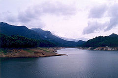
Location Kashmir Valley Coordinates 34°15′N 74°40′E / 34.25°N 74.667°ECoordinates: 34°15′N 74°40′E / 34.25°N 74.667°E Lake type Fresh water Catchment area 33 km2 (13 sq mi) Basin countries India Max. length 5km Max. width 1km[1] Surface area 2.81 km2 (1.08 sq mi) Average depth 4.5 m (15 ft) Max. depth 13 m (43 ft) Water volume 0.0128 km3 (0.0031 cu mi) Residence time 1.2 years Shore length1 10.2 km (6.3 mi) Surface elevation 1,583 m (5,194 ft) Settlements Kondabal 1 Shore length is not a well-defined measure. Manasbal Lake is located in the Jhelum valley, north of Srinagar city in the State of Jammu and Kashmir in India. The name Manasbal is said to be a derivative of the Lake Manasarovar.[2] Lake is encircled by three villages viz., Jarokbal, Kondabal (also called Kiln place, is situated on the north-eastern side of the lake) and Ganderbal and is stated to be the deepest lake (at 13 m/43 ft depth) in the Kashmir valley. The large growth of lotus (Nelumbo nucifera) at the periphery of the lake (blooms during July and August) adds to the beauty of the clear waters of the lake. The Mughal garden, called the Garoka, (meaning bay window) built by Nur Jahan overlooks the lake.[3]
The lake is a good place for birdwatching as it is one of the largest natural stamping grounds of Aquatic birds in Kashmir and has the sobriquet of "supreme gem of all Kashmir Lakes".[4][5] The rootstocks of lotus plant which grows extensively in the lake are harvested and marketed, and also eaten by the local people.[2]
Contents
Access
The lake is approached from Srinagar by a 30-kilometre (19 mi) road via Shadipur, Nasim and Gandarbal. Road to Wular Lake, the largest lake in Kashmir, passes through this lake, via Safapur.[2]
History
It is believed to be an ancient lake by locals but exact dating is yet to be done. Close to the northern shore of the lake are the ruins of a 17th century fort, called the Darogabagh, built by the Moghuls, used in the past by caravans traveling from Punjab to Srinagar.[2][4]
Topography
The lake is surrounded by the Baladar mountains on the east, by an elevated plateau known as 'Karewa' comprising lacustrine, fluviatile and loessic deposits on the north and bounded by the Ahtung hills in the south, which are used for limestone extraction.[4]
Along the course of the Jhelum River, the Manasbal Lake falls under the third series of high altitude lakes of the Himalayas (designated with respect to their origin, altitudinal situation and nature of biota they contain) as the valley lakes (Dal, Anchar, Manasbal etc.) situated at the altitudinal zone of 1,585–1,600 m (5,200–5,200 ft); the other two types being the high altitude wetlands (altitude 1,585–4,000 m/5,200–13,000 ft amsl) of the second series of lakes (Nilnag) in the lower fringes of Pir Panjal ranges right in the midst of pine forests, and the glaciated lakes of the first series situated on the inner Himalayas between 3,000–4,000 m (9,800–13,000 ft) amsl (Alipathar, Sheshnag, Kounsarnag, Tar Sar, Mar Sar, Vishansar, Gangbal, Kishna Sar, Kyo Tso, Pangong Tso, etc.) which have probably originated during the third Himalayan glaciation.[6] A fissure is reported to be running from east to west at the centre of the lake.[7]
Land use
Important vegetation in the catchment of the lake comprise Orchards (apple, mulberry), some Platanus (Chinar trees) and Salix trees. Safar, a nearby village of Safapur which has a grove of Chinar trees, is known as Badshah Boni, royal Chinar, and was planted in imitation of the Nasim Bagh in Srinagar. Maize, mustard and wheat are generally the main crops grown in the agricultural lands of the catchment. In recent years, land use pattern has changed with more land used for horticulture and also diversion of land for construction purposes.[4] &.[3]
Hydrology
The drainage basin for the lake, covering an area of 33 km2 (13 sq mi), has no major inlet channels and is thus fed mainly by precipitation (rain and snow fall) and springs (more than 1,200 springs).[8] Lake water outflows to the Jhelum River through a regulated outflow channel. The lake is the source of water for fishing and for obtaining food and fodder plants.[2]
The lake not only provides source of water but also offers facilities for navigation and transportation, fisheries, harvesting of economically useful plants, sightseeing, tourism and recreation.[4]
Water quality issues
Some of the water quality parameters reported relate [4] to:
- The lake is Monomictic Mixing type and develops thermal stratification in March to November. Maximum depth of the Thermocline is 9 metres (30 ft). Hypolimnion temperature ranges from 8.5 °C (47.3 °F) to 11 °C (52 °F).
- pH value varied from a maximum of 8.8 on the surface to a minimum of 7.7 at 11 metres (36 ft) depth in year over the 12 months period
- DO [mg l-1] value varied from a maximum of 10.4 on the surface to a minimum of 2.2 at the bottom in year over the 12 months period
- Maximum Nitrogen Concentration (NH4-N [micro l-1] of 13 on the surface and 120 at the bottom of the lake have been reported.
- The lake water temperature varied from a minimum of 6 °C (43 °F) in January to 27.5 °C (81.5 °F) in June/July at the surface and correspondingly 6 °C (43 °F) and 19 °C (66 °F), at the bottom of the lake.
Flora
Within the lake water, the flora recorded comprise the following.[4]
- Emerged Macrophytes, floating Macrophytes, submerged Macrophytes and Phytoplankton. In the reported period, the biomass production due to Planktons was a maximum of 864.9 milligrams/ sq cm in June with a minimum of 54 milli grams/sq cm in December.
Fauna
The fauna recorded in the lake are the Zooplankton, Benthos and Fish. The economically important fishes reported are[4]:
- Schizothorax niger, S. esocinus, Cyprinus carpio specularis+, C. carpio communis+ and Neomacheilus latius.
Note:+ considered economically important
Cyprinus, an exotic species, has proliferated extensively after its introduction in 1956. A decline in the population of indigenous species due to rapid changes in the environment was reported.
Deterioration of the lake
Eutrophication was recorded and confirmed by the test results in the lake. Ceratophyllum demersum recorded increase in the lake area. Dense mono specific stands have been created by the weeds. Further, decrease in species diversity has occurred, increase in the period of anoxic conditions and accumulation of H2S in deeper waters has been reported. Pollution has also taken place due to lack of waste water treatment plants.[4]
World Wide Fund for Nature (WWF) which conducted an extensive survey of the lake in 1997 attributed the reasons for the deterioration of the lake, particularly on its banks, gradually turning it into a stinking marsh, due to the following.[9]
- large-scale illegal encroachment on the periphery on Ganderbal and Qazibagh sides in the form of hundreds of tress, vegetable gardens, toilets, residential structures, garbage dumping sites
- siltation due to noxious run-off from adjoining fields, stone quarries and lime kilns;
- the flow of sewage and use of fertilizers in the agricultural fields in its adjoining villages
- 80 per cent of the lake was seen under the thick blanket of weed
WWF recommended several measures to be undertaken for the restoration of the lake.
Lake restoration works
It was only in the year 2007 that lake restoration measures could be undertaken with the formation of Wular-Manasbal Development Authority (WMDA) under the Government of Jammu and Kashmir.[9]
WMDA undertook the following measures for restoration and to improve the general environment of the lake.
- removing the illegal constructions;
- pedestrian walkway/pathway construction around the lake periphery of 11 km (6.8 mi)
- manual de-weeding
- dredging
- demarcation of the lake
- construction of STPs and
- regulation of limestone extraction and afforestation of mountains to restore lake’s glory
Chief Executive Officer of the WMDA has been reported stating that:
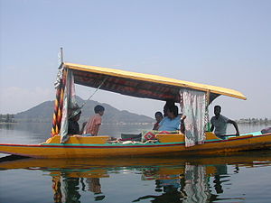
It was after long deliberations with locals that we could start work on the lake. We made the locals understand that Manasbal’s conservation was imperative not only from tourism point of view, but for their livelihood too. Now, there is community participation in the restoration process.Shikara operators of the Lake area have reported that “there has been a lot of improvement in its condition”
Hindu temple
Wullar-Manasbal Development Authority has reported unearthing of an ancient Hindu temple, on the eastern shore of the Manasbal Lake, built in the traditional architectural style of ancient Kashmir. The lower half of the temple, which was buried in earth, was found during the restoration works undertaken for the lake. Dated to 800-900 AD, during Avantivarman or Sankaravarman rule, based on epigraphic writings, the temple, constructed in local grey stone, has a unique pyramid-shaped roof top with Corinthian or floral motifs. It is stated to be a new pilgrimage attraction for pilgrims who visit the cave shrine at Amarnath and the Kheer Bhawani temple at Tulmulla in Ganderbal district.[10] Other tourist attractions in the lake area are the Manasbal Temple, the ruins of a terraced Mughal garden and sculptured stones of some Buddhist shrines on the banks of the lake.[7]
Water skiing
The weather is pleasant in the months of May and August, when the lake offers water skiing sport, which is now becoming an increasingly popular activity in many rivers and lakes in India. Jammu & Kashmir Tourism Department (JKTD) provides essential water skiing equipment and trained instructors to adventure seekers.[11] The lake’s surface sheen and its long length and width attract tourists to water skiing sport.[7] However, the noise and turbulences of waterskiing boats will totally change the environment of this last quiet lake and could risk to take away one of its main attractions: Peace. There is still a discussion going on whether or not a more environmentally sensitive form of sustainable tourism would be more appropriate for this special lake - to not turn it into a second Dal Lake.
References
- ^ http://moef.nic.in/downloads/public-information/NWIA_Jammu_and_Kashmir_Atlas.pdf
- ^ a b c d e http://kashmir-tourism.com/jammu-kashmir-lakes-mansabal-lake.htm, Manasbal Lake
- ^ a b http://www.indiainfoweb.com/jammu-kashmir/lakes/mansabal-lake.html Mansbal lake
- ^ a b c d e f g h i http://www.ilec.or.jp/database/asi/asi-57.html Manasbal Lake
- ^ http://www.mascottravels.com/kashmirlakes.htm kashmir lakes
- ^ http://www.ramsar.org/wurc/wurc_mgtplan_india_wular.pdf Comprehensive Management, Action Plan for Wular lake, Kashmir
- ^ a b c http://www.india9.com/i9show/-Jammu-and-Kashmir/Manasbal-Lake-15415.htm Manasbal Lake
- ^ http://www.dailyexcelsior.com/web1/07nov26/news.htm, Dal look for Manasbal lake soon
- ^ a b http://www.greaterkashmir.com/full_story.asp?Date=23_8_2007&ItemID=57&cat=1, Community participation makes it possible, Arif Shafi Wani
- ^ http://news.webindia123.com/news/ar_showdetails.asp?id=711180334&cat=&n_date=20071118 Unique eighth century Hindu temple restored in Kashmir
- ^ http://www.vacationsindia.com/water-skiing-in-india.html, Water Skiing in India
External links
Hydrology of South Asia Inland Indus · Ganges · Yamuna · Chenab · Jhelum · Bhagirathi River · Brahmaputra · Godavari · Narmada · Tapti · Ravi · Beas · Sutlej · Padma · Sarasvati · Sharda · Krishna · Kaveri · Kali River · Meghna · Gandaki River · Mahanadi · Mahaweli · Son · Ghaghara · Betwa · Chambal · Kosi · Sankosh · Ganges Basin · Ganges Delta · Indus Delta · Dal Lake · Pookode Lake · Skeleton Lake · Chilka Lake · Lake Powai · Borith Lake · Saiful Muluk · Gosaikunda · Nizam Sagar · Red Hills Lake · Malampuzha · Kerala Backwaters · Damodar · LuniCoastal Categories Lakes of India / Nepal / Pakistan · Reservoirs and dams in India · Rivers of Bangladesh / Bhutan / India / Nepal / PakistanCategories:- Lakes of Jammu and Kashmir
- Kashmir
- Tourism in Jammu and Kashmir
Wikimedia Foundation. 2010.


